
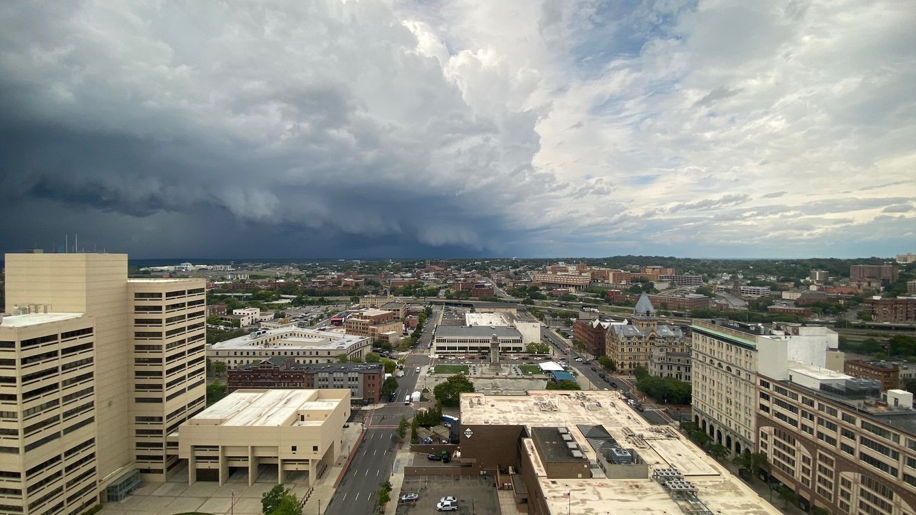
As expected, the weather on Friday was spectacular with plenty of sunshine and much better air quality than Wednesday and Thursday due to the smoke from Canadian wildfires being pushed away from Central New York.
However, some of that smoke will be heading back across our area for a shorter period of time on Saturday before again leaving by or before sunset Saturday.
Even so, the air quality will likely become at least “unhealthy for sensitive groups” and may again become “unhealthy for everyone” during Saturday.
An air quality alert is in effect through Saturday:
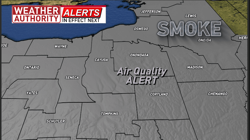
Air quality alert remains in effect through Saturday
What is going on?:
–Air quality levels of outdoor air are predicted to be greater than an air quality index value of 100 for the pollutant of ozone.
–The air quality index (AQI) was created as an easy way to correlate levels of different pollutants to one scale.
–The higher the AQI value, the greater the health concern.
Why is this happening?:
–Canadian wildfire smoke aloft and at the surface will likely increase over our entire area Saturday before again exiting by sunset Saturday.
What are the impacts?:
–When pollution levels are this high for Saturday, the New York state Department of Health recommends that everyone should at least limit outdoor activities but could increase to a level that means everyone should avoid staying outside too long.
–Those with symptoms should consider consulting their personal physician.
–Skies may look eerie. Besides the air pollution aspect for people, when the smoke is thick enough it can obscure and even make daytime skies look much different than normal.
While Saturday does have some smoke concerns, I am even more concerned about damaging isolated to scattered thunderstorms at some point during Saturday with the best chances during the middle or possibly late afternoon.
It’s part of our next weather makers:
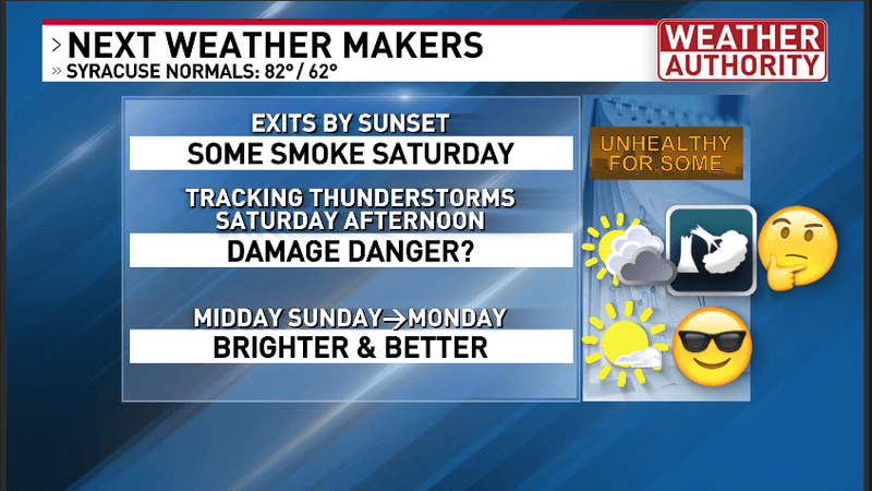
Central New York’s next weather makers
Here is an overview of the storm system setup for Saturday:
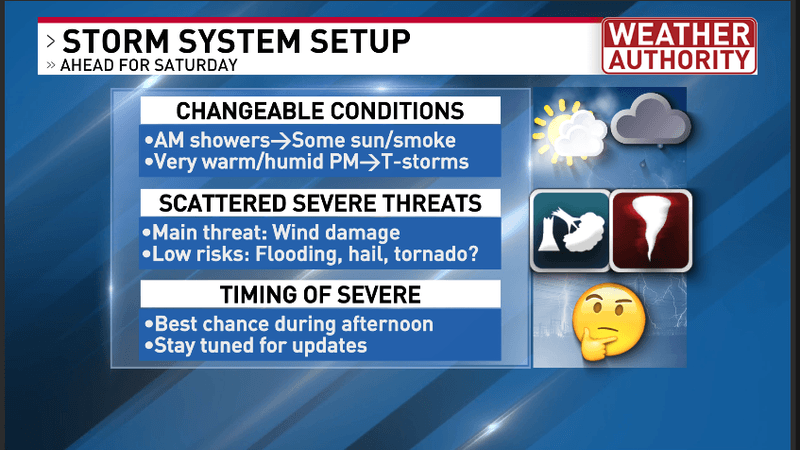
Here are important facets for Saturday’s weather maker
A dew point/warm front will be moving through our area from west to east Saturday morning. This will give our area a threat for some passing scattered showers or thunderstorms during parts of Saturday morning. There is uncertainty to the amount of cloud coverage and amount of rain from this first system. However, there should also be some sunshine and this should likely increase by the end of the morning through midday.
I am expecting a dry period with some sunshine for a while midday and through parts of the early afternoon Saturday. At the same time, the temperatures and dew point/humidity values should increase notably. I am expecting a high in the upper 80s with higher heat index values over 90 degrees. If enough sunshine occurs, I cannot rule out the high temperature reaching 90 degrees. The combination of building instability from the heat and humidity plus an approaching strong cold front and upper-level system will give our area an increasing threat for showers and thunderstorms especially late Saturday afternoon with the potential for a damaging, severe thunderstorm!
As noted above and below, there is a notable 40 to 50% risk for wind damage withing 25 miles of any one point in the “orange” zone.
While a much lower risk, we cannot rule out any type of severe damage. Note that there is a 5 to 9% risk for a tornado withing 25 miles of any one point in the “orange” zone. While that threat is relatively low by comparison, it is pretty rare to get those types of percentages here in our area!
Here are the severe t-storm threats from the Storm Prediction Center Saturday:
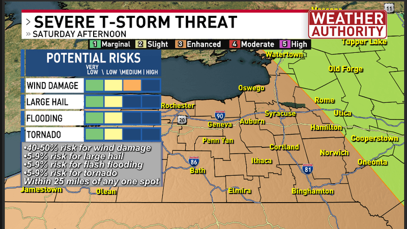
Here are the severe thunderstorm threats and the risk for them to occur within 25 miles of any one point in CNY via the Storm Prediction Center
Be aware that Saturday’s weather will be quite changeable. Even though, there will be times where it is dry, breezy and borderline hot and humid, fast paced changes will probably occur during the afternoon with rapid development of scattered thunderstorms.
Make sure you and your family have a way to receive any severe weather watches or warnings if and when they are issued.
Important reminder about severe weather watches & warnings:
–A “watch” means conditions are favorable for t-storms, some of which could produce damaging wind, hail, possibly a tornado. However, there is no immediate threat of any of these severe weather elements.
–A “warning” means that imminent danger from a severe thunderstorm is moving in! Seek shelter/take cover immediately!
Thereafter, while Sunday starts a bit cloudy, I am expecting increasing sunshine, decreasing humidity and more refreshing air!
For more specifics about all of this hour-by-hour, watch my video forecast:
Video forecast from NBC3 News Live at 5:00 PM Friday July 17th, 2026