
Hurricane Erin rapidly intensified, reaching a “catastrophic” Category 5 level as heavy rain swept across parts of the Caribbean. Weather authorities have warned of possible flash floods and landslides. Erin is the first hurricane of what is predicted to be a particularly active Atlantic season. While the storm is not expected to make landfall, it is forecast to bring strong winds and heavy rain to several islands.
According to the US National Hurricane Center (NHC), Erin’s maximum sustained winds have risen to 160 miles (255 kilometres) per hour. The storm was last located about 135 miles (215 kilometres) northwest of Anguilla in the northern Leeward Islands, a region that includes both the US and British Virgin Islands.
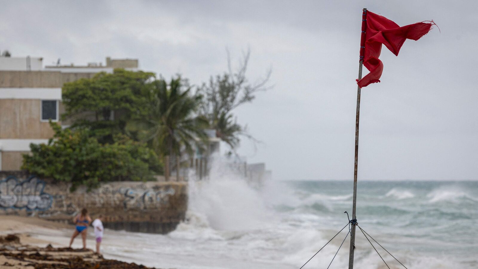
A flash flood warning has been issued for Saint Thomas and Saint John in the US Virgin Islands, as Erin’s outer rain bands moved across the area, the US National Weather Service said.
Tropical storm watches are also in place for St Martin, St Barthelemy, Sint Maarten, and the Turks and Caicos Islands.
“Erin is now a catastrophic Category 5 hurricane,” the NHC told news agency AFP. Category 5 is the highest level on the Saffir-Simpson scale, indicating extremely dangerous storms with sustained winds above 157 mph.
The storm intensified quickly, reaching Category 5 just over a day after first becoming a Category 1 hurricane. Experts say such rapid intensification is happening more often because of global warming.
Over the weekend, Erin’s centre is expected to move just north of the northern Leeward Islands, the Virgin Islands and Puerto Rico. It is then predicted to pass east of the Turks and Caicos Islands and the southeastern Bahamas on Sunday night, before weakening.
The NHC said the storm could bring up to six inches (15 centimetres) of rain in isolated areas. It also warned of “locally considerable flash and urban flooding, along with landslides or mudslides.”
Where is Hurricane Erin going to hit?
Swells from Hurricane Erin are expected to impact the northern Leeward Islands, the Virgin Islands, Puerto Rico, Hispaniola, and the Turks and Caicos Islands over the weekend.
According to the US National Hurricane Center (NHC), these swells will reach the Bahamas, Bermuda, and the US East Coast early next week, creating “life-threatening surf and rip currents.”
The hurricane is forecast to turn northwest on Saturday night before moving north early next week. It is likely to begin weakening from Monday.
Meteorologists remain confident that Erin will stay well offshore from the US, but they warned it could still trigger dangerous waves and coastal erosion, particularly in North Carolina.
The Atlantic hurricane season, which runs from June to late November, is expected to be more active than usual, forecasters have said.