
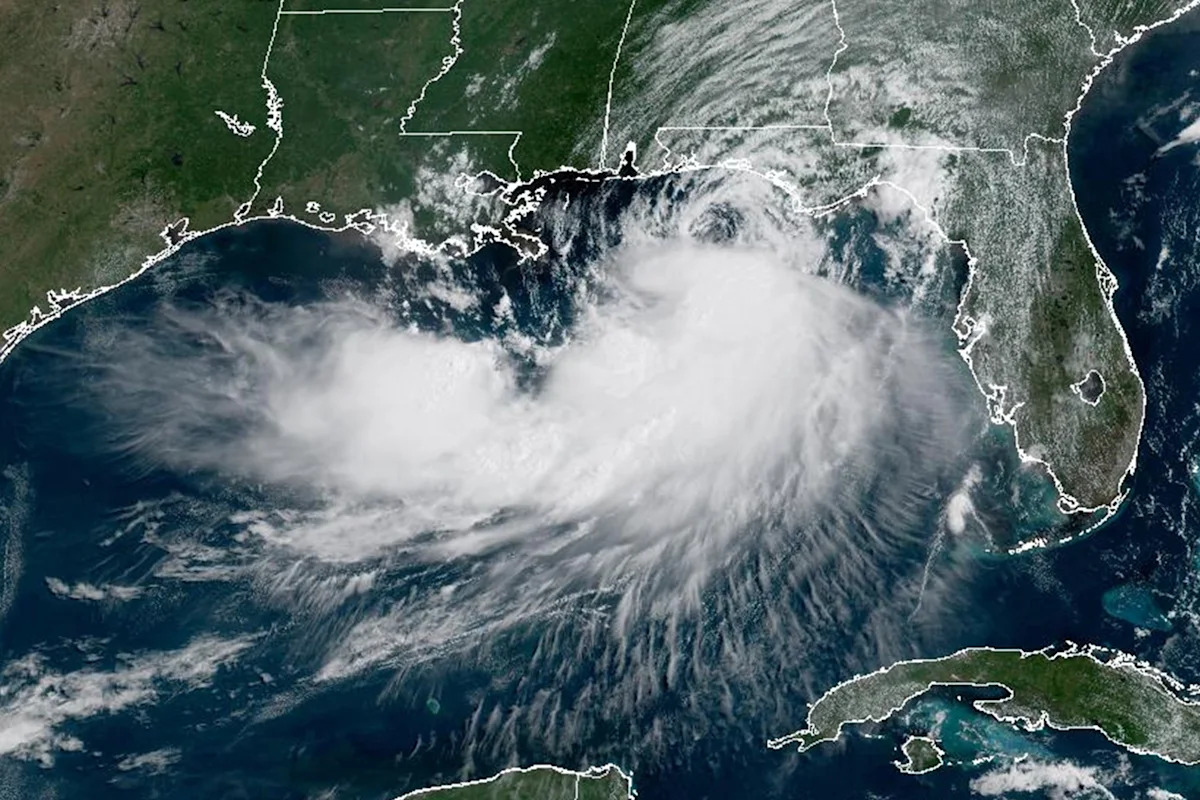
Tropical Storm Bertha, the second named storm of the 2026 Atlantic hurricane season, strengthened overnight and is threatening to bring heavy rain and possible flash flooding across the northern Gulf Coast, forecasters say.
The National Hurricane Center said Tuesday that Bertha, which formed on Monday, had become better organized and slightly increased its speed over the warm waters of the Gulf. A tropical storm warning was extended from the Florida Panhandle to Lafourche Parish, La. — southwest of New Orleans — while a coastal flood warning was issued for portions of southeastern Louisiana and Mississippi.
The season’s first named storm, Tropical Storm Arthur, brought heavy rain and flash flooding to parts of southern Texas, Louisiana and Mississippi last month.
Where is Bertha now, and what is its path?
According to the hurricane center’s latest advisory, as of 2 p.m. ET on Tuesday:
Bertha was located about 90 miles south-southwest of Panama City, Fla., and about 125 miles southeast of Mobile, Ala.
The storm has maximum sustained winds of 60 mph
It is moving northwest at 5 mph
The storm began slowly turning to the west on Tuesday afternoon, putting it on a track that will take it near or along the northern Gulf Coast over the next several days and potentially making landfall in southeast Louisiana by midweek.
Watches and warnings in effect
A tropical storm warning is in effect for:
The Bay-Gulf County line in Florida to the Terrebonne-Lafourche Parish line in Louisiana
This means that tropical storm conditions are expected within 36 hours.
A tropical storm watch is in effect for:
The Terrebonne-Lafourche Parish line to the Vermilion-Cameron Parish line
Metropolitan New Orleans, Lake Pontchartrain and Lake Maurepas
This means that tropical storm conditions are possible in the next 24 to 48 hours.
The biggest threats from Bertha
The primary impacts from the system are expected to be heavy rain, wind and storm surges, which could lead to flash flooding across the Gulf Coast, especially in areas that recently experienced torrential rainfall, like Texas’s Hill Country.
According to forecasters, the storm is expected to produce 2 to 4 inches of rain along the Gulf Coast until Thursday, with up to 6 inches possible in isolated areas.
A storm surge of up to 4 feet is possible in coastal Louisiana, Mississippi and Alabama/Florida border.
Swells generated by the system could cause life-threatening surf and rip currents at beaches throughout the Gulf.
How is the 2026 Atlantic hurricane season shaping up?
The 2026 Atlantic hurricane season began on June 1 and lasts until Nov. 30. Forecasters with the National Oceanic and Atmospheric Administration are predicting eight to 14 total named storms, considered a below-normal season for the Atlantic basin. Out of those named storms, three to six are forecast to become hurricanes, including one to three major hurricanes (considered Category 3, 4 or 5).
An average season has 14 named storms, including seven hurricanes and three major hurricanes.
The 2025 Atlantic hurricane season produced 13 named storms, including five hurricanes and four major hurricanes.