
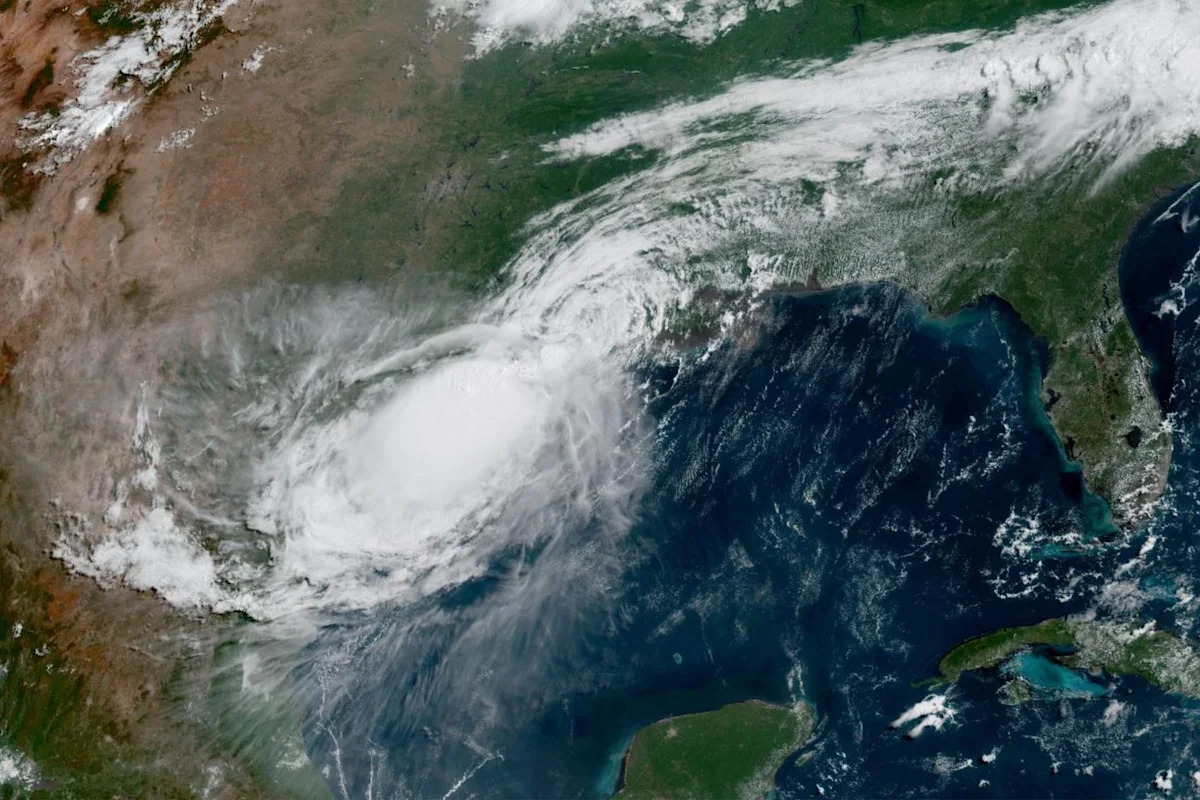
Tropical Storm Bertha continued to travel inland over eastern Texas on Thursday as forecasters said its path would take it into the center of the state by Friday morning.
Bertha made landfall in Louisiana on Wednesday and hugged the coastline overnight before heading out of the Gulf of Mexico and into Texas, where it is expected to eventually dissipate. The storm has already weakened slightly, but it still brings the risk of heavy rain and potential flash flooding to areas in its path.
The National Hurricane Center lifted its tropical storm warnings for most of the Louisiana coast, but kept them in effect for the westernmost part of the state and the Texas coastline.
Bertha is the second named storm of the 2026 Atlantic hurricane season. The first, Tropical Storm Arthur, brought heavy rain and flash flooding to parts of southern Texas, Louisiana and Mississippi last month.
Where is Bertha now, and what is its path?
According to the hurricane center’s latest advisory, as of 5 p.m. ET on Thursday:
Bertha was located about 35 miles north of Galveston, Tx.
The storm has maximum sustained winds of 40 mph
It is moving west-northwest at 13 mph
“Bertha is expected to gradually weaken, and it is forecast to dissipate in a day or so,” NHC forecasters said Thursday afternoon.
Watches and warnings in effect
A tropical storm warning is in effect for:
The Vermilion/Cameron Parish Line in Louisiana to Sargent, Texas.
This means that tropical storm conditions are expected within 24 hours.
There are no tropical storm watches in effect.
The biggest threats from Bertha
Though it’s weakening, Bertha is expected to produce 1 to 3 inches of rainfall, with up to 4 inches in isolated areas, which could lead to flash flooding.
Potential storm surge is still possible, and water levels along the coast may remain elevated at least through the next high tide cycle, forecasters said.
How is the 2026 Atlantic hurricane season shaping up?
The 2026 Atlantic hurricane season began on June 1 and lasts until Nov. 30. Forecasters with the National Oceanic and Atmospheric Administration are predicting eight to 14 total named storms, considered a below-normal season for the Atlantic basin. Out of those named storms, three to six are forecast to become hurricanes, including one to three major hurricanes (considered Category 3, 4 or 5).
An average season has 14 named storms, including seven hurricanes and three major hurricanes.
The 2025 Atlantic hurricane season produced 13 named storms, including five hurricanes and four major hurricanes.