Official Evacuation Information and map from Spokane Regional Emergency Communications: Click Here
See Stevens County evacuation information here: Stevens County Public Information Map
UPDATE: August, 2 at 1:53 p.m.
Washington Gov. Bob Ferguson said he spoke with President Donald Trump and Secretary Mullen about the Spokane Area Fires.
UPDATE: August 2 at 1:35 p.m.
Forward progression has been stopped on the Fairview Fire, according to Spokane County Fire District 9. The Fairview Fire is one of multiple fires burning within city limits being referred to as the Spokane Area Fires.
“Please continue to monitor official evacuation maps for the latest notices,” SCFD 9 said. “Fire crews remain in the area strengthening containment lines and addressing hotspots.”
UPDATE: August 2 at 12:59 p.m.
According to Governor Bob Ferguson, the Department of Homeland Security has pledged full support.
UPDATE: August 2 at 12:09 p.m.
The latest acreage estimations for the three fires making up the Spokane Area Fires are as follows, according to Tom Stokesberry with the California Interagency Incident Management Team 7:
Old Trails Fire: 3,481 acres
Fairview Fire: 914 acres
Autumn Lane Fire: 3,333 acres
Spokane Fire Department spokesperson Justin De Ruyter said Sunday morning that he expected the final county of damaged structures to exceed the early estimate of 640.
UPDATE: August 2 at 11:50 a.m.
Spokane Fire Chief Justin De Ruyter said the estimate of 600 structures destroyed is a preliminary estimate and called it “low.”
“There are hundreds of primary residents that were affected within the city itself,” De Ruyter said.
UPDATE: August 2 at 11:14 a.m.
According to Betsy Robertson with the Red Cross Northwest Region, more than 400 people stayed overnight at the evacuation shelter at the Spokane Convention Center.
UPDATE: August 2 at 10:23 a.m.
Flett Middle School confirmed the campus is unharmed.
“We also know some of our families and staff are facing difficult circumstances right now,” the school wrote. “We’re working with SPS Crisis Response to understand needs and will share ways to support one another soon.”
We’ve reached out to Spokane Public Schools for information about other schools in the affected evacuation articles. As soon as new information is available, updates will be added to this article.
We’re in the Indian Trail neighborhood with a look at the destruction cased by fires Saturday.
UPDATE: August 2, 2026 at 10:05 a.m.
Avista said that it has shut off natural gas service in affected areas where it is safe to do so. However, the utility said customers may still notice the smell of natural gas because gas remains in service lines and interior piping after service is shut off.
According to Avista, the remaining gas may dissipate quickly or could remain in the lines for an extended period, depending on the system.
UPDATE: August 2, 2026 at 8:15 a.m.
The Spokane Area Fires are now estimated to be burning 5,390 acres, according to InciWeb.
UPDATE: August 2, 2026 at 7:54 a.m.
Evacuations have expanded to include additional Level 1 “Get ready” status.

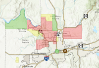
Courtesy of Spokane Regional Emergency Communications
View the full evacuation map online through Spokane Regional Emergency Communications.
UPDATE: August 2, 2026 at 7:30 a.m.
The Old Trails Fire, Autumn Lane Fire and the Fairview Fire are now being reported as one complex named the Spokane Area Fires. According to California Interagency Incident Management Team 7, as many at 600 structures have been destroyed per preliminary assessments.
A shelter has been opened for evacuees at the Spokane Convention Center.
As of Sunday morning, the following areas are under level 3 evacuation for the complex of fires:
Old Trails Fire:
RUTTER ON THE NORTH. STRONG ON THE SOUTH. SPOKANE RIVER ON THE WEST. DIVISION ON THE EAST.
STRONG ON THE NORTH. FRANCIS ON THE SOUTH. SPOKANE RIVER ON THE WEST. FIVE MILE ON THE EAST.
FRANCIS ON THE NORTH. WELLESLEY ON THE SOUTH. ASH ON THE WEST. DIVISION ON THE EAST.
Level 2 evacuations for the Old Trails Fire are in place for this area:
MAGNESIUM ON THE NORTH. FRANCIS ON THE SOUTH. DIVISION ON THE EAST AND NEVADA ON THE WEST.
Autumn Lane Fire:
ALL HOUSES NORTH OF CHARLES FROM THE DAM TO BOND LN
ALL HOUSES ON THE EAST SIDE OF CHARLES FROM BOND LN TO HIGHLAND.
EAST TO CHARLES RD. SOUTH TO HIGHLAND. NORTH TO THE END OF LUPIN LN. NORTH TO 12418 W CHARLES.
LENETTE ON THE NORTH. THE END OF LUPIN ON THE SOUTH. LAKE SPOKANE ON THE EAST. WILLYNWOOD ONTHE WEST.
BERNHILL ON THE NORTH. RUTTER ON THE SOUTH. STEVENS COUNTY LINE IN THE WEST. HAZARD ON THE EAST.
BALLARD ON THE NORTH. RUTTER ON THE SOUTH. HARZARD ON THE WEST. AUSTIN ON THE EAST.
in the area of Hazard to the east, Bernhill to the south, Woolard to the north, Lincoln County line to the west.
Level 2 evacuations are in place for the Autumn Lane fire in the following area:
RIDGEWAY ON THE NORTH. AUSTIN TO THE EAST. BALLARD ROAD FROM THE SOUTHEAST AND AS IT MOVES NORTHWEST TO HAZARD AND CONTINUES WEST TO STEVENS COUNTY LINE.
Fairview Fire:
MT SPOKANE PARK DR ON THE NORTH. ORCHARD ON THE SOUTH. MARKET ON THE WEST. FORKER ON THE EAST.
PEONE ON THE NORTH. LINDGREN ON THE SOUTH. HWY 395 ON THE WEST AND BRUCE ON THE WEST.
ORCHARD ON THE NORTH. LINCOLN/PLEASANT PRAIRIE ON THE SOUTH. FORKER ON THE EAST. MARKET ON THE WEST.
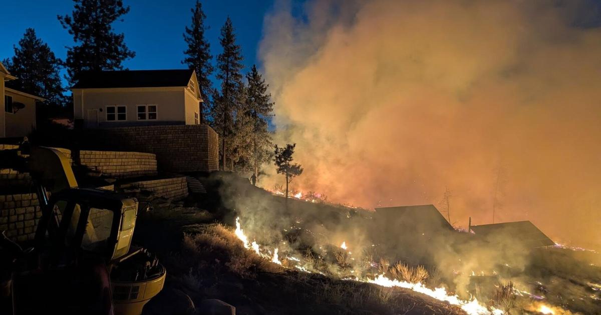
SPOKANE, Wash. – Fires have several homes in the Spokane area evacuated Saturday.
Officials are telling everyone impacted that all evacuation traffic should be moving eastbound. People are asked to use side streets.
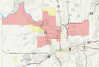
The current area is evacuated due to the Old Trails Fire north of Airway Heights as of 9:24 pm:
RUTTER ON THE NORTH. STRONG ON THE SOUTH. SPOKANE RIVER ON THE WEST. DIVISION ON THE EAST.
STRONG ON THE NORTH. FRANCIS ON THE SOUTH. SPOKANE RIVER ON THE WEST. FIVE MILE ON THE EAST.
FRANCIS ON THE NORTH. WELLESLEY ON THE SOUTH. ASH ON THE WEST. DIVISION ON THE EAST.
Level 2 evacuations are in place for this area:
MAGNESIUM ON THE NORTH. FRANCIS ON THE SOUTH. DIVISION ON THE EAST AND NEVADA ON THE WEST.
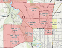
Screenshot of the Spokane County Evacuation Map taken on August 1, 2026 at 9:25 p.m.
The following area is on Level 3 evacuations due to the Fairview Fire near Mead:
MT SPOKANE PARK DR ON THE NORTH. ORCHARD ON THE SOUTH. MARKET ON THE WEST. FORKER ON THE EAST.
PEONE ON THE NORTH. LINDGREN ON THE SOUTH. HWY 395 ON THE WEST AND BRUCE ON THE WEST.
ORCHARD ON THE NORTH. LINCOLN/PLEASANT PRAIRIE ON THE SOUTH. FORKER ON THE EAST. MARKET ON THE WEST.
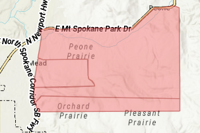
Screenshot of the Spokane County Evacuation Map taken on August 1, 2026 at 6:43 pm.
The following areas are under level 3 evacuations for the Autumn Lane Fire near Five Mile Falls:
ALL HOUSES NORTH OF CHARLES FROM THE DAM TO BOND LN
ALL HOUSES ON THE EAST SIDE OF CHARLES FROM BOND LN TO HIGHLAND.
EAST TO CHARLES RD. SOUTH TO HIGHLAND. NORTH TO THE END OF LUPIN LN. NORTH TO 12418 W CHARLES.
LENETTE ON THE NORTH. THE END OF LUPIN ON THE SOUTH. LAKE SPOKANE ON THE EAST. WILLYNWOOD ONTHE WEST.
BERNHILL ON THE NORTH. RUTTER ON THE SOUTH. STEVENS COUNTY LINE IN THE WEST. HAZARD ON THE EAST.
BALLARD ON THE NORTH. RUTTER ON THE SOUTH. HARZARD ON THE WEST. AUSTIN ON THE EAST.
Homes in Suncrest are also under level 3 evacuations.
Level 2 evacuations have been issued for:
RIDGEWAY ON THE NORTH. BALLARD ON THE SOUTH. STEVENS COUNTY LINE ON THE WEST. AUSTIN ON THE EAST.
PINE BLUFF ON THE NORTH. FOUR MOUND/SEVEN MILE ON THE SOUTH. DOVER ON THE WEST. SPOKANE RIVER ON THE EAST.
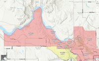
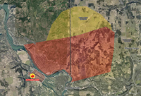
The Espanola Fire has homes in the following area under level 2 evacuation near Medical Lake:
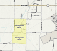
NORTH TO MCFARLANEAND SOUTH TO THORPE. EAST TO RITCHEY AND WEST TO ESPANOLA.
MANILA ON THE SOUTH. THORPE ON THE NORTH. ESPANOLA ON THE WEST. RITCHEY ON THE EAST.