

Published on Jul. 19, 2025, 12:51 AM
Updated on Jul. 19, 2025, 2:38 PM
Strong wind gusts and torrential rain will pose the main threat in Saturday’s storms across southern Ontario and parts of cottage country
The lower humidity that arrived in southern Ontario on Thursday and Friday brought some gorgeous mid-July weather to the region. A change is coming, though, and it’s one that’ll require folks across the region to keep an eye to the sky.
A low-pressure system moving into the Great Lakes on Saturday will help spark strong to severe thunderstorms across southern Ontario.
DON’T MISS: See fireballs and meteors crisscross the night sky over the next month
Keep an eye on the radar and listen for severe weather alerts in your area as you go about your day.
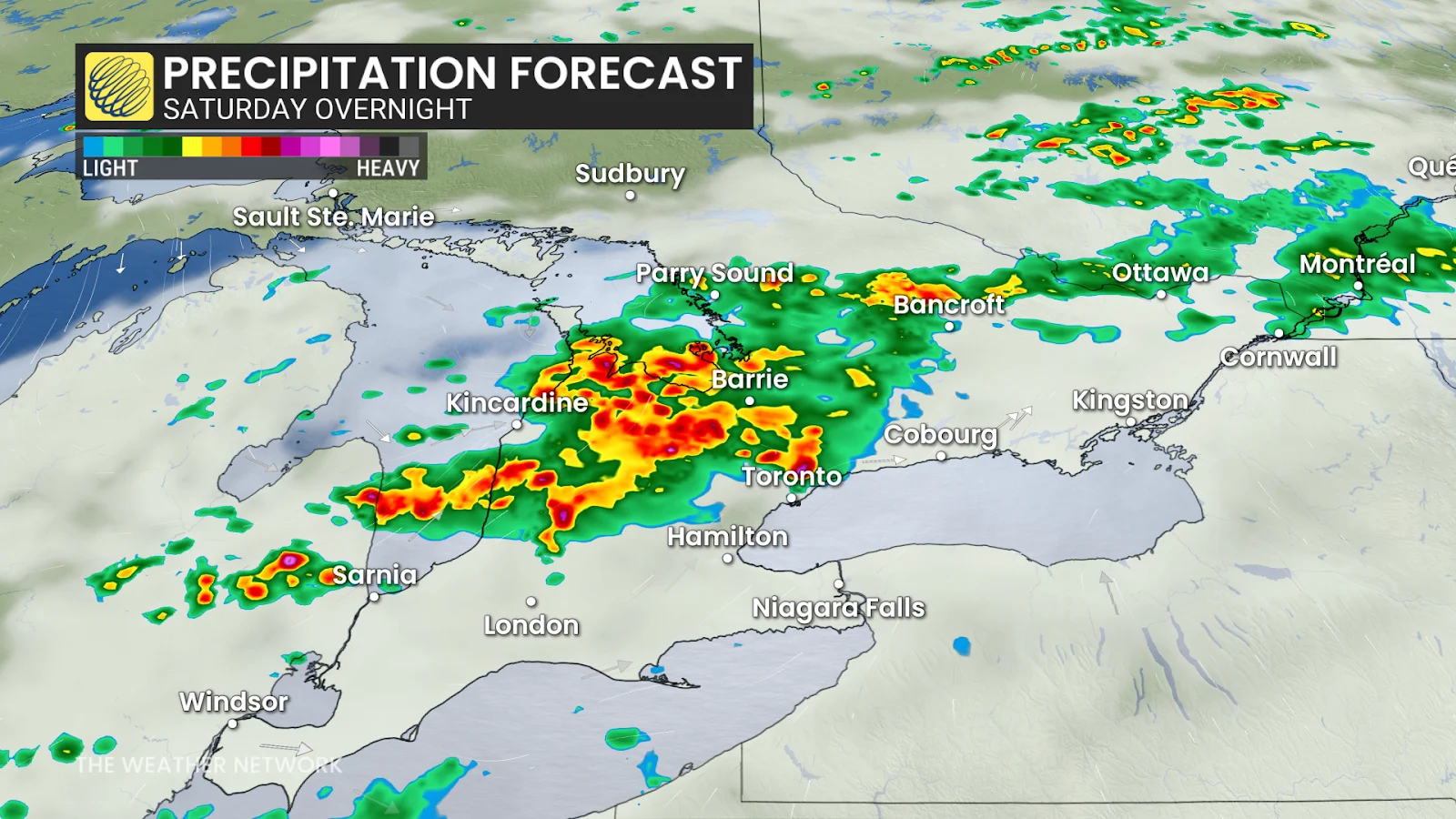
A low-pressure system moving into the Great Lakes region on Saturday will send temperatures soaring to the 30-degree mark in spots as a warm front lifts across Ontario. This system will help spark scattered showers for central Ontario during the day.
As the day progresses, we’ll see thunderstorms develop stateside and push toward southern Ontario during the afternoon hours. By late Saturday afternoon, a cluster of storms may move toward the shores of Lake Huron and Georgian Bay.
Severe weather is possible from Muskoka to Sarnia by late evening and into the overnight. Strong wind gusts and heavy rainfall appear to be the main threats at this time.