
When Tropical Storm Dolly forms, it’s not connected to Dolly Parton
Tropical Storm Dolly is forecast to face an increasingly hostile environment enhanced by El Niño as it approaches the Caribbean in the next few days.
Where the storm is now
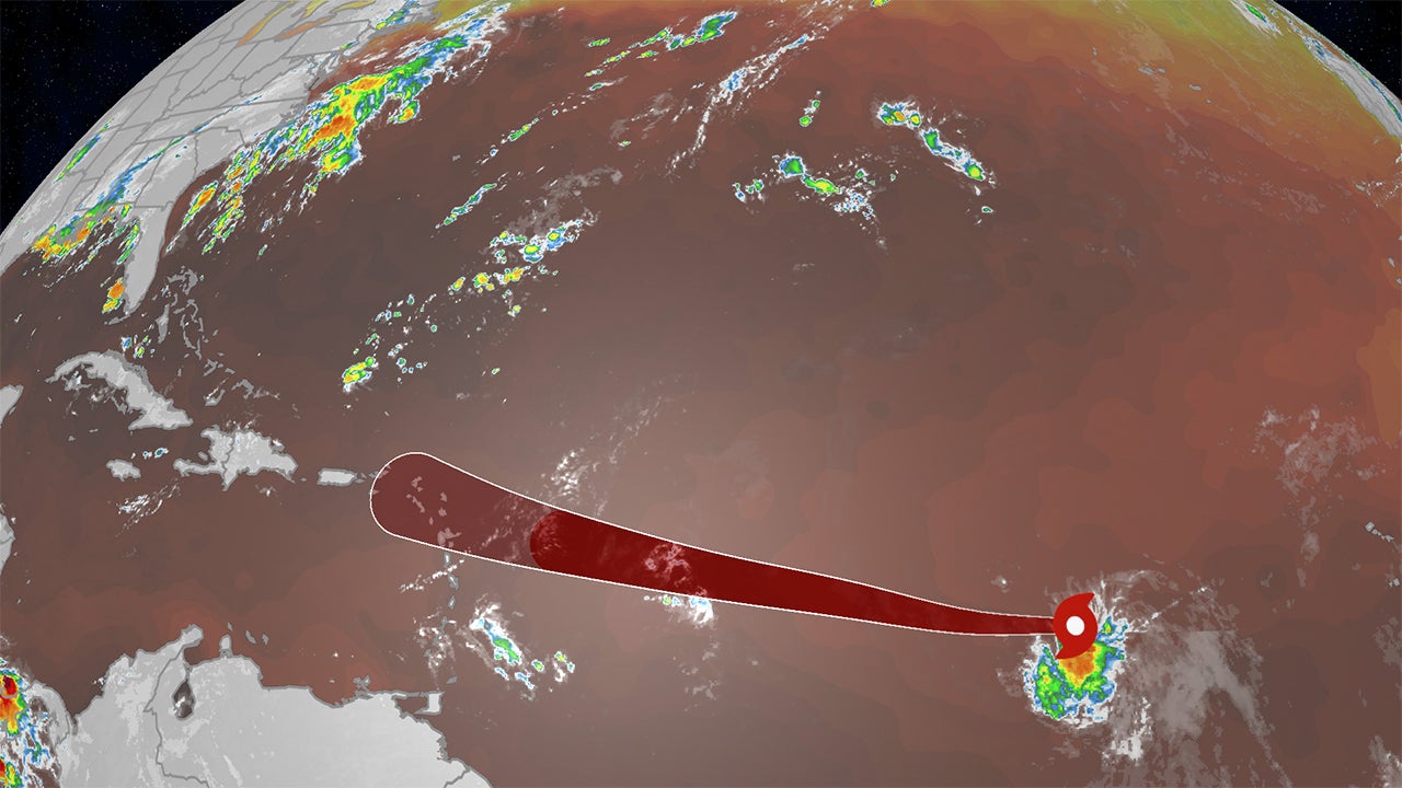
Tropical Storm Dolly formed Thursday morning, becoming the fourth storm of the 2026 Atlantic hurricane season.
It’s located over 1,000 miles east of the Lesser Antilles, moving toward the west.

Weather in your inbox
By signing up you agree to the Terms & Privacy Policy. Unsubscribe at any time.
The timing of the use of this name for a tropical storm is “purely coincidental”, according to the National Hurricane Center. The name “Dolly” was chosen in the early 1990s, has been on a rotating list of names since 1996 and was also used prior to the 1990s.
(MORE: A tropical storm is called ‘Dolly’, but it’s not meant as a tribute)
Dolly won’t last long
The National Hurricane Center forecasts Dolly will eventually disorganize and spin down to a remnant known to meteorologists as a tropical wave by this weekend.
Get More of Our News on Google
Set The Weather Company as a ‘Preferred Source’ to get quicker access to the news you value.

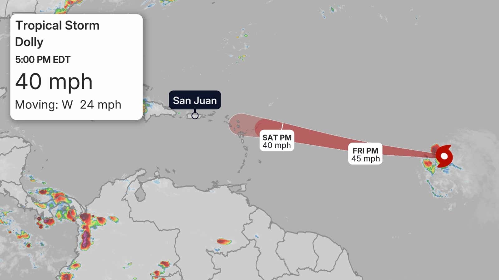
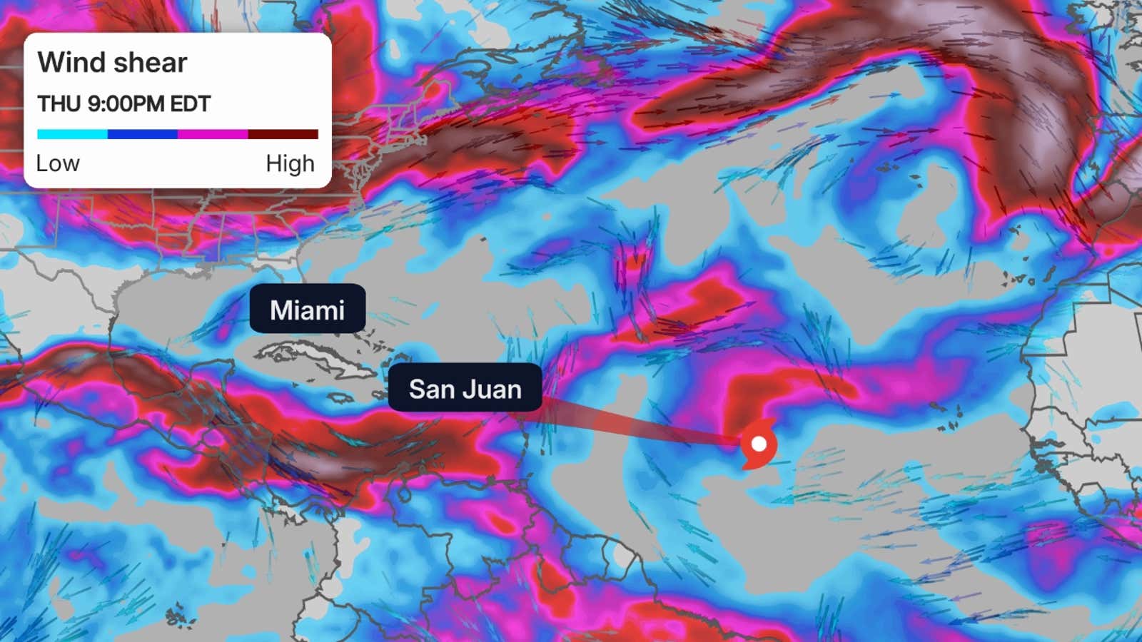
That’s because Dolly will face a combination of dry air and wind shear as it draws closer to the Leeward Islands.
These two factors, both enhanced by the strengthening El Niño, are hostile to tropical systems. They’re the same factors other tropical wannabes have fought against and lost in recent weeks.
(MORE: What is wind shear?)
 Soaking rain, regardless
What’s left of the system is expected to arrive over the Leeward Islands Saturday night or Sunday with at least some gusty winds possible.
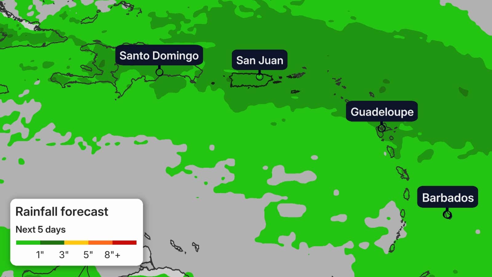
Even though it may lose the name “Dolly”, locally heavy rain is also possible in parts of the Leeward Islands, Puerto Rico, the Virgin Islands and Hispaniola from late Saturday through Monday.
While this is welcomed news for the extreme drought in Puerto Rico and the Virgin Islands, these locally heavy downpours could lead to flash flooding in some areas, particularly in hilly or mountainous terrain.
 That may not be the end of the story
After Dolly weakens to a tropical wave, it will continue moving toward the west-northwest next week, as all these tropical waves do in hurricane season.
There are a few computer models suggesting this system could have a chance of redeveloping later next week somewhere near the Bahamas or Bermuda Triangle.
By that time, the atmosphere may become a bit more favorable for development.
But even if that never occurs, tropical waves can still bring gusty winds and heavy rain in their path, so the Lesser Antilles, Puerto Rico, Hispaniola, Cuba and the Bahamas can still see some impacts.
(MORE: What tropical terms actually mean)
For now, it’s far too soon to know if that will happen and if it does, where it may track and how strong it may become.
The area north of the Caribbean is typically a more favorable area for activity, even in El Niño.
It’s a reminder that while we expect a quieter hurricane season, you should have your hurricane safety plan ready to go and monitor forecasts throughout the season.
It only takes one storm to make a hurricane season impactful.
Hurricane lull meets most active month
We are quickly nearing the typical peak of Atlantic hurricane season activity, usually around the second week of September.
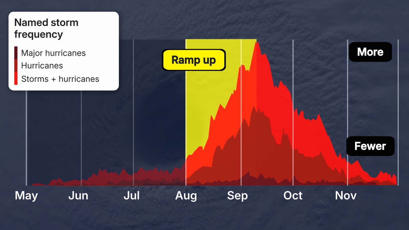
However, it has been the quietest start to an Atlantic season in almost 40 years, with only three short-lived tropical storms and no hurricanes so far.
That’s due in large part to the intensifying El Niño, enhancing wind shear and sinking, dry air hostile for development, as alluded to earlier.
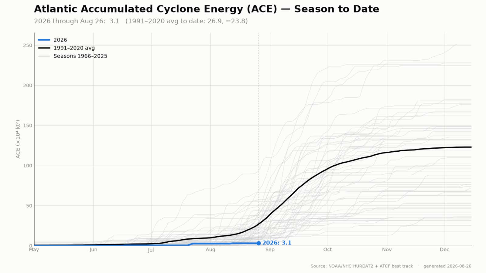
This graph shows the ACE index for the 2026 Atlantic hurricane season through Aug. 26 in blue, the average season ACE in black, and other ACE index values of hurricane seasons in the satellite era since 1966 in gray.
(Data: NOAA/NHC)
Rob Shackelford is a meteorologist and climate scientist at weather.com. He received his undergraduate and master’s degrees from the University of Georgia, studying meteorology and experimenting with alternative hurricane forecasting tools.