
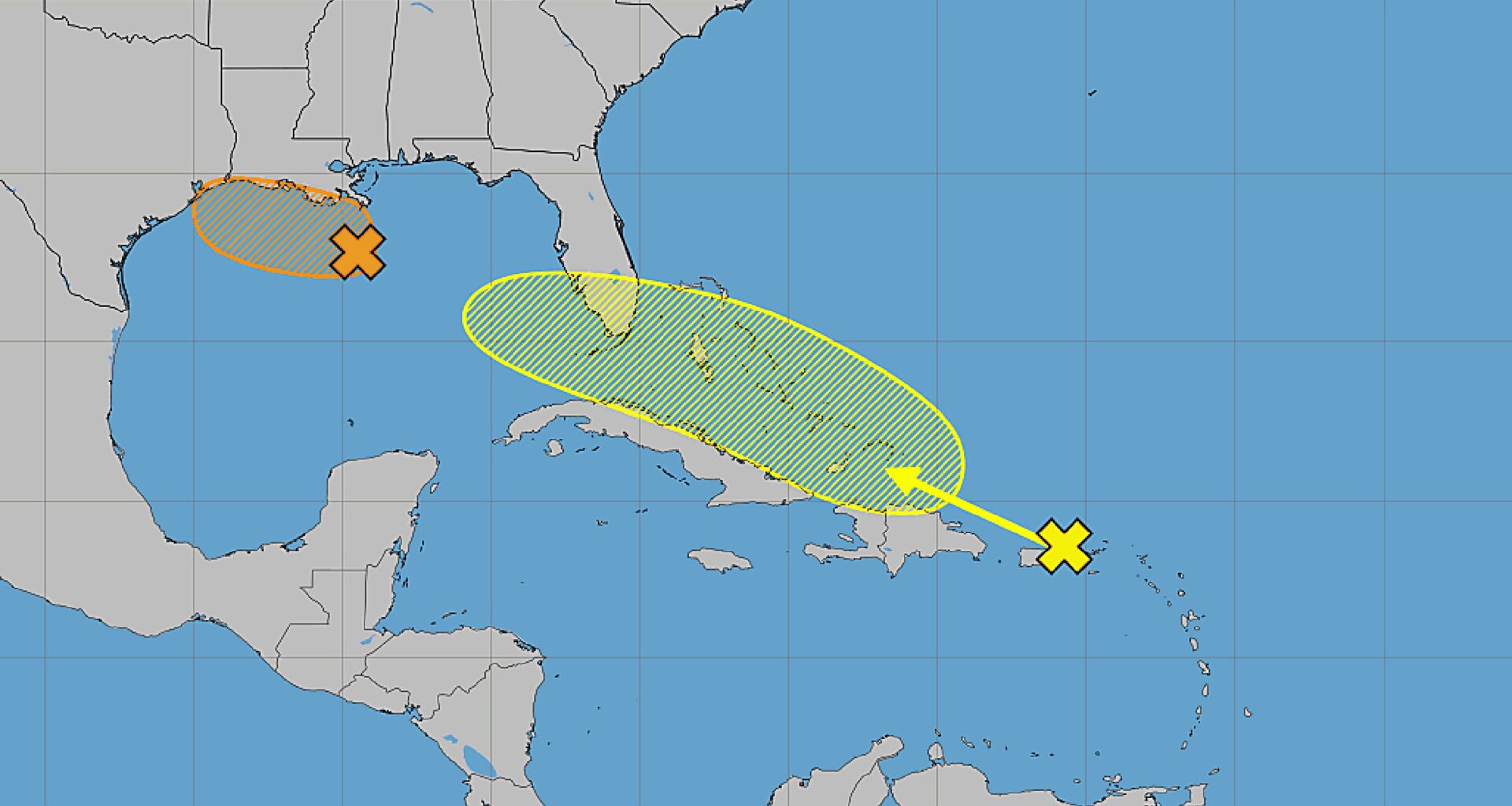
The National Hurricane Center on Sunday upped the odds that two systems, one in the Gulf, and the remnants of what had been Tropical Storm Dolly, could develop.
As of the NHC’s 2 p.m. tropical outlook, what had been Dolly for just one day last week, but is now a strong tropical wave, was producing an area of showers and thunderstorms from Puerto Rico and eastward across the Virgin Islands and the northern Leeward Islands.
“Satellite data and surface observations indicate that there are no signs of a closed surface circulation, and redevelopment is unlikely during the next day or two while the wave moves westward to west-northwestward at about 25 mph,” forecasters said. “The system should bring locally heavy rains and gusty winds to portions of the Leeward Islands, the Virgin Islands, Puerto Rico, and Hispaniola over the next couple of days.
The NHC said conditions may become more conducive for redevelopment by the middle of the week, though, as the system moves near Florida and into the Gulf.
The NHC gave it a 20% chance to develop in the next seven days.
[1 pm CDT Aug 30] The area of low pressure over the northern Gulf could become a short-lived tropical depression or storm as it drifts generally west-northwestward over the next couple of days. Regardless of development, locally heavy rainfall is expected across far southern… pic.twitter.com/elFERQnJ0x
— National Hurricane Center (@NHC_Atlantic) August 30, 2026
The second system being tracked by the NHC was already in the northern Gulf about 125 miles south of the coast of southeastern Louisiana.
“Satellite imagery and recent satellite wind data indicate that this system has become better organized since yesterday,” forecasters said. “Additional development is possible as the low moves slowly west-northwestward, and a short-lived tropical depression or tropical storm could form before the system reaches the upper Texas or southwestern Louisiana coasts Tuesday or Tuesday night.”
The area of low pressure had showers and thunderstorms that became more concentrated since Saturday. People in the Louisiana and upper Texas coasts should monitor the system’s progress.
“Regardless of development, locally heavy rainfall is possible over portions of the upper Texas or southwestern Louisiana coasts during the next couple of days,” forecasters said.
The NHC increased its forecast giving the system a 50% chance to develop in the next two to seven days.
After Dolly, the next name on the 2026 Atlantic hurricane list is Edouard.
Dolly had become the fourth named storm after tropical storms Arthur, Bertha and Cristobal.
Hurricane season began June 1 and runs through Nov. 30, but the height of hurricane season runs from mid-August through mid-October.
The National Oceanic and Atmospheric Administration earlier this month updated its seasonal forecast and now expects between seven and 13 named storms this year. Of those, two to six would become hurricanes. It also predicted that there might not be any major hurricanes this year, or at most two.
Already, 2026 was forecast to have lower-than-average storm generation, and that has been reduced even further with the latest forecasts from the NOAA and other weather groups.
An average year would see 14 named storms and seven hurricanes, with three of those growing to Category 3 strength or higher.