
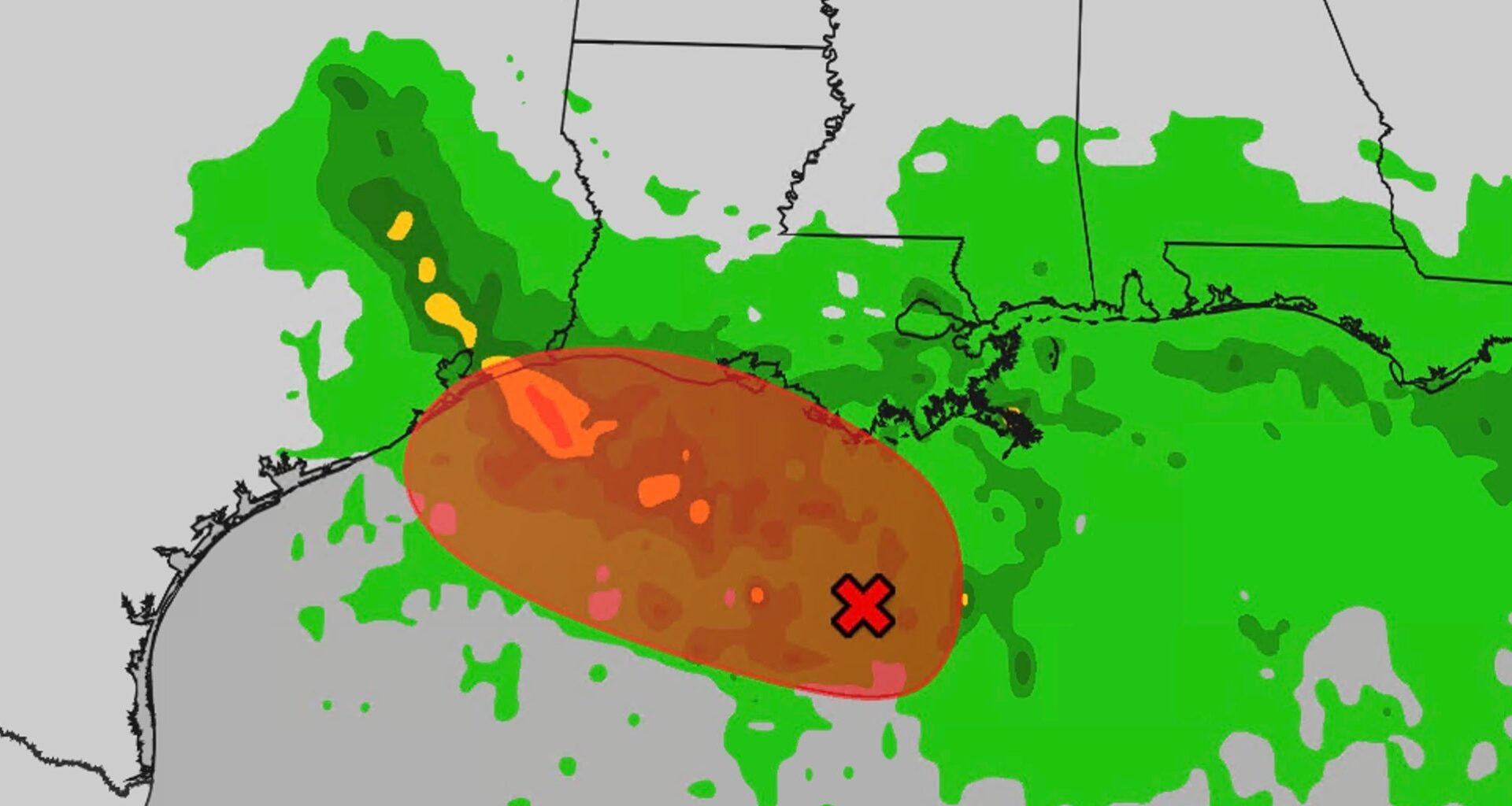
Tropical Storm Edouard could form in the Gulf and while it won’t last long, it wring out flooding rain in parts of eastern Texas and Louisiana, including the Houston metro area.
New this morning: Wind alerts have been issued and the system has been tagged Potential Tropical Cyclone Five.
Wind alerts
Tropical storm warnings have been issued from Port Bolivar, Texas, to the Vermilion/Cameron Parish Line in Louisiana, meaning winds of 40+ mph are expected beginning on Tuesday. This includes Houston and Galveston.

Weather in your inbox
By signing up you agree to the Terms & Privacy Policy. Unsubscribe at any time.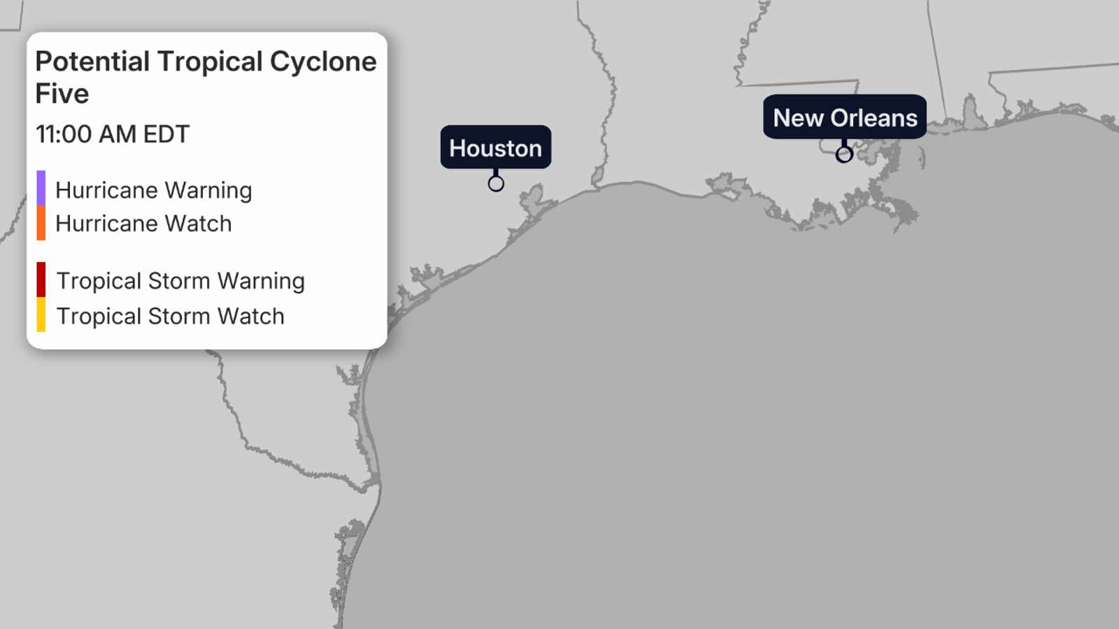 Where the system is now
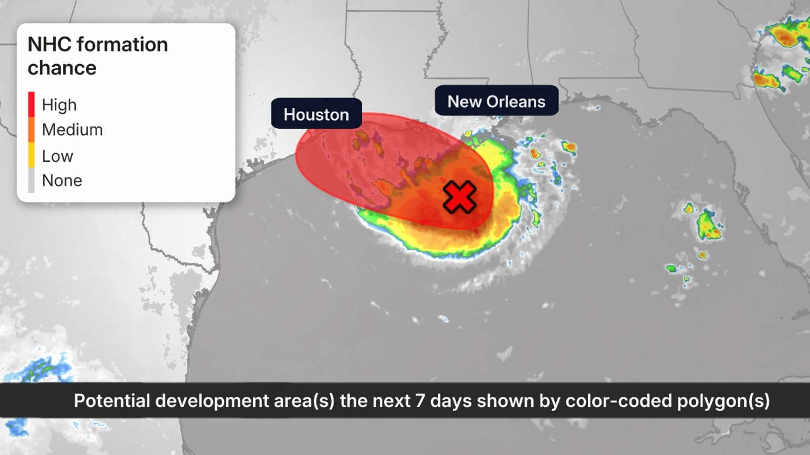
The National Hurricane Center is monitoring an area of low pressure in the northern Gulf a little more than 100 miles off the coast of Louisiana. It is moving west-northwest.
Thunderstorms are becoming increasingly clustered, wind shear is fairly light and Gulf water temperatures are in the upper 80s, all favorable for additional development.
For now, they’re calling the system Potential Tropical Cyclone Five because the system does not meet the criteria to be a tropical depression just yet. The Hurricane Hunters found weak winds on a flight through the storm this morning.
Get More of Our News on Google
Set The Weather Company as a ‘Preferred Source’ to get quicker access to the news you value.

A potential tropical cyclone, or PTC, is a disturbance that has not yet developed into a tropical cyclone but poses the threat of bringing tropical storm or hurricane conditions to land areas within 72 hours.
(IN DEPTH: What is a Potential Tropical Cyclone?)
Where it’s headed
Fortunately, this system won’t spend much time over the warm Gulf, but is expected to move inland over eastern Texas sometime Tuesday. It could do so as either a tropical depression or Tropical Storm Edouard.
The small size of this system could allow it to strengthen more than currently shown, but rainfall is expected to be the bigger impact.
(MORE: What the tropical terms mean)
 Impacts
If a tropical storm, it could bring some tropical-storm-force gusts to parts of the upper Texas and southwest Louisiana coasts near and for a few hours after its landfall.
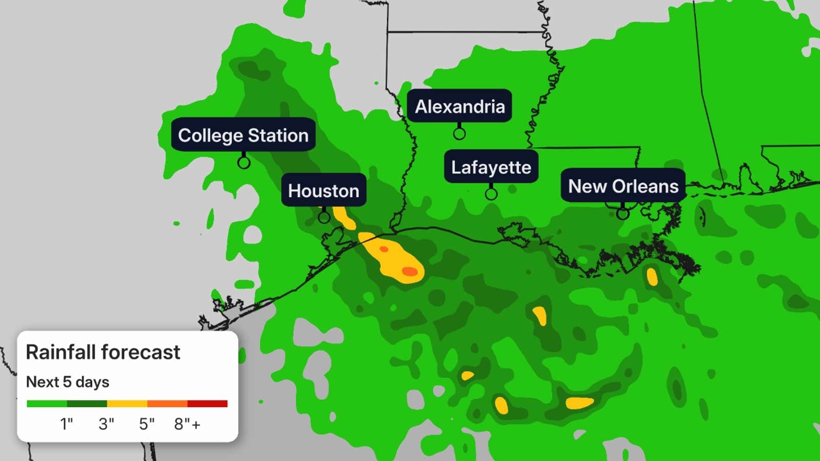
That said, the primary concern from this system is heavy rainfall, both near the coast and to some extent inland, especially over eastern Texas.
Areas of locally heavy rain could persist with the remnant low Wednesday, perhaps even Thursday in eastern Texas.
While this area is in drought, these bands of heavy rain could lead to flash flooding, including in parts of the Houston metro area.
(MORE: Why impacts aren’t just at the coast)
A one to three foot storm surge is also possible on the Texas and Louisiana coastlines.
Third short-lived Gulf storm
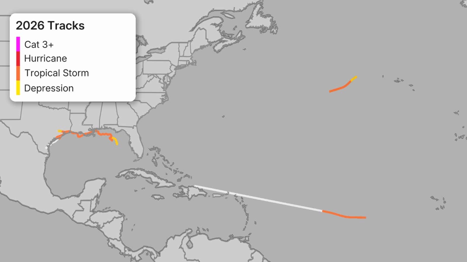
If this becomes Edouard, it would be the third short-lived Gulf storm of the 2026 Atlantic hurricane season.
Tropical Storm Arthur and its remnants soaked parts of the northern Gulf Coast in mid-June.
About a month later, Tropical Storm Bertha produced some strong wind gusts and coastal flooding, but was hammered by strong wind shear which kept its rainfall impacts relatively limited along the Gulf Coast.
(MORE: Record long wait for first Atlantic hurricane of season?)
 The latest on Dolly
The remnants of Tropical Storm Dolly are passing north of the Greater Antilles and there is a low chance of development near the Bahamas or South Florida.
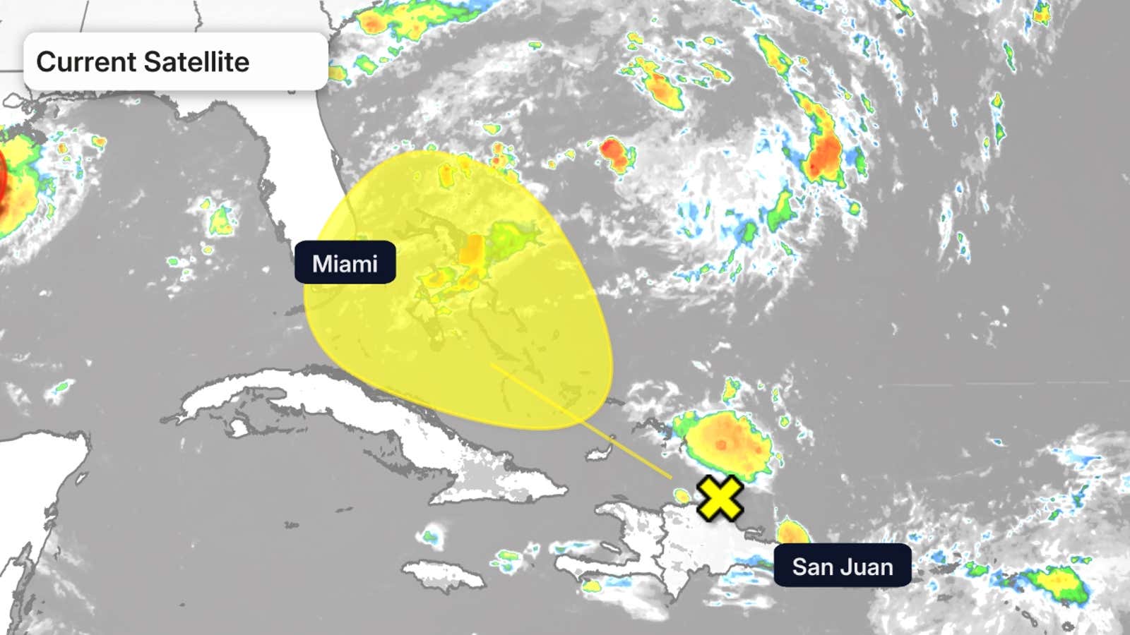
Tropical Storm Dolly formed Thursday morning, becoming the fourth storm of the 2026 Atlantic hurricane season. By late Friday morning, observations showed that Dolly was an open tropical wave and no longer a tropical storm.
A rapid forward speed toward the northwest and strong shearing winds aloft will likely continue to prohibit re-development.
The timing of the use of this name for a tropical storm is “purely coincidental,” according to the National Hurricane Center. The name “Dolly” was chosen in the early 1990s, has been on a rotating list of names since 1996 and was also used prior to the 1990s.
(MORE: A tropical storm is called ‘Dolly,’ but it’s not meant as a tribute)
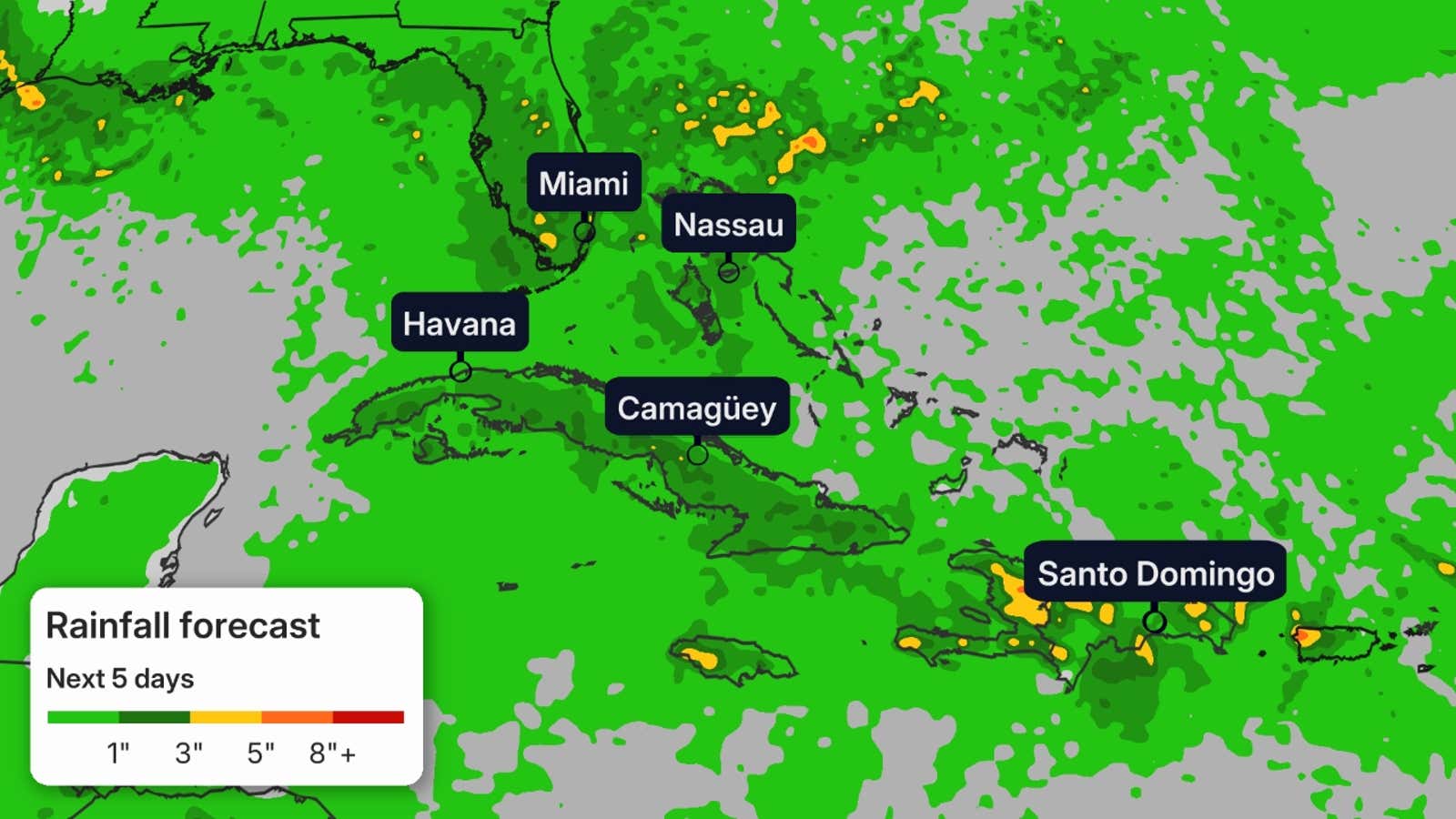
The remnants of Dolly will bring much-needed rainfall to the Greater Antilles and South Florida, but a few of these locally heavy downpours could lead to flash flooding in some areas, particularly in hilly or mountainous terrain.
It’s a reminder that while we expect a quieter hurricane season, you should have your hurricane safety plan ready to go and monitor forecasts throughout the season.
The Weather Company and Kalshi, a CFTC-regulated event-contract exchange, share data: we provide certain data Kalshi uses to resolve markets, and Kalshi provides market data featured in content like this article. Kalshi alone operates its event-contract exchange and is responsible for the contracts, trading, and settlement on its exchange. If you use our links to communicate with Kalshi and then open a Kalshi account or trade on Kalshi, we may earn a fee.
For Kalshi’s complete member agreement, click here.