
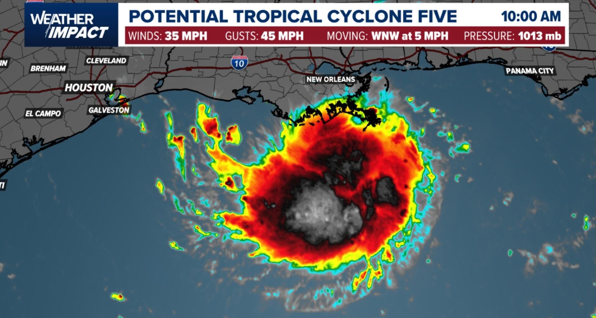
A newly formed disturbance in the Gulf is forecast to strengthen into a tropical storm before reaching the upper Texas and SW Louisiana coastlines on Tuesday.
BEAUMONT, Texas — The National Hurricane Center has issued a Tropical Storm Warning for portions of the upper Texas and southwestern Louisiana coasts as Potential Tropical Cyclone Five forms in the northwestern Gulf of Mexico. The system is forecast to strengthen into a named tropical storm before making landfall along the northwestern Gulf Coast on Tuesday, bringing risks of coastal flooding, heavy rainfall, and tropical-storm-force winds.

This story continues below.
Current Location and Storm Statistics
The center of the disturbance is located near latitude 27.8 North, longitude 91.0 West. This position places the system approximately 130 miles south of Morgan City, Louisiana, and about 230 miles southeast of Port Arthur, Texas.
– Maximum sustained winds: 35 mph with higher gusts
– Present movement: West-northwest at 5 mph
– Minimum central pressure: 1013 mb (29.92 inches)
– Chance of formation: 80 percent through 48 hours and 7 days
Active Watches and Warnings
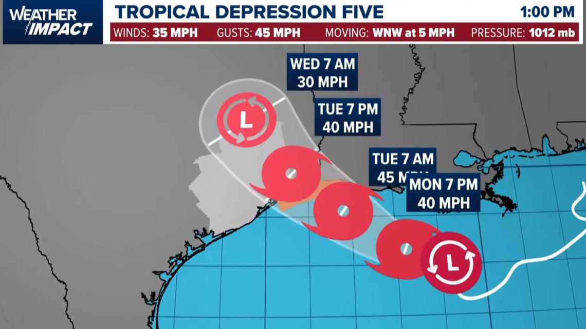
A Tropical Storm Warning is in effect from Port Bolivar, Texas, eastward to the Vermilion and Cameron Parish line in Louisiana.
A Tropical Storm Warning indicates that tropical storm conditions are expected within the specified area within the next 24 to 36 hours. Residents should complete any necessary outside preparations before conditions deteriorate.
Track and Intensity Outlook
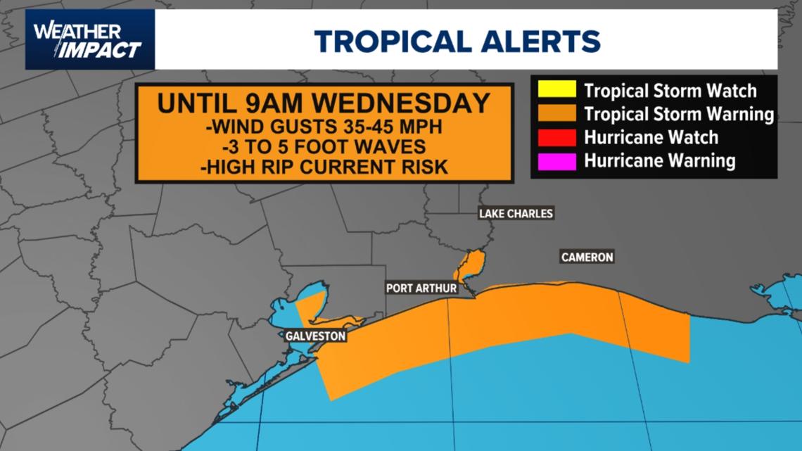
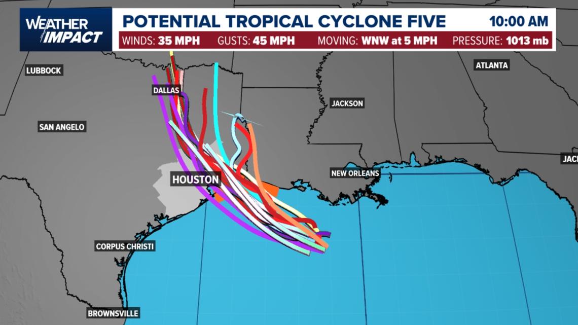
The disturbance is drifting west-northwest at approximately 5 mph, a general motion expected to persist over the next day or two. On the current forecast trajectory, the center of the system will reach the northwestern Gulf Coast within the warning area on Tuesday.
Environmental conditions favor development, and the National Hurricane Center projects the system will organize into a tropical storm by tonight. Strengthening is anticipated as the system moves over warm Gulf waters ahead of Tuesday landfall.
Hazards and Expected Land Impacts
The system poses multiple coastal and inland hazards across southeastern Texas and southwestern Louisiana:
Wind: Tropical storm conditions are expected to arrive within the warning area by Tuesday, creating hazardous travel and complicating outdoor preparations.
Storm Surge: Inundation of 1 to 3 feet above ground level is possible from High Island, Texas, to the Vermilion and Iberia Parish line in Louisiana if peak surge coincides with high tide.
Rainfall: Precipitation totals of 3 to 6 inches, with isolated maximum amounts up to 9 inches, are forecast across the upper Texas coast inland through east-central Texas. Southwest Louisiana is forecast to receive 2 to 3 inches.
Flooding: Heavy rainfall rates may produce flash flooding, with the highest risk occurring in urban centers and low-lying drainage basins.
Track the storm with the interactive radar below (click here if the map doesn’t load)
Staying Prepared and Informed
As the Atlantic hurricane season nears its historical peak, coastal residents should review their emergency plans and supply kits.