1. Current radarChevron Down
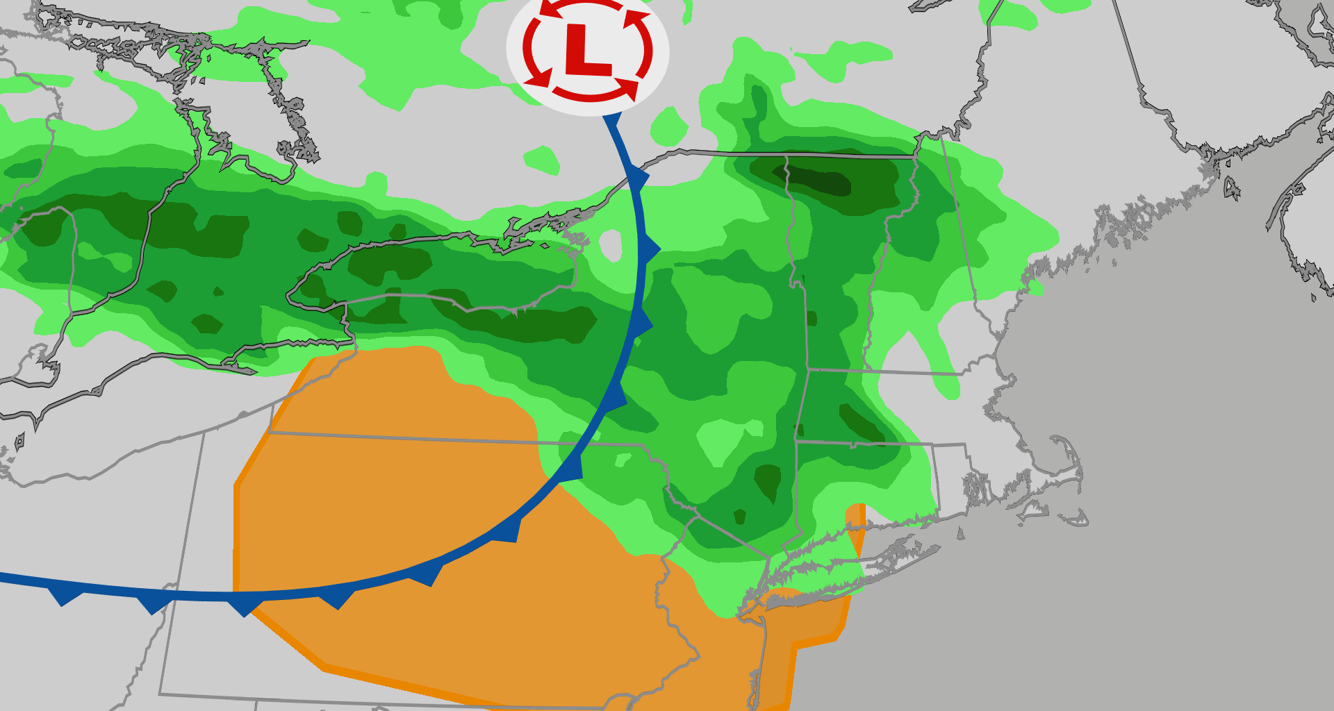
Much of the Northeast will continue to be in the crosshairs of a fast-moving belt of stormy weather through the next few days that could bring hail, wind and even a tornado threat to cities like New York City and Philadelphia.
Current radar
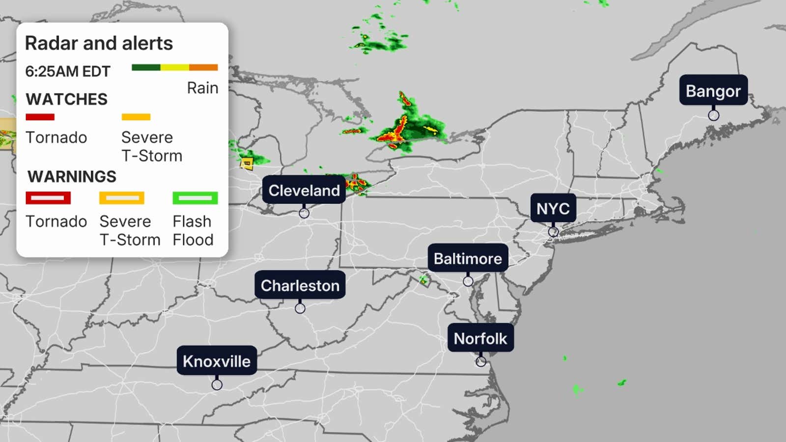
Here’s where rain is currently falling along with any watches and warnings:
 Wednesday peak?
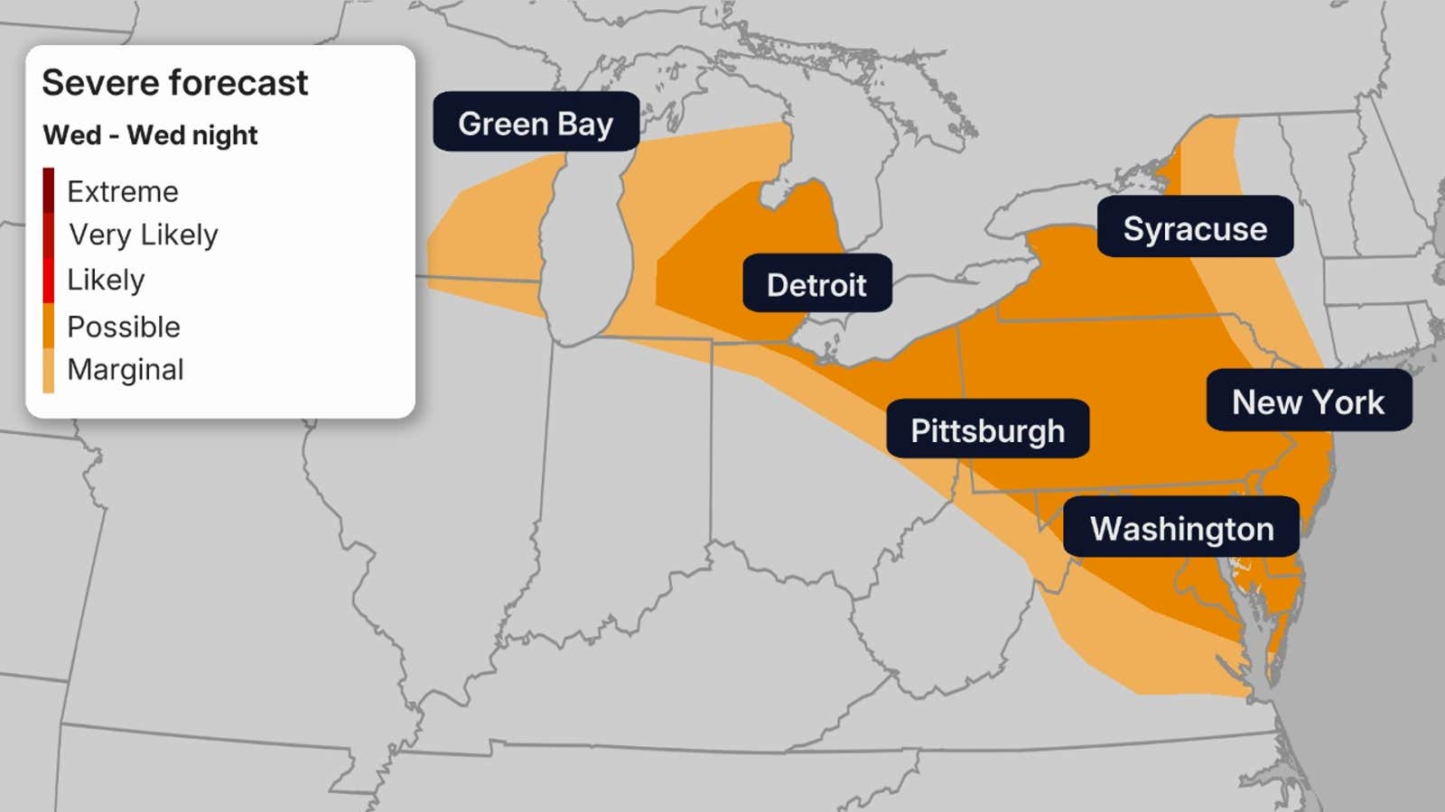
The Storm Prediction Center has highlighted a possible area of severe weather for Wednesday. Storms on Wednesday are again expected to flare up by dawn in the eastern Great Lakes and interior Northeast, then continue southeastward through the afternoon for cities like New York City, Washington, D.C., and Philadelphia.

Weather in your inbox
By signing up you agree to the Terms & Privacy Policy. Unsubscribe at any time.
Another round of storms is possible late Wednesday evening into early Thursday.
The main threats will likely be heavy rain, damaging winds and hail.
 Beyond Wednesday?
This threat of batches of windy thunderstorms likely will persist into Thursday and Friday. The threat will shift slightly south each day.
Get More of Our News on Google
Set The Weather Company as a ‘Preferred Source’ to get quicker access to the news you value.

For Thursday, storms may again start early across the region and move swiftly southeastward through the mid-Atlantic.
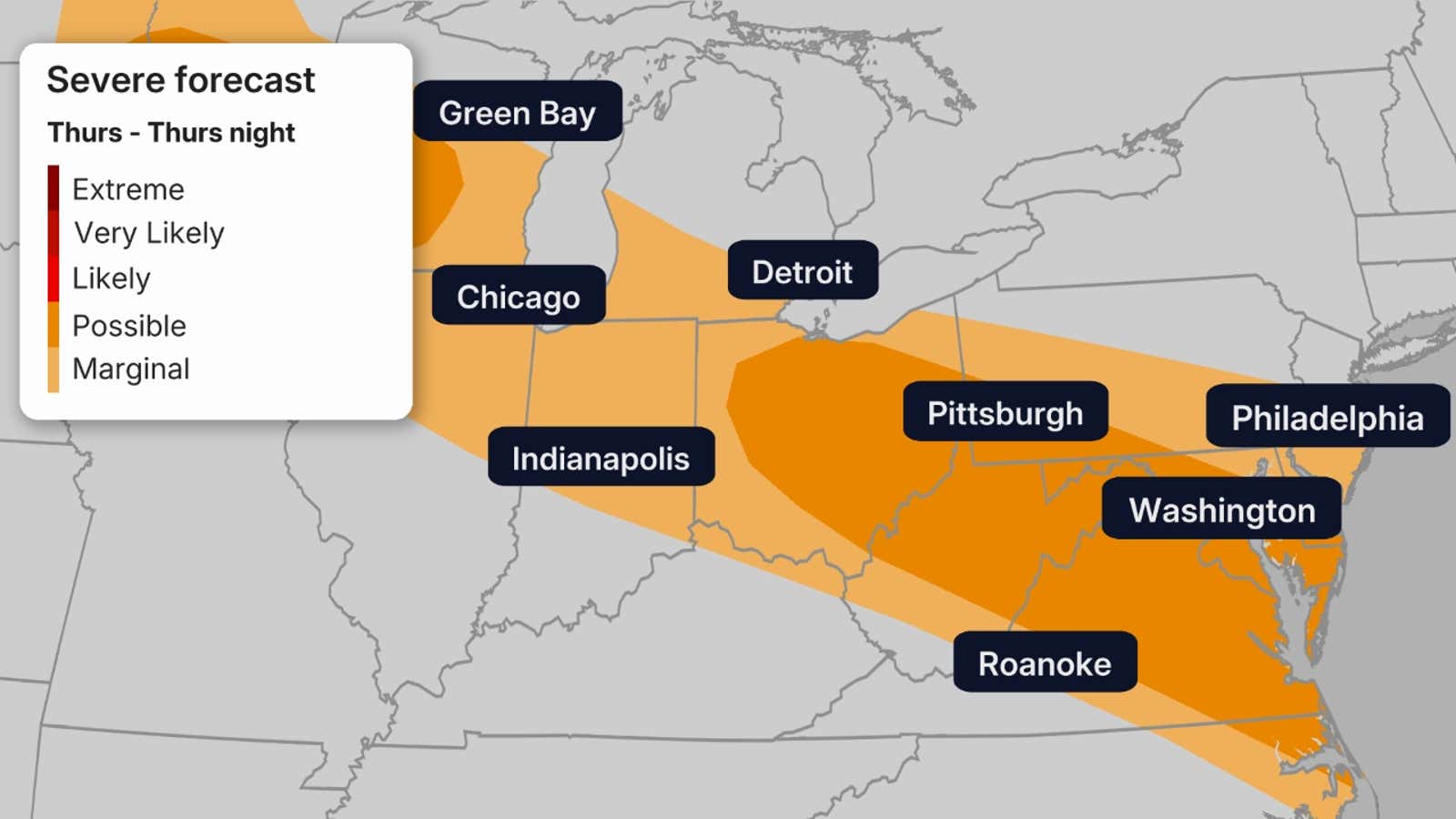
These storms are again situated around rush hour, so take precautions on the trip home.
This time, the threat will be focused more on Washington D.C. and Richmond, Virginia as well as Pittsburgh and Columbus, Ohio.
By Friday, the threat will be highest over the Virginias and North Carolina.
Flood threat?
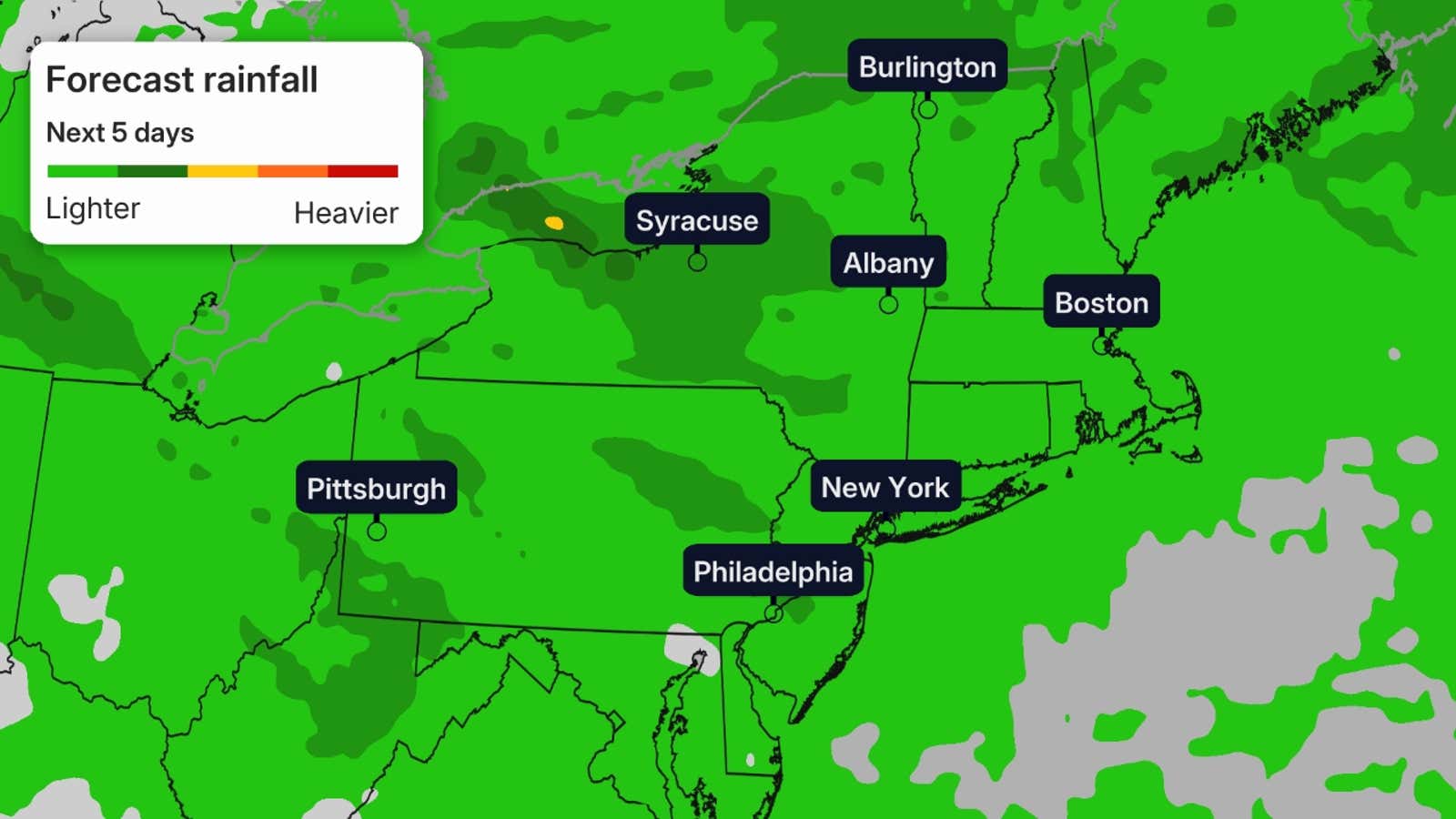
Days of rain and storms also bring the threat of flooding. While there are no flood watches in effect at this time, multiple days of heavy rainfall are possible. Rainfall totals of 1-3 inches are possible for multiple days, so the threat of isolated and urban flooding is not out of the question. These totals could be increased in the coming days as the forecast lines up.