
Early look at Labor Day: Could you see rain or sweltering temps?
Whether you plan to spend your Labor Day weekend out on the lake, grilling, watching college football or just soaking in the last bits of summer, you’ll want to keep an eye on the weather.
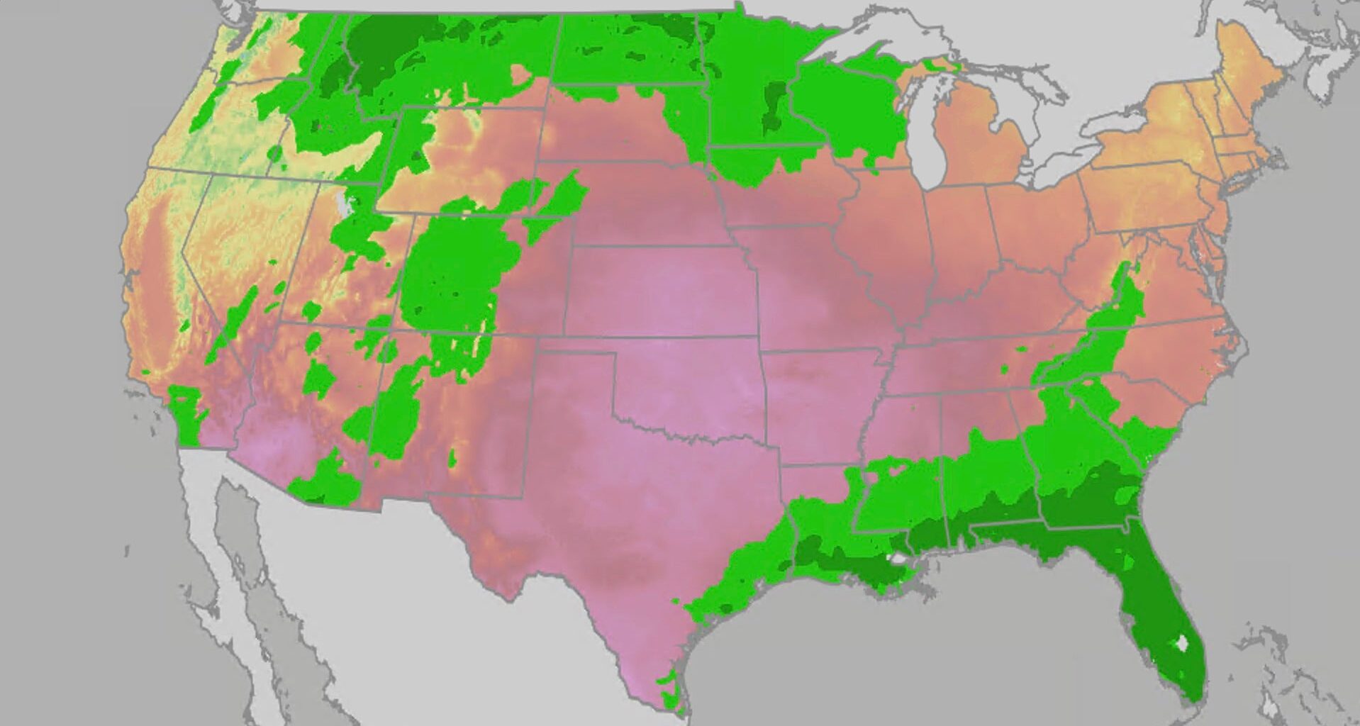
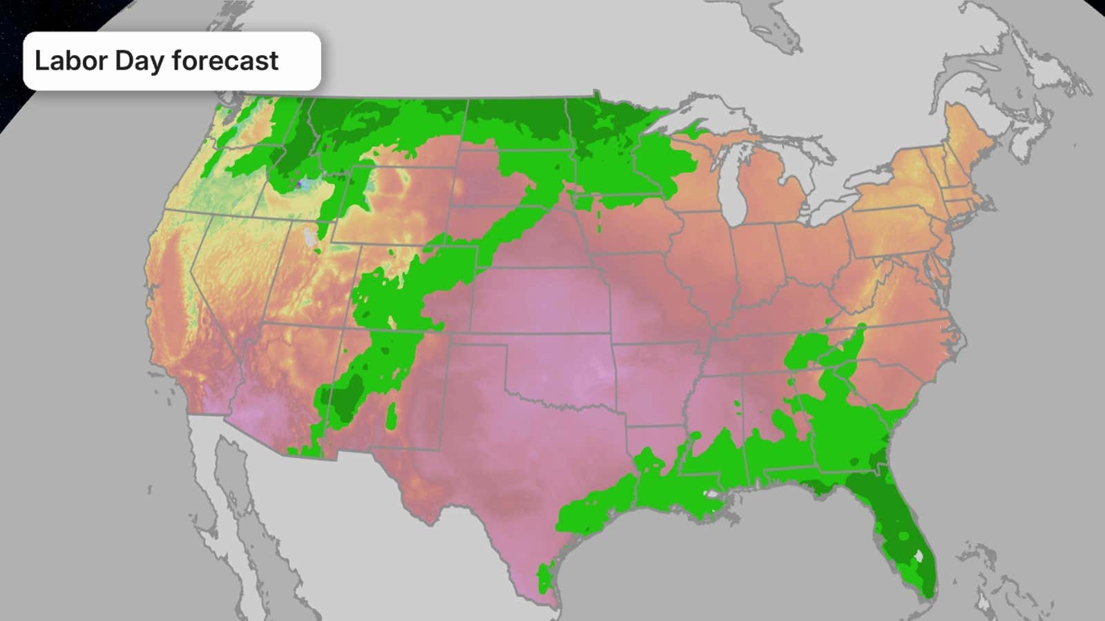
Heat across the central U.S. may make any outdoor plans feel miserable; meanwhile, parts of the Southeast and Rockies may see plans get rained out, at least in the afternoon.
Here’s a look at what the weather has in store for your holiday weekend.

Weather in your inbox
By signing up you agree to the Terms & Privacy Policy. Unsubscribe at any time.
Keep in mind that we are still multiple days out, so as we get closer to the weekend, the forecast will become clearer. Be sure to check back for the latest forecast updates.
 How hot will it be?
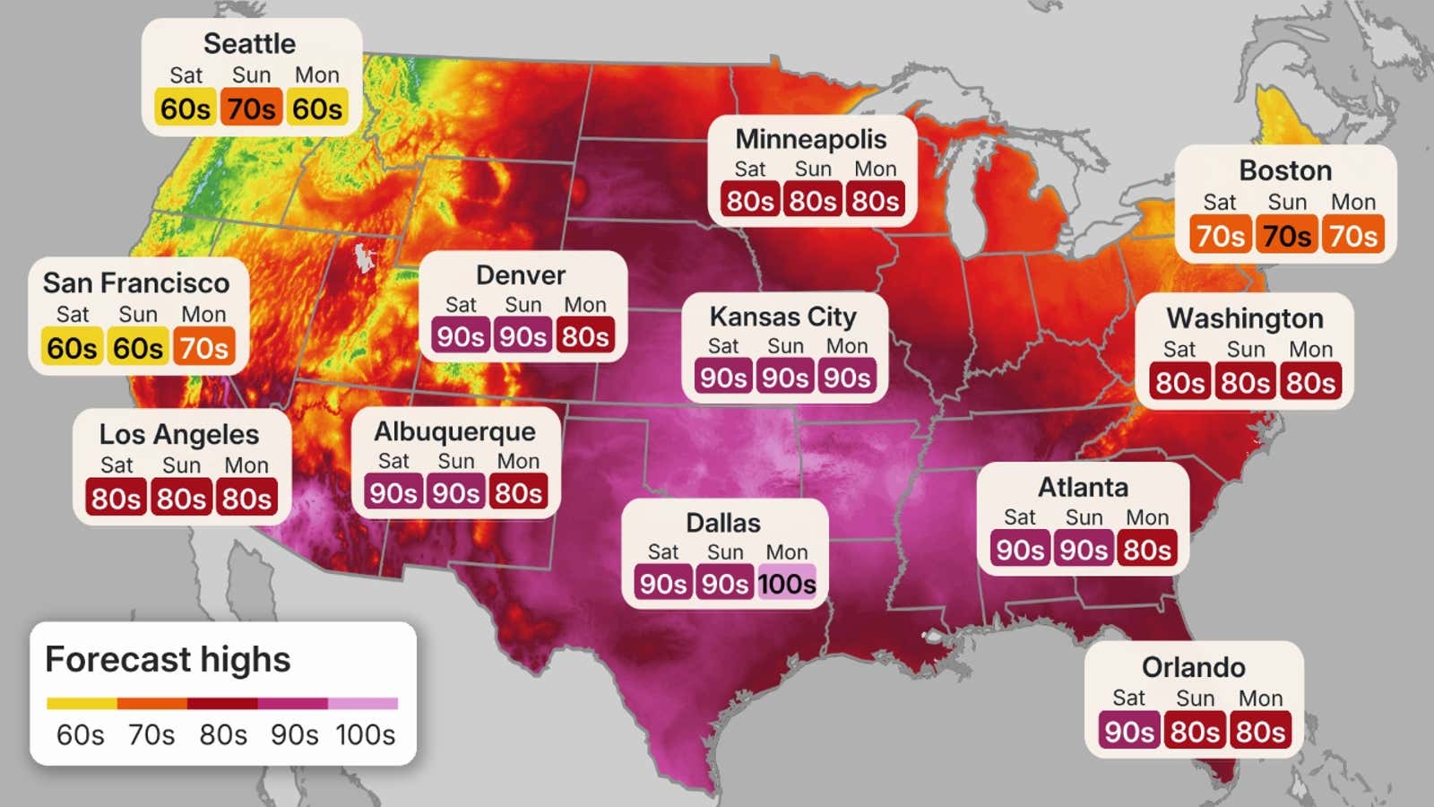
Much of the central U.S. will be significantly hotter than average, especially across the Plains.
Parts of the Southern Plains and even some of the Central Plains will be in the triple digits throughout the holiday weekend, and most of the rest of the Central and Northern Plains will be in the 90s.
Get More of Our News on Google
Set The Weather Company as a ‘Preferred Source’ to get quicker access to the news you value.

The Southeast will start out the weekend with highs in the 90s but some less-hot 80s for highs will sink southward from Virginia into the Carolinas and Georgia Sunday into Monday.
Unfortunately, humidity will make it feel even worse outside. Heat indices in the triple digits are possible across the Deep South and Southern Plains and even as far north as Iowa.
(MAPS: Daily US Highs/Lows)
Meanwhile, the Northwest and Northern California will be cooler than average throughout the weekend, with highs only in the 60s or 70s.
The rest of the country will be close to average for this time of year, which means the Northeast and Great Lakes can expect highs in the 70s or low 80s.
 Soggy or not?
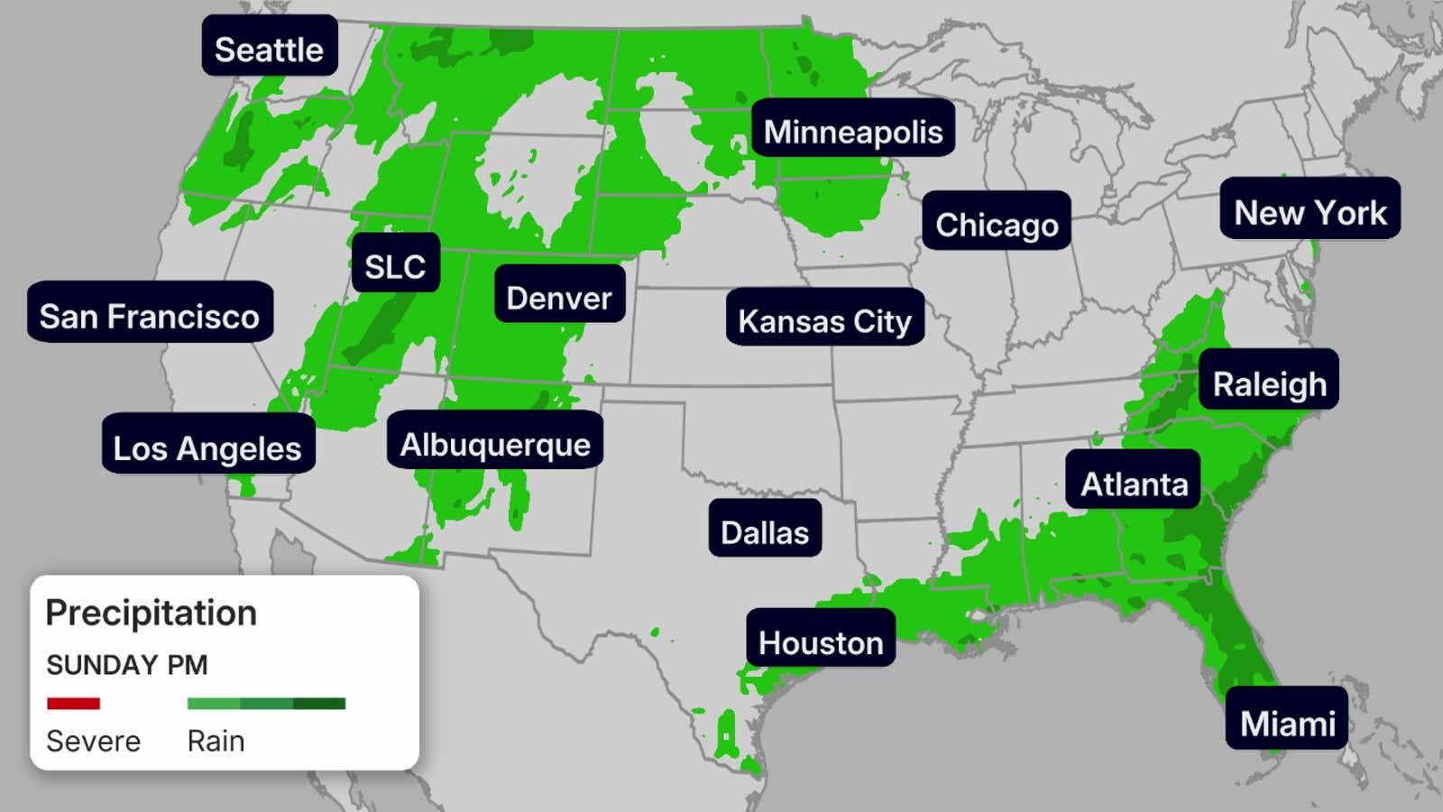
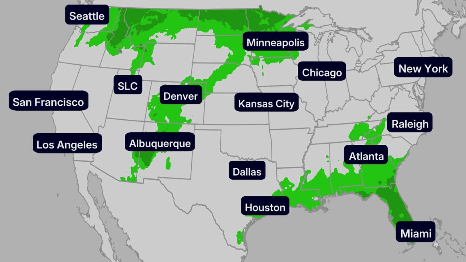
If you’re in the Southeast, you could see a soggy holiday weekend.
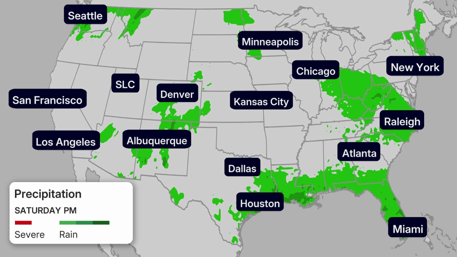
A system is expected to move through the Ohio Valley and mid-Atlantic region on Saturday, bringing potential scattered severe storms as it moves towards the Southeast. The Pacific Northwest could also see scattered showers.
On Sunday, parts of the Southeast could see showers and thunderstorms, so this might be the worst day to plan outdoor activities in that area. The Northern Plains and Rockies could also see scattered showers and thunderstorms.
By Monday, showers could linger for those along the Gulf Coast and parts of the Southeast. The Northern Rockies and Northern Plains could again see scattered thunderstorms, especially in the afternoon and early evening.
(MAPS: 7-Day US Rainfall Forecasts)
Meanwhile, the Four Corners could see more monsoonal moisture fuel scattered thunderstorms throughout the weekend. If you have outdoor plans, you may want to make sure those are done in the morning, before those thunderstorms fire up.
The rest of the country will stay dry this holiday weekend, but you’ll want to limit your time outdoors if you’re in the thick of the heat.
Saturday
Sunday
Monday
Miriam Guthrie is an associate meteorologist with weather.com who graduated from Georgia Tech with her undergrad and graduate degrees in Earth & Atmospheric Sciences.