1. Current radarChevron Down
Much of the Northeast and mid-Atlantic continue to be in the crosshairs of a fast-moving belt of stormy weather through the next few days that could bring hail, wind and even a tornado threat.
Current radar
Severe thunderstorms are most likely today from the upper Midwest into the mid-Atlantic states with multiple clusters of storms moving through the region into early Friday morning.
Here’s where rain is currently falling along with any watches and warnings:

Weather in your inbox
By signing up you agree to the Terms & Privacy Policy. Unsubscribe at any time.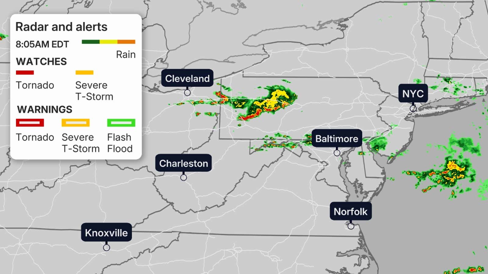 Thursday and Friday
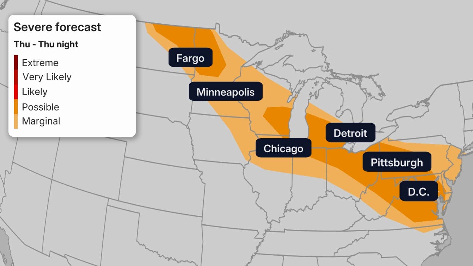
On Thursday, scattered severe thunderstorms are expected in parts of the mid-Atlantic, but could also extend westward into the upper Midwest.
The main threat with these storms is damaging thunderstorm wind gusts capable of downing trees or tree limbs and knocking out power, and large is possible in the upper Midwest area shaded in the darkest contour below. A few tornadoes are also possible and one or two could be strong.
Once again, damaging winds are the main concern in each area. However, hail larger than golf balls is possible in the upper Midwest area shaded in the darkest contour below.
Get More of Our News on Google
Set The Weather Company as a ‘Preferred Source’ to get quicker access to the news you value.

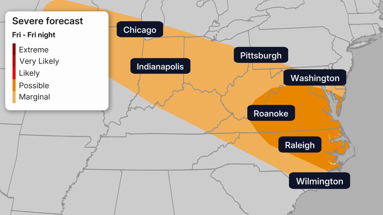
By Friday, the severe threat will have slid a bit farther south in the East into parts of southern Virginia, West Virginia and North Carolina.