
1. Happening nowChevron Down
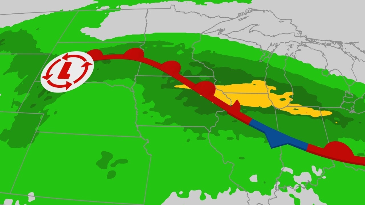
An elevated threat of flash flooding is expected this weekend across the Midwest, with heavy rainfall affecting areas already soaked this week including Chicago into parts of Indiana and Ohio.
Happening now
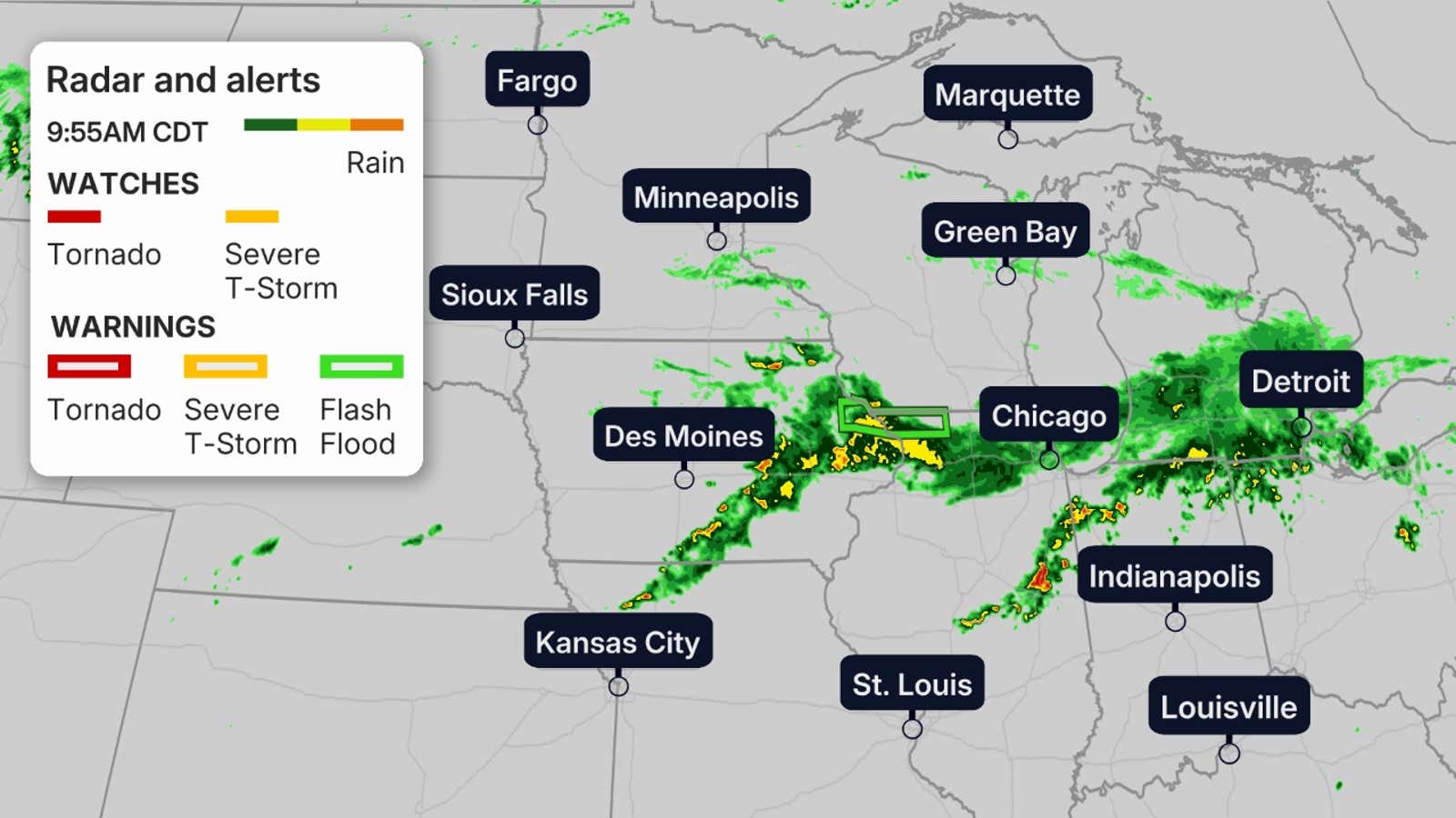
The map below shows where rain is falling right now, along with any flash flood warnings in the green polygons.
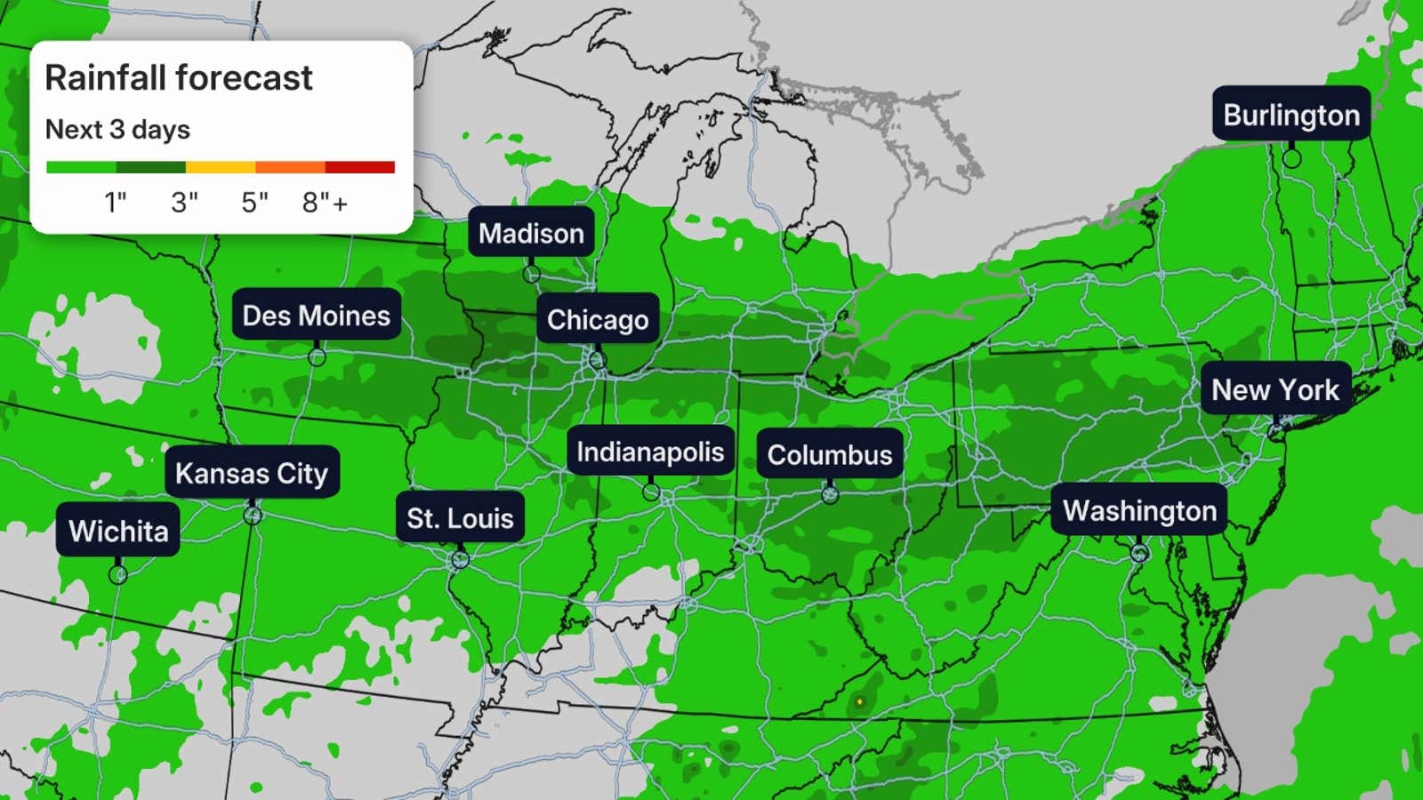
The heaviest rain through Saturday is expected from eastern Iowa to southwestern Michigan.

Weather in your inbox
By signing up you agree to the Terms & Privacy Policy. Unsubscribe at any time.
Local flash flooding is possible in cities such as Des Moines, Milwaukee, Chicago and Indianapolis.
 Day by day forecast
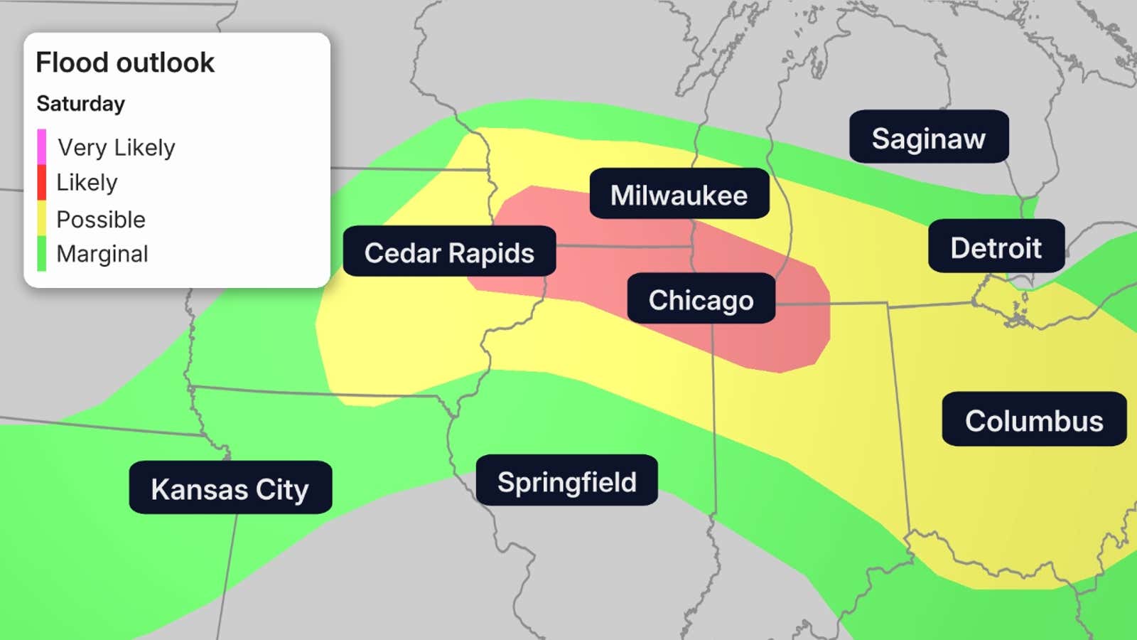
On Saturday, the heaviest rain shifts a bit to the south and spreads east.
Two rounds of heavy rain are possible, one in the morning and another in the evening, across portions of southern Wisconsin and northern Illinois. They could linger over those areas, including Chicago and Milwaukee, for several hours with high rainfall rates.
Get More of Our News on Google
Set The Weather Company as a ‘Preferred Source’ to get quicker access to the news you value.

Flooding is likely in the area marked in red on the map below.
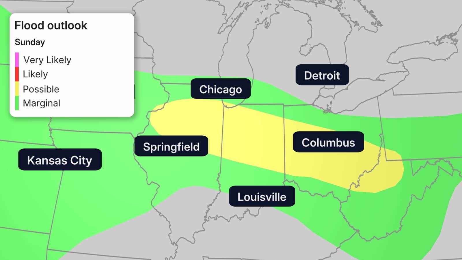
On Sunday, the heavy rain threat may linger from northern Illinois through northern Indiana and western Ohio, while also spreading into parts of the Northeast.
 How much more rain?
Additional rain is expected in the darker green on the map below.
The biggest concern this weekend is the corridor from eastern Iowa into northern Illinois, northern Indiana and western Ohio, where flooding rain fell earlier this week. Additional heavy rain is likely to result in flash flooding and perhaps some river flooding once again.
 Why the flooding?
The rainfall is due to rounds of rain and storms traveling around the outer rim of a heat dome in the Southeast. Any fronts that try to approach slow to a crawl and rain themselves out over the same areas in the Midwest.
The heat dome will stay put through the weekend, and the areas that could see more flooding are highlighted by the graphic.
(MORE: Why the Midwest flooding kept hitting the same areas)
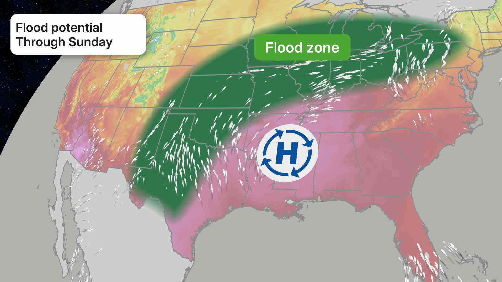
With a stubborn area of high pressure in place for the Southeast, rounds of storms are expected to continue to move around this high and lash parts of the Midwest and Central Plains.