
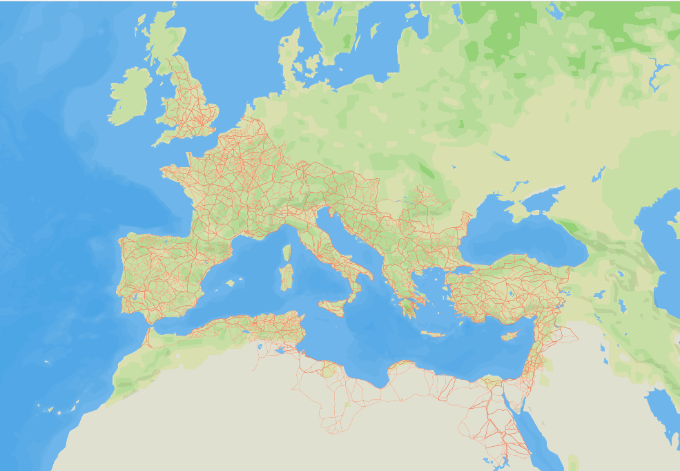
The old line about all roads leading to Rome? Not so much, a new study finds. Researchers digitally mapped some 190,000 miles of Roman roads and concluded that Constantinople—now Istanbul—sat at the true crossroads of the empire’s land routes, far better positioned than Rome for empire-wide travel. “Rome is centrally located for Mediterranean shipping, but not particularly central in the Roman road system,” archaeologist Tom Brughmans, lead author of the study published in Nature Communications, tells Reuters. Even the most central road on the Italian peninsula follows the Adriatic coastline, “bypassing Rome altogether,” he notes.
The analysis shows provincial hubs like London, Ankara, and Corinth were especially well placed for moving officials, soldiers, taxes, and goods along a network that linked deserts, rivers, and sea lanes across three continents. It also disputes the idea that Roman roads were always straight, finding geography won when it had to. Routes are notably linear in flatter regions like northern France and the Po Valley, but more winding around mountains and rivers, “probably due to topography and technology limitations,” reports New Scientist. These paths continued to shape travel and trade well into the medieval era and beyond: The team found that many modern highways still shadow those ancient paths, from Spain’s Via Augusta to roads in Britain and the Near East.