
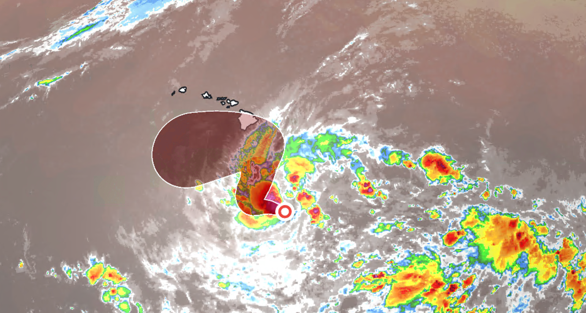
Tropical Depression Fifteen-E has reformed in the Pacific, and its interesting forecast track will bring it close to the islands by Friday as a hurricane. Tropical storm watches could go up for parts of Hawaii later today.
This will be Hawaii’s fourth tropical system of the 2026 hurricane season, which would once again hit parts of the state with heavy rain and gusty winds.
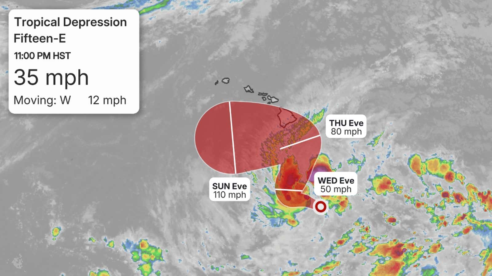 What is the forecast?
Tropical Depression Fifteen-E is currently located several hundred miles southeast of Hawaii.

Weather in your inbox
By signing up you agree to the Terms & Privacy Policy. Unsubscribe at any time.
The system is expected to strengthen as it moves in a zig-zag pattern over the next week.
The forecast shows this storm becoming a tropical storm later today, then strengthening to a hurricane by tomorrow, which means it would be named “Nolo.”
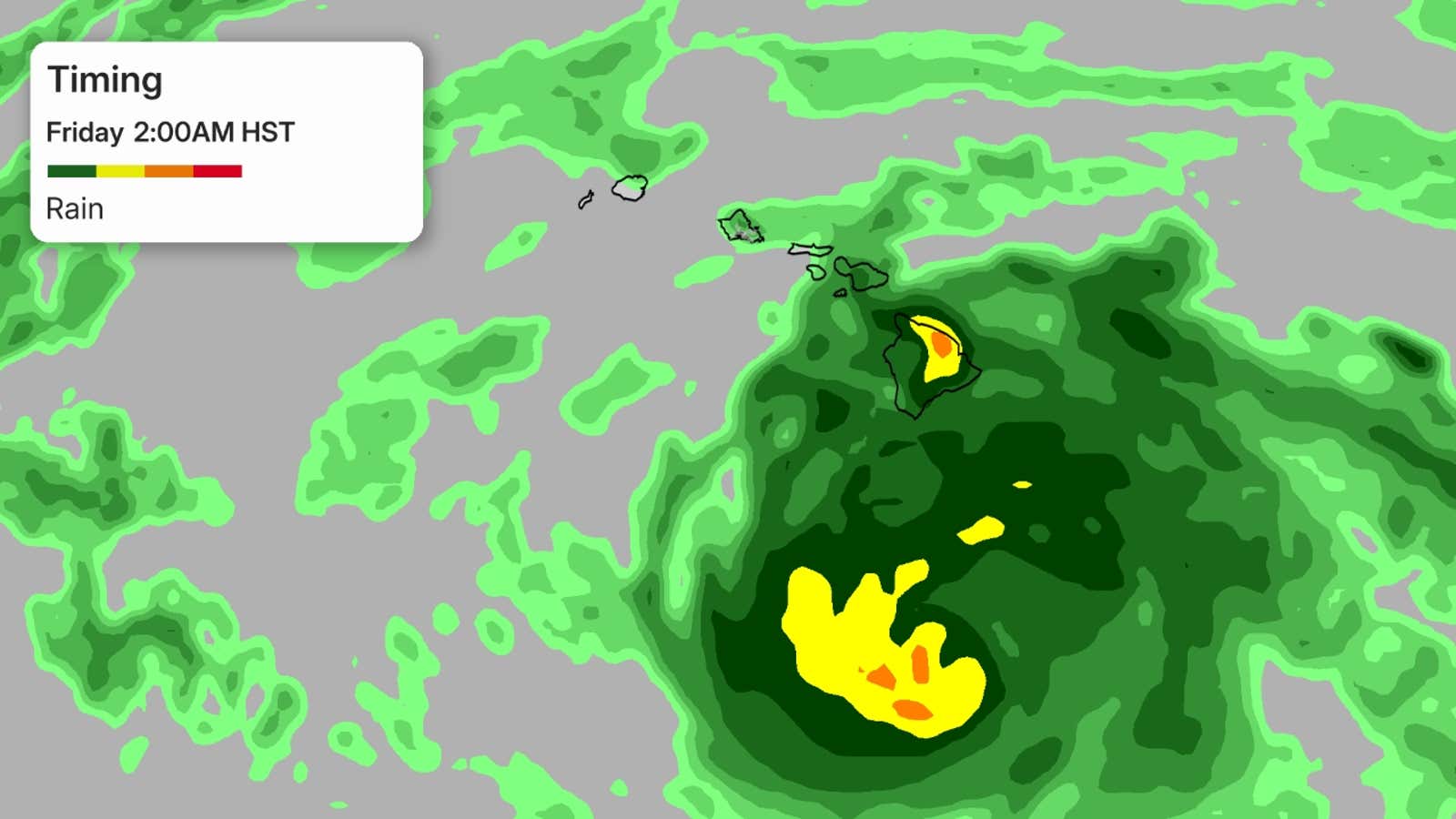
What happens next is a little bit more uncertain:
Get More of Our News on Google
Set The Weather Company as a ‘Preferred Source’ to get quicker access to the news you value.

The most likely scenario is that the system will continue its west-northwest track, slow and meander a bit for a few days south of the Big Island starting Thursday, then resume its general west-northwest track by early next week.
Another scenario is that the system could track much closer to at least the Big Island, and even making landfall, before it slows down and resumes its westerly track.
Even if the storm doesn’t make landfall, that doesn’t mean there wouldn’t be impacts.
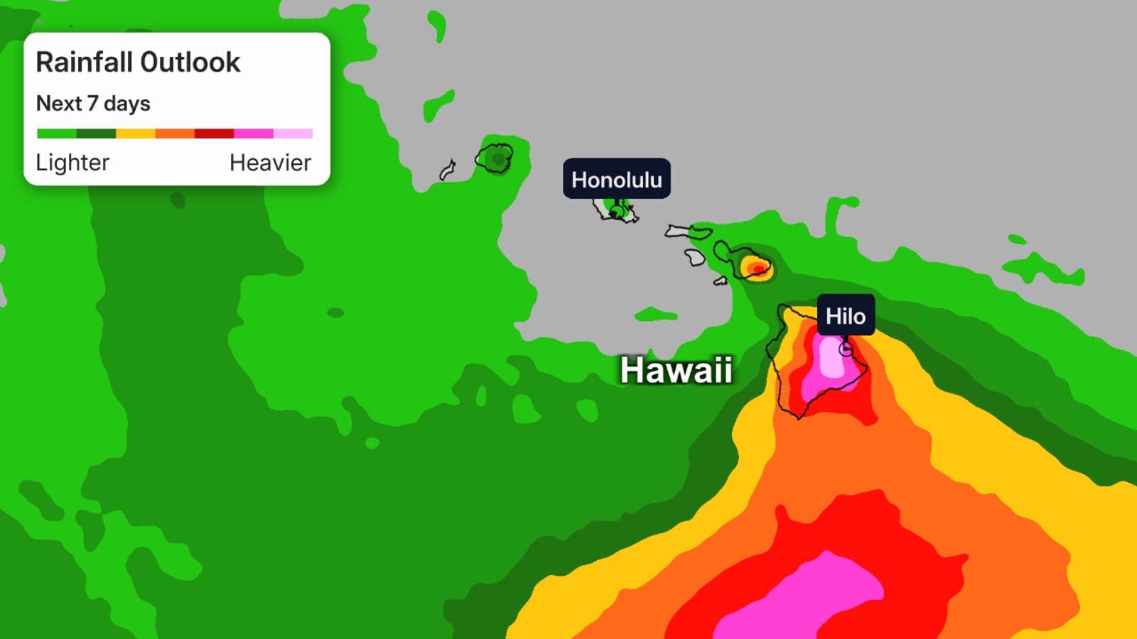
How much rainfall?
Either scenario brings a threat of substantial rainfall to the Big Island. Flood watches are expected to be issued.
Rainfall across the state could be measured in feet rather than inches, especially at higher elevations, should this storm’s worst outcome play out. The Big Island was already hit hard by Lala earlier this year.
 Fourth potential flood event
This system could become the fourth to at least graze Hawaii, bringing flooding and winds to parts or most of the state.
We first had Hurricane Lala, whose eyewall grazed the southern end of the Big Island. Torrential rain hit and gusty winds caused power outages to skyrocket.
(MORE: Lala Recap)
NNext up was Tropical Storm Moke, which traveled farther south than Lala but still hit part of the Big Island with rain and winds from its outer bands. Moke’s impacts were less significant, but flooding still occurred because the ground was still saturated from Lala.
Then there was Hurricane Lowell, a powerful hurricane that reached Category 5 strength at its peak. The storm weakened before making its closest pass, but it slammed the western islands with wind, rain and waves.
(MORE: Lowell Recap)
Zombie storm?
This area of interest originally formed as Tropical Depression Fifteen-E over a week ago. The system then fizzled as it traveled west, moving into strong wind shear that disrupted its structure. But the system continued its trek west and now has moved into areas with less shear, allowing for its second life.