
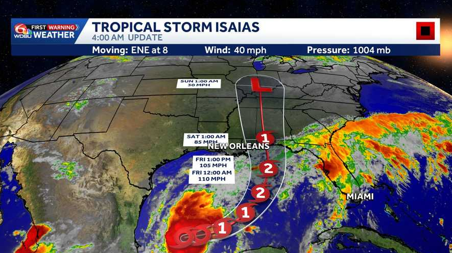
Isaias is forecast to strengthen rapidly and approach the northern Gulf Coast Friday. Hurricane watches are likely for part of the coast later Wednesday.
Tropical Storm Isaias has formed in the Gulf and is expected to strengthen rapidly over the next day or two.
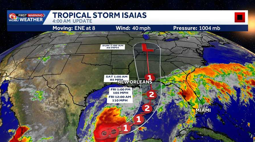
The National Hurricane Center expects Isaias to become a hurricane by Thursday and approach the northern Gulf Coast Friday.
Latest on Isaias
As of 4 a.m. Wednesday, Isaias had maximum sustained winds of 40 mph. The storm was about 580 miles southwest of the mouth of the Mississippi River, moving east-northeast at 8 mph.
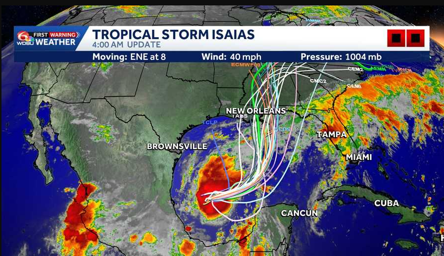
Tropical-storm-force winds extended up to 45 miles from the center.
Isaias is expected to continue moving east-northeast Wednesday, then turn northeast and north Thursday and Friday. Its forecast path takes it north of Mexico’s Yucatan Peninsula Thursday before approaching the northern Gulf Coast Friday.
Hurricane watches likely later Wednesday
No coastal watches or warnings were in effect as of 4 a.m. Wednesday. However, the National Hurricane Center said hurricane watches will likely be needed for part of the northern Gulf Coast later in the day.
Residents in southeast Louisiana and along the northern Gulf Coast should closely monitor the storm.
Heavy rain and flooding possible
From Friday through the weekend, Isaias could bring 3 to 6 inches of rain, with localized totals up to 10 inches, across parts of the northern Gulf Coast from far southeastern Louisiana to the Florida Panhandle.

Those amounts are a regional forecast and do not mean every community will receive that much rain. The storm’s track will help determine where the heaviest rainfall develops.
Flash flooding, street flooding and isolated river flooding will be possible.
Dangerous surf and rip currents are also expected along the Gulf Coast late this week.
What to know locally
Friday and Saturday are WDSU First Warning Alert Days because of the potential for significant weather impacts.
The storm’s track and strength will determine local conditions. Residents should review their hurricane plans, check supplies and follow updates from WDSU First Warning Weather and the National Hurricane Center.
The next complete NHC advisory is scheduled for 10 a.m. Wednesday.
Hurricane Hunters are expected to investigate the system today, providing valuable data that should help refine the forecast.