
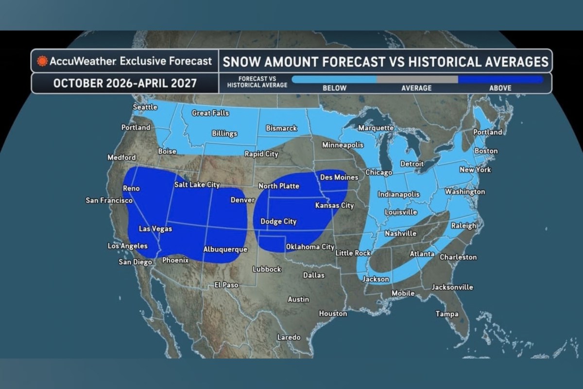
El Niño is expected to cause a major shift in snowfall patterns across the United States this winter, according to a new forecast map.
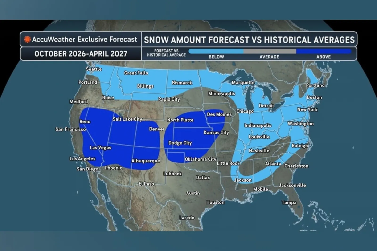
Snowfall is set to be below normal across much of the Northern U.S. this winter, according to AccuWeather. But an early burst of snow in the Sierra Nevada and the central and southern Rockies could also benefit ski resorts and help replenish strained water supplies.
Meanwhile, warmer than average conditions across the Northeast and Great Lakes are expected to delay winter’s arrival and reduce snowfall, AccuWeather said.
Read More on Weather
Federal forecasters have said the ongoing El Niño—a naturally recurring climate pattern associated with warmer waters in the Pacific—is likely to strengthen into a “very strong” event this fall and winter. There is a 75 percent chance of surpassing every El Niño recorded since 1950 during the October to December period, according to the Climate Prediction Center (CPC).
El Niño winters typically feature milder weather in northern parts of the U.S. and wetter conditions across southern areas, according to the National Oceanic and Atmospheric Administration (NOAA).
During El Niño, warmer-than-usual tropical Pacific waters shift atmospheric circulation, strengthening and repositioning the jet stream. This often steers more storms and moisture toward the southern United States, producing wetter conditions, while the northern states receive fewer storms and tend to be drier.
“The intensity of the El Niño that is coming on, a very strong, near-record or record El Niño, builds the confidence that we should see a lot more moisture in the southern tier of the nation, unlike what we saw last year and other years prior to that,” AccuWeather’s lead long-range expert Paul Pastelok said in a statement shared with Newsweek on Wednesday.
AccuWeather forecasts 10 to 20 inches of snow in New York City, compared with a historical average of 29.8 inches. Chicago could receive 12 to 25 inches, below its average of 38.4 inches, while Boston is forecast to record 15 to 30 inches against an average of 49.2 inches.
“While we are forecasting below-average snow, it only takes one storm to flip the script, especially for the East Coast cities,” said Pastelok. “So that is something we have to watch, especially as we get into late January and February.”
One of AccuWeather’s largest projected shortfalls is in Buffalo, New York, where 55 to 70 inches is expected, compared with the city’s 95.4-inch average. Farther west, Salt Lake City, Utah, could receive 50 to 65 inches, putting snowfall near or above its 51.9-inch average after only 3.7 inches last winter. Denver, Colorado’s forecast of 45 to 55 inches is also close to its 49.4-inch average.
AccuWeather also said a storm track running from the Southwest into the central Plains could increase the risk of snow, sleet and ice from Kansas to central Iowa. The forecaster said the potential would be greatest in January and February, when cold air is more likely to be in place. Near- or above-average snowfall is considered more likely in the southern Appalachians, the interior northern Gulf states and northern parts of the Northeast, it said.
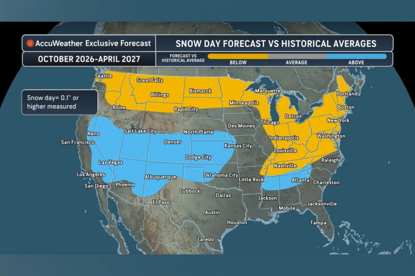
The forecaster added that late January and February could provide opportunities for major storms in the East.
Snowfall prospects in the Northeast and mid-Atlantic would increase if atmospheric blocking developed near Greenland and sufficient cold air was available.
New York City and Philadelphia are expected to have fewer days with measurable snow, although AccuWeather said the number of heavier snow events could remain near historical levels.
Newsweek’s reporters and editors used Martyn, our AI assistant, to produce this story. Learn more about Martyn here.
Contact Newsweek editors on this story: Matthew Robinson and James Debens