
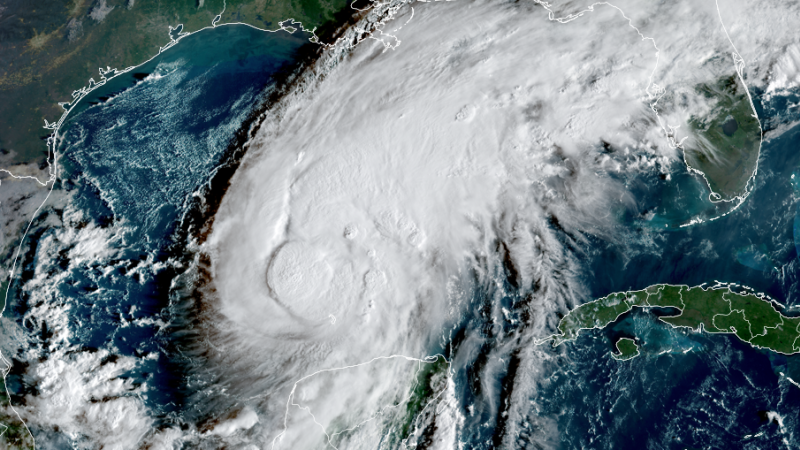
Rain and flooding
Isaias’ heaviest rain will lash southern Alabama and the Florida Panhandle, so the biggest flash flood threat is expected there. The hardest-hit areas could see 4 to 8 inches of rain, with up to 15 inches in spots.
The storm’s fast movement plus dry ground will prevent flash flooding from being too widespread across the rest of the Southeast, but significant impacts are still possible in limited areas. Most locations can expect 1 to 3 inches, but localized totals up to 5 inches are possible.
The downpours will ramp up along the coast Friday and then continue to soak the region while pushing farther inland through the weekend.
Friday:
Saturday:
Tropical storm-force winds of 39 mph or stronger, with higher gusts, could reach southeastern Louisiana after sunrise and parts of Mississippi, Alabama and the Florida panhandle Friday afternoon.
Hurricane-force winds of 74 mph or more are likely Friday night into early Saturday morning where Isaias makes landfall. Numerous power outages and downed trees are possible from southeast Mississippi to southern Alabama and the western Panhandle.
Wind gusts of 30 to 50 mph could spread well inland across parts of central and northern Alabama, northern and western Georgia and northeast Mississippi on Saturday. That could be enough to cause at least isolated to scattered power outages and topple some trees, particularly in Alabama.
The biggest push of dangerous and life-threatening storm surge will be near and just east of where the storm’s center makes landfall on Friday night.
Locations on the Alabama and western Florida Panhandle coast could experience 5 to 7 feet of inundation above normally dry ground if the peak surge happens at high tide. This could flood roads and damage structures near the coast.
Isaias will produce at least a few tornadoes within its rainbands Friday night through Saturday. Areas to the east of the storm’s center will be most at risk for these tornadoes. Tropical tornadoes tend to be short-lived and sometimes pop up with little notice.
The greatest tornado threat is expected in the areas shaded darkest orange in the maps below.
Friday:
Saturday: