
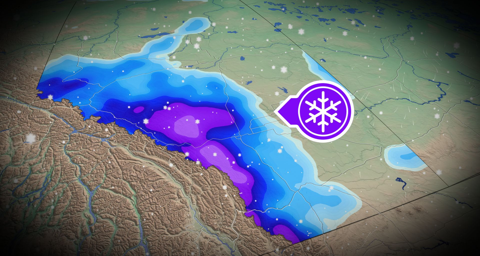
Get ready for a shot of winter weather, Alberta, during this Thanksgiving long weekend.
An upper-level trough is bringing a long weekend chill to Western Canada, with Alberta seeing the most significant snowfall. Accumulations of 10-20 cm for some areas will likely impact weekend travel.
DON’T MISS: Canada’s Winter Sneak Peek: El Niño puts record warmth in play
However, accumulations will be highly localized and variable as temperatures will be hovering at or slightly above freezing.
Stay updated for the latest weather alerts, and check road conditions before venturing out.
Temperatures plunge across southern Alberta Saturday
The southern Alberta foothills look to score the first snow jackpot of the season, while southern Manitoba reaches the mid-20s on Saturday afternoon.
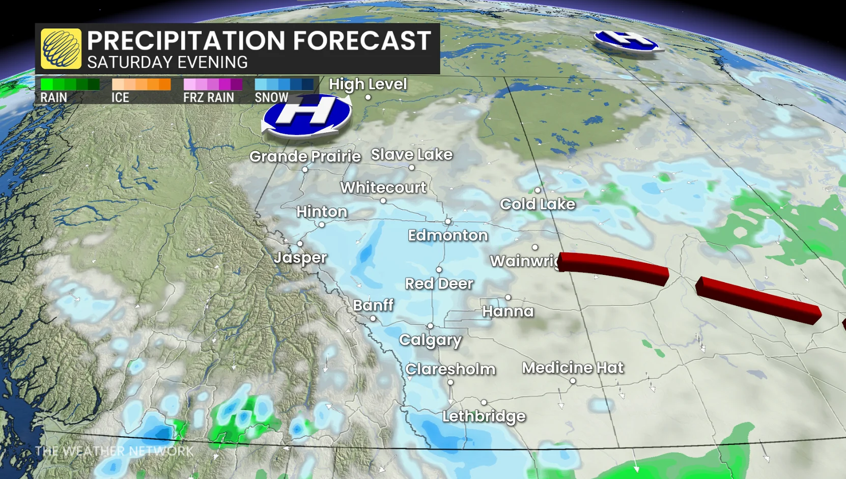
At 7 a.m. local time on Saturday morning, Edmonton International Airport reported its first snowflakes of the season.
Flurries take over Alberta on Saturday morning, moving south towards Calgary, continuing through the afternoon and evening.
Environment and Climate Change Canada (ECCC) issued snowfall warnings for parts of Alberta, along with special weather statements.
“Travel will likely be challenging. Visibility will likely be reduced at times. Local utility outages are possible,” the agency said. “Allow extra time for travel. Take frequent breaks and avoid strain when clearing snow.”
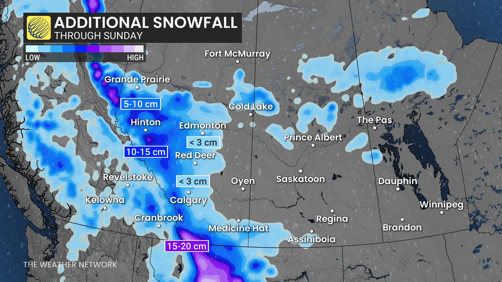
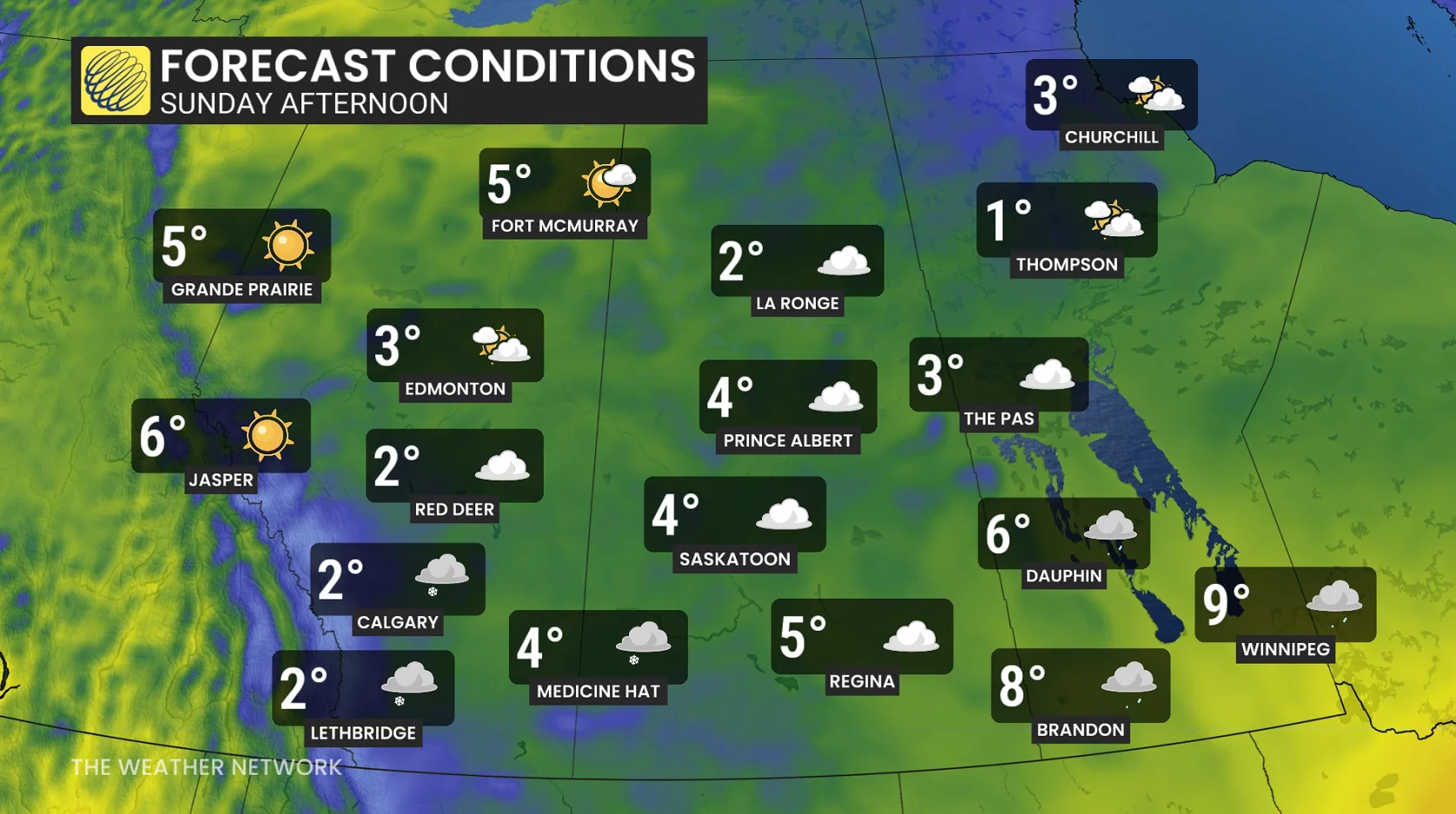
Upslope snow is expected to continue bringing flurries to southern Alberta’s foothills through Sunday. Approximatrly 2-5 cm of snow is possible over the weekend from Edmonton to Calgary, with a risk of the former overperforming to accumulate 5+cm.
Higher totals will be found farther west as the elevation increases. Hinton, Grande Prairie, Jasper and Whitecourt are all under a snowfall warning–highlighting variable snowfall amounts possible.
Lower elevations and valley locations can expect substantially less snowfall accumulation.
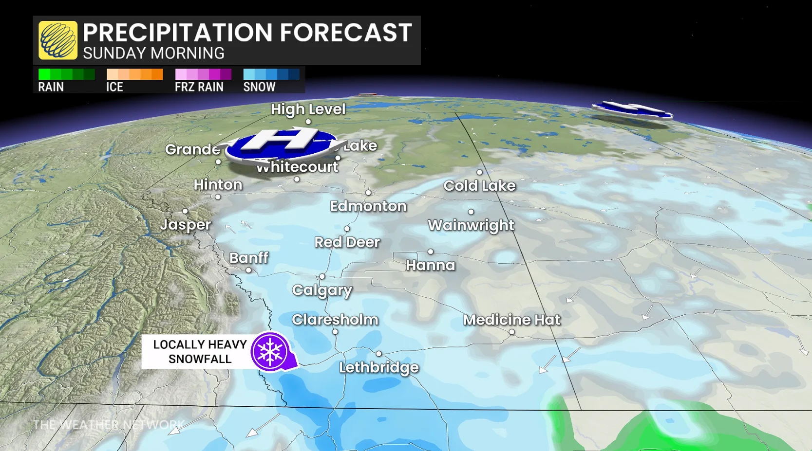
By Sunday, most of the snow has shifted to across the southern portion of the province, with additional, wet snow expected throughout Sunday.
Temperatures across Alberta fall below the freezing mark, with the wind chills making it feel like the negative double digits on Sunday night.
These likely represent the season’s first snowflakes for large parts of central and southern Alberta, with potential Thanksgiving travel delays due to winter driving conditions.
DON’T MISS: First blizzard warning of the season for major Canadian highway
Early-season snowfalls present unique challenges to forecasters. Amounts will be highly variable, from just a couple of cm around the Calgary region to upwards of 20 cm across the highest terrain farther west.
Strong winds are not a major factor, so blowing snow is not a primary or major concern, although expect some visibility reductions under heavier, wet snow bands.
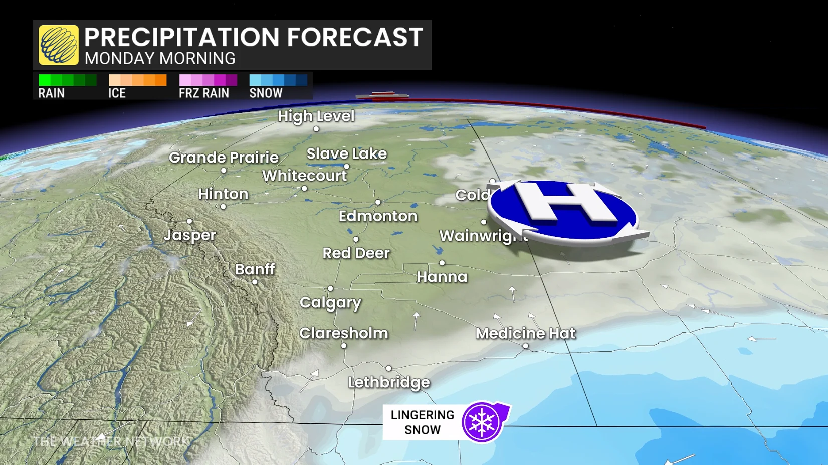
Thanksgiving Monday will feature mostly calm conditions, with some lingering snowflurries across extreme southeastern portions of the province.
WATCH: Could this be Canada’s warmest winter on record?