

Atlantic Canada may be in for a rough second half of the week, with forecasters keeping a close eye on the system formerly known as Subtropical Storm Josephine.
The storm has been meandering up the Eastern Seaboard this week as a powerful low-pressure system.
DON’T MISS: Canada’s Winter Sneak Peek: El Niño puts record warmth in play
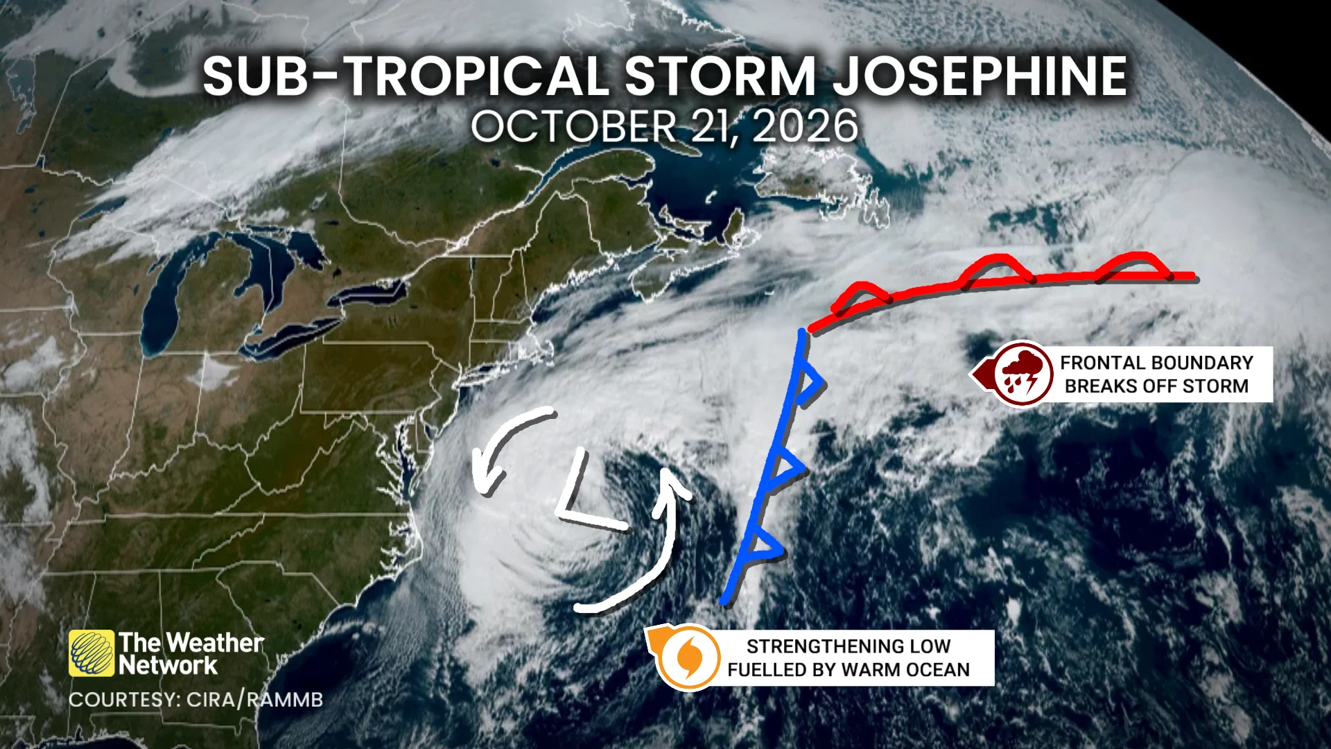
The system will swipe southern Atlantic Canada with potent wind gusts, heavy rainfall, snowfall and three- to five-metre waves along the coastal areas, elevating the risk of flooding.
Low-pressure systems exist on a spectrum between tropical and extratropical (non-tropical).
Josephine has slipped across the spectrum in both directions several times over the past week. Originally a strong nor’easter, the system evolved into a subtropical storm on Wednesday before returning to its roots on Thursday.
A subtropical storm is one that has characteristics of both a tropical and extratropical system, a sort of hybrid storm that can bring hazardous weather to the affected regions.
While this is no longer a named storm, it will still pack hazardous winds and heavy rainfall across the region.
Atlantic Canada impacts
The powerful system will continue to strengthen into Friday, with Category 1-strength winds expected offshore.
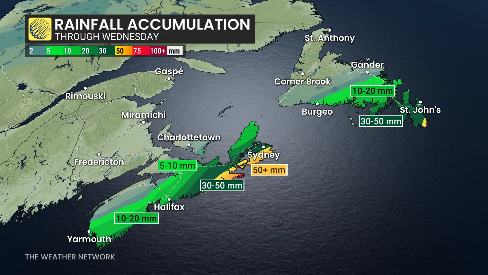
Rain that began across Nova Scotia on Thursday morning will move east, reaching Cape Breton by the overnight. Rain will continue Friday morning.
Rain bands in southeastern Newfoundland will persist through late Friday.
SEE ALSO: Fight flu season with nature: Four immune-boosting foods to try this fall
Across both regions, rainfall amounts of 20-50+ mm are possible.
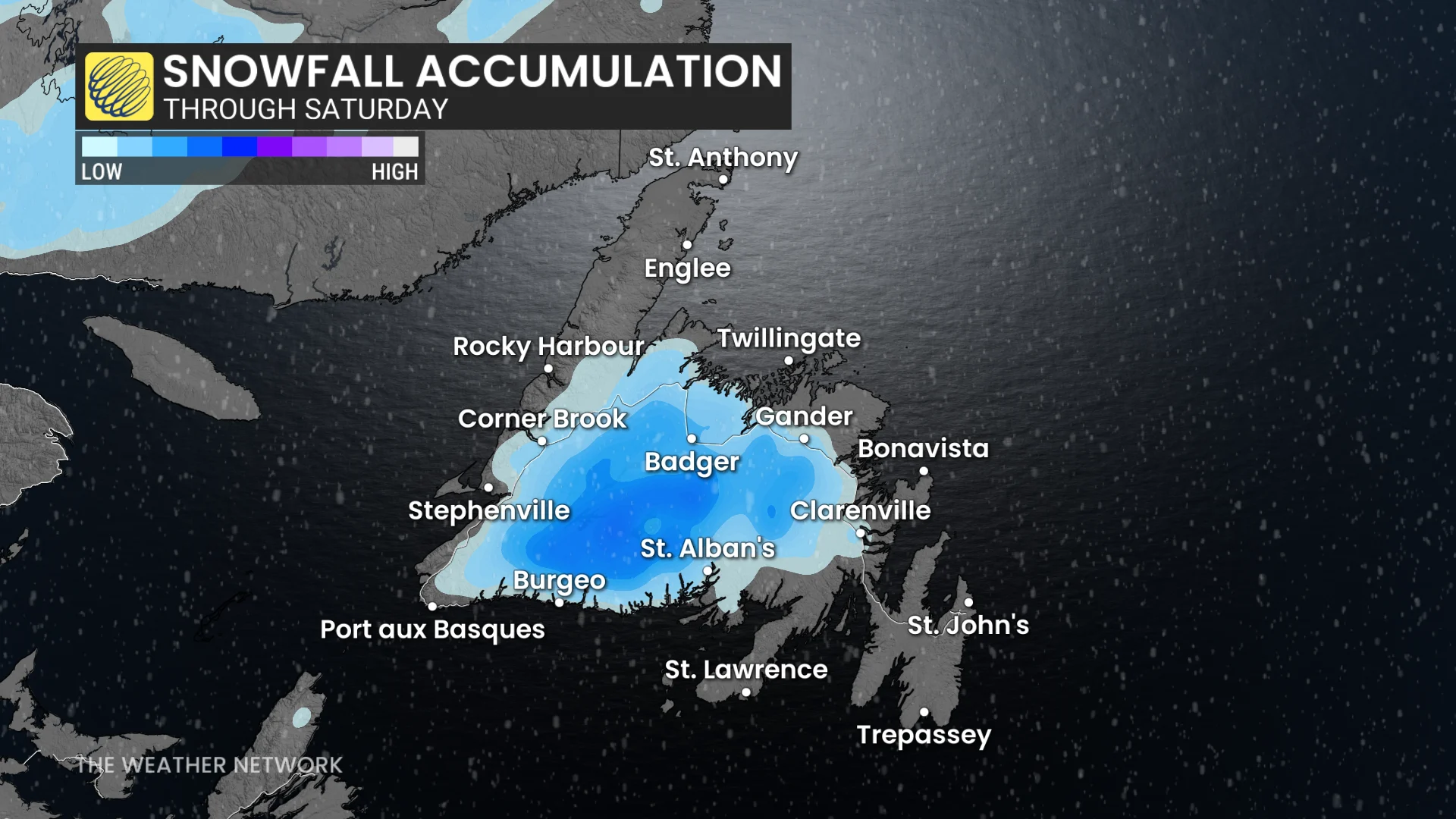
Cold air wrapping in behind the storm will lead to a chance for a rain-snow mix at times in central Newfoundland and the Burin Peninsula through Friday.
Aside from the precipitation, wind will pose a significant hazard with this storm.
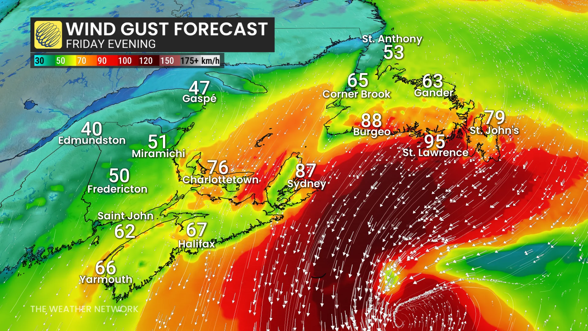
Winds will pick up in the Maritimes late on Thursday, peaking Friday morning, with 50-90 km/h gusts possible. The highest will be along Nova Scotia’s south coast.
Wind gusts will increase in Newfoundland Friday morning, intensifying through the day. Gusts of 70-100 km/h are possible, locally higher for the southeastern coast.
With the strong winds will also come a risk of coastal flooding, as wave heights and swells could reach 3-5 metres.
Widespread power outages and tree damage are also possible.
Stay with The Weather Network for the latest updates and information on your forecast across Atlantic Canada.
WATCH: Nor’easter strands tropics-bound cruise passengers in Halifax