
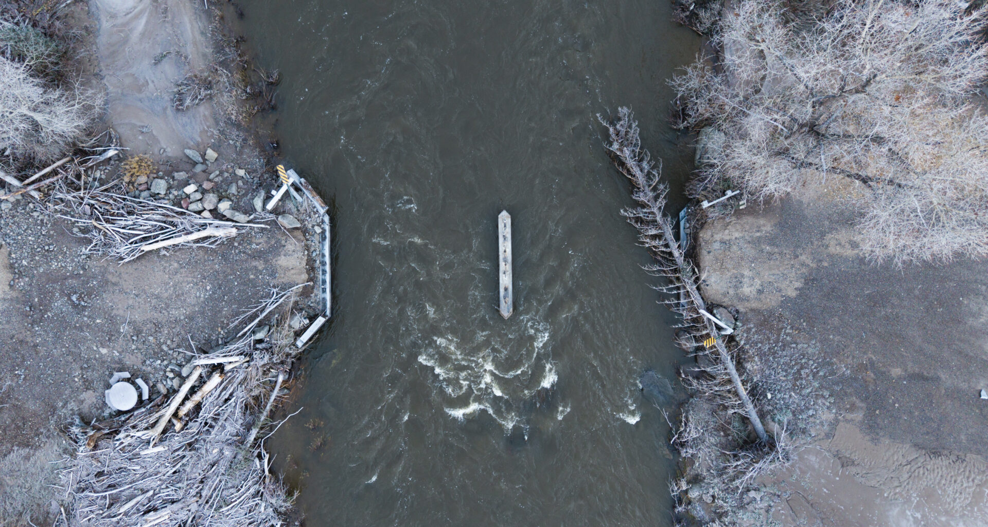
Authorities are urging residents in parts of southwestern Colorado to evacuate immediately as the San Juan River in Pagosa Springs is forecast to rise more than 4 feet higher than a 1911 historic flood that wiped away much of what was then the town.
The forecast says the San Juan River is expected to rise to 21.84 feet by 11 p.m., Brooke Scholtens, a meteorologist with the National Weather Service’s Office in Grand Junction, said Sunday afternoon.
The warnings Sunday come as the region is still reeling from flooding last week that damaged roads, bridges and public infrastructure and left communities working to recover.
Flows would also be nearly 7 feet above last week’s peak of about 15 feet. In 1911, much of what was then the town of Pagosa Springs was wiped out when the river crested at 17.8 feet.
As of 7 p.m. Sunday, the San Juan River was at about 16.56 feet, which is considered above major flooding levels, the agency reported.
Residents living in low-lying areas along the San Juan, Rio Blanco, Navajo and Piedra rivers should leave immediately, the Archuleta County Sheriff’s Office said Sunday morning. People should not wait for water to rise or for another warning, the sheriff’s office said.
The county also issued a shelter in place order, asking all residents to avoid nonessential travel for the duration of the storm.
Evacuations were ordered Sunday night by San Juan County for anyone living within a half-mile of the La Plata, San Juan or Animas rivers in the county.
More than 1,000 homes are under mandatory evacuation orders in Archuleta County, many of which were also under evacuation orders for last week’s storm, Sheriff Mike Le Roux said.
“We can do a lot of door-to-door knocking and try to make contact with as many people as possible. But we can’t guarantee that once people left, that they did not go back into their home. So it’s hard for us to say how many people are still in the evacuation zone. We can only go back so many times to knock on doors,” Le Roux said during a briefing Sunday afternoon.
The saturated ground has little capacity to absorb more rain, increasing the risk of flooding, said Charles Balke, incident commander for the incident management team leading the flood response.
“So everything that’s coming down is leading to flood potential and increased standing water in areas outside of what would be considered a normal drainage of any type,” Balke said.
Smaller creeks and drainage areas are also seeing significant flooding from surface water runoff, not just the major river basins, leading to a growing number of unexpected road closures.
 A collapsed section of Colorado 151 as seen on Oct. 27, 2026, between Pagosa Springs and Ignacio. Recent heavy rains have caused severe flooding across southwestern Colorado, forcing evacuations and damaging roads and homes. (Cheney Orr, The Colorado Sun via Report for America)
Evacuation is the highest priority right now because during intense periods of rain, it will be challenging for swift-water rescue teams to reach people, Balke said.
If the river reaches forecast levels, there’s a high chance major roads will be washed out, downtown bridges, many of which were damaged in last week’s storm, could collapse, especially with large debris flowing downstream, Balke said.
Power poles near the river could also be knocked down, causing power outages.
“People have been mostly compliant because I do think they understand,” the sheriff said of evacuation orders. “And given the fact that we had a significant event last year, we do have the benefit of hindsight, at least for significantly high floodwaters.”
Between 1 and 3 inches of rain are expected across southwestern Colorado, with up to 4 inches in some areas, Sunday through Monday, according to the Weather Service.
Forecasters previously believed the San Juan River, which flows through Pagosa Springs, would peak at 19.71 feet by 6 p.m. but later updated its forecast to a higher level arriving later in the night.
Sewage has begun flowing into the river, prompting public health officials to warn residents to keep themselves and their pets away.
All incoming traffic into Pagosa Springs was shut down Sunday afternoon.
First responders are stationing resources in high-risk areas and requesting additional ground search and rescue teams, equipment from the Colorado National Guard, aircraft and specialized rescue teams.
“Our ability to respond during the worst time of this storm will be extremely limited,” the sheriff’s office said. “Helicopters will be grounded, and first responders may not be able to reach people in danger until the storm passes and conditions improve.”
Some voter center and ballot drop box locations in La Plata and Archuleta counties have changed because of the severe rain and flood risk, the Colorado Secretary of State’s Office said Sunday night.
On Saturday, Gov. Jared Polis requested about $27 million in federal aid to help repair public infrastructure damaged in last week’s flooding, including roads, bridges, utilities, parks and recreation facilities.
Residents needing shelter can go to Open Door Church at 110 Trinity Lane in Pagosa Springs. Small animals can be brought to the Humane Society at 465 Cloman Boulevard and larger animals can be brought to the Archuleta County Fairgrounds.
Evacuation orders also issued in Rio Grande, Conejos counties
Mandatory and preevacuation orders were issued for parts of Rio Grande County on Sunday morning, ahead of flooding expected in South Fork, Del Norte and Monte Vista, South Fork Fire Rescue said in an update Sunday.
Sunday evening, a mandatory evacuation order was issued from along the Rio Grande at the intersection of Highway 160/Rio Grande County 5N East through the town of Monte Vista to Rio Grande County Road 6E, South Fork Fire Rescue announced.
The risk of flooding is concentrated along the South Fork of the Rio Grande and the Rio Grande downstream. As the water moves through the San Luis Valley, toward Del Norte and Monte Vista, excess runoff can cause rivers, streams and creeks to overflow.
Evacuation shelters have been set up at South Fork Community Building at 254 CO 149 in South Fork and at the Rio Grande Hospital Wellness Center at 310 County Road 14 in Del Norte. Animals can be brought to the McMullen Building in the Ski Hi Complex at 2335 Sherman Ave. in Monte Vista.
Across Rio Grande and Mineral counties, teams are working to remove debris from the Rio Grande riverbed to protect infrastructure and help improve water flow to reduce the possibility of new flooding, South Fork Fire Rescue said in a post to its Facebook page Saturday.
In Conejos County, several communities were placed under mandatory evacuations Sunday evening. An evacuation center was set up at Knights of Columbus Hall in La Jara. Small animals and livestock can be brought to the La Jara Arena.
The evacuation issued at 5 p.m. include Manassa and the areas of Platoro down the Conejos River Canyon to Fox Creek and Mogote, including Canon, Ortiz, San Anotio Guadalupe and Manassa, the county announced.
“We anticipate flooding to reach the same level or higher as last time, and the Tixier Ramirez bridge is at risk of failure. Leave immediately. Be prepared to be away from your home for multiple days. Bring necessary medications, identification and important documents,” the warning states.
The South and North Conejos school districts have canceled classes for Monday, the districts announced Sunday evening.
In La Plata County, all roads were closed at about 2:30 p.m. and officials are urging residents to stay home until further notice because of mudslides, debris and flooding.
“Our crews are working hard, but the situation has become unsafe,” the county said in a post on its Facebook page.
A winter storm warning is in effect for the San Juans above 10,000 feet, where 12 to 18 inches of snow is possible Sunday night through Monday. Farther north, 5 to 10 inches of snow is possible for the Flat Tops and the central Colorado mountains Sunday night and Monday, forecasters said.
Ahead of the storm, the Wolf Creek ski area announced a temporary closure until mandatory evacuation orders in Archuleta County are lifted.
“All municipal, county, and state agencies are under extreme duress, and as a precautionary measure, Wolf Creek Ski Area has determined it is in the best interest of the public to temporarily be closed,” the ski area said.
This is a developing story that will be updated.
Type of Story: News
Based on facts, either observed and verified directly by the reporter, or reported and verified from knowledgeable sources.