
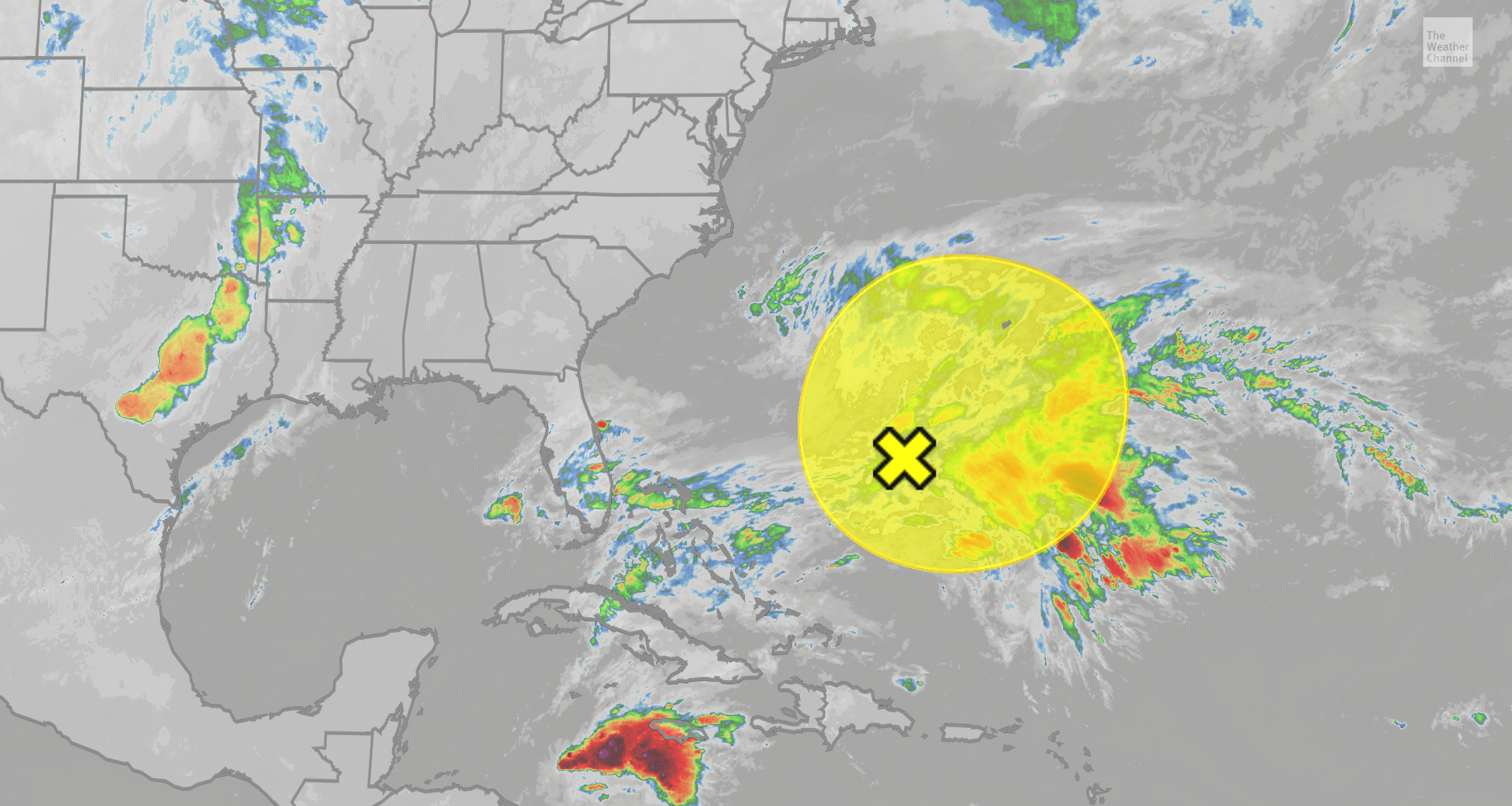
A subtropical storm could form in the Atlantic this week, after two weeks without activity in the basin.
If it develops, it would take the next name on the list, Kyle.
The latest
It may be November, and it may have been quiet since Subtropical Storm Josephine, but we have a new area to watch for development in the Atlantic Basin.

Weather in your inbox
By signing up you agree to the Terms & Privacy Policy. Unsubscribe at any time.
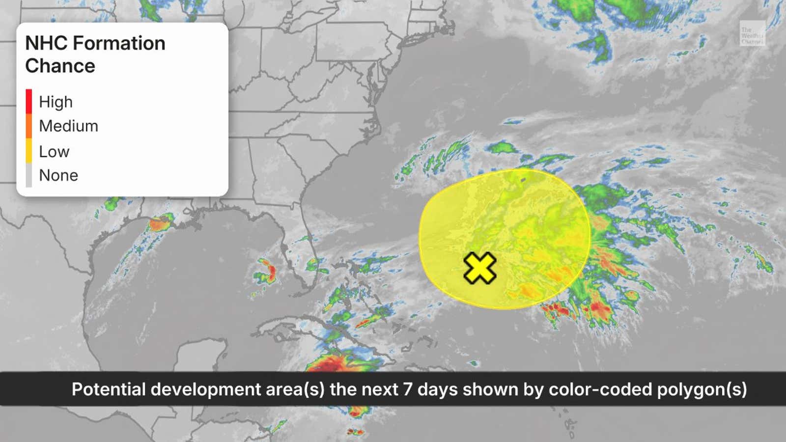
A broad area of low pressure could form on a weakening frontal boundary well off the East Coast and several hundred miles to the northeast of the Bahamas.
If that area of low pressure pops enough thunderstorms near its center, it could transition into something called a subtropical storm.
(WATCH: Rising surf from Josephine cuts off homes on Outer Banks)
Get More of Our News on Google
Set The Weather Company as a ‘Preferred Source’ to get quicker access to the news you value.

But this storm’s window is tight. It has to get its act together this week, because if it doesn’t, unfavorable conditions will end its chances of getting a name by this weekend.
Fortunately, it will remain far off the East Coast, and poses no threat to the U.S. But it could bring some impacts to Bermuda.
Regardless of what meteorologists call it, this system is expected to drift to the east or northeast into the open Atlantic Ocean.
What is a subtropical storm?
On Oct. 21-22, Subtropical Storm Josephine briefly formed off the East Coast, and this system has the chance to become Subtropical Storm Kyle.
A subtropical storm is a type of storm that is a mix between a tropical storm and the kind of low pressure system you see on weather maps attached to cold and warm fronts.
(MORE: What is a subtropical storm?)
The National Hurricane Center issues advisories and forecasts for subtropical depressions and storms and they are assigned a number or name, just like a tropical depression or storm.
Subtropical storms can still bring heavy rain, gusty winds and storm surge like a tropical system or hurricane.