
Wild winds have eased after battering parts of the South, but colder weather is coming in their wake, prompting snow warnings for some southern roads.
A “potent front” moving up the country prompted a raft of severe weather advisories for much of the South Island earlier today, but these have now expired.
Severe weather updates⚠️
💨 Strong winds in the far south have eased this morning, and watches for those areas have now lapsed.
⚠️ Watches and warnings remain in place today for parts of the South Island and Wellington.
👉 From tomorrow (6am–8pm), a new strong wind watch comes… pic.twitter.com/7w7LkxW09d
— MetService (@MetService) August 27, 2025
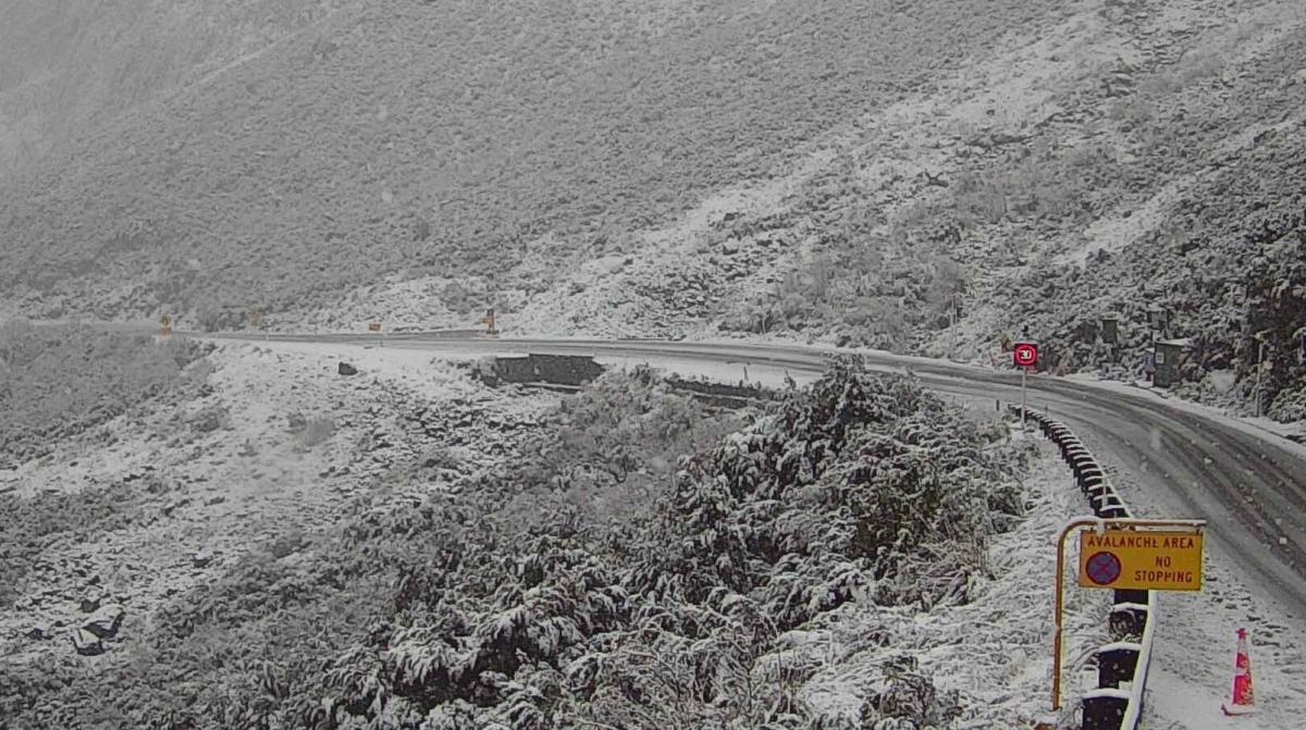
However, MetService has issued road snow warnings for the Crown Range Road and the Milford Road (State Highway 94), saying the latter could expect from 8 to 15cm of snow at the summit.
The Crown Range warning is for 13 hours from 5am to 6pm on Friday, while the Milford Road one covers 24 hours from 10pm today.
NZ Transport Agency Waka Kotahi (NZTA) earlier advised that SH94 will close overnight from 5pm today, owing to snow. NZTA said it expected the road to close again on Friday night, and that more snow was expected over the weekend.
Southerners were earlier being urged to take care on roads as wild winds hammered the area.
The Central Otago District Council said contractors were dealing with “widespread” wind-related issues across the roading network, and that wheelie bins were being blown on to roads across the region.
The council urged people whose bins weren’t full to take them back on to their properties and put them out again next week.
In a statement this afternoon MetService said observed wind gusts reached 116kmh for Mount Cook Airport, 112kmh for Roxburgh Airport and 98kmh for Wallacetown this morning.
MetService meteorologist Alanna Burrows said the wild conditions were moving on to the North Island but were expected to ease for the whole country by the end of Friday.
She said temperatures were expected to drop over southern New Zealand, “and snow may affect some elevated parts of the South Island, including some of the higher roads there”.
“Then, as we move into the last weekend of winter, we are expecting to see another boost to winds and swell, combined with fast-moving rainbands.
“A strong northwesterly flow builds over the country ahead of another front, which moves on to southern New Zealand late in the day on Saturday and quickly over the country on Sunday, followed by a strong and showery west to southwest flow.
“And with a nod to winter, there is a chance that snow may affect some of the higher South Island roads this weekend.”
– Allied Media