
Whether you’re looking to dip in a spring, wade beneath a waterfall, explore a unique Crusader fortress, spot one of Israel’s rarest wildflowers, or meet the mysterious “man in the wall,” this is your complete guide to exploring Kziv stream.
The stream originates on Mount Meron, about 1,000 meters (3,280 feet) above sea level, then winds its way for 43 kilometers (27 miles) through a dramatic landscape of cliffs, caves, some with evidence of ancient human habitation, and lush vegetation before reaching the sea. Its main water sources are three large springs: Ein Ziv, Ein Tamir and Ein Hardalit.
34 View gallery
")
Kziv stream
(Photo: Ozrot Ha’Galil)
34 View gallery
")
Kziv stream
(Photo: Ayala Musery)
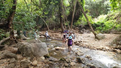
34 View gallery
")
Hiking at the Kziv stream
(Photo: Rinat Russo, Nature and Parks Authority)
34 View gallery
")
Kziv stream
(Photo: Iris Arbel, Nature Israel)
34 View gallery
")
The green woodland of Kziv nature reserve
(Photo: Zur Musery)
Thanks to Israel’s Nature and Parks Authority reintroduction program, the reserve is home to a thriving herd of Persian fallow deer, a species that had previously disappeared from the region.
East of Ein Ziv, the stream flows through a closed nature reserve to protect the Galilee’s sensitive ecological corridor. But west of the spring, numerous trails offer shaded hikes, ideal even in summer heat, beneath a canopy of tall Plane trees and passing through cool, inviting pools perfect for a refreshing break.
Ein Ziv, located in the upper section of the Kziv stream, is the stream’s largest spring. Since the 1950s, its waters have been diverted for drinking water, but a long environmental campaign led to a significant reduction in pumping.
Since 2006, the spring’s water has returned to the stream via a pipe from the nearby pump station, creating a striking waterfall.
34 View gallery
")
Persian fallow deer at Kziv nature reserve
(Photo: Liron Shapira, Nature and Parks Authority)
34 View gallery

(Photo: Liron Shapira, Nature and Parks Authority)
In the past, a paved road led directly to Ein Ziv, but to protect the environment, vehicle access is now restricted. To reach the spring, drive east on Route 89 from Nahariya. After entering the Meona community, turn left (north) onto President Herzog Boulevard and continue into the city of Ma’alot-Tarshiha. Pass through two roundabouts, and at the third (Olives Roundabout), make a U-turn. After about 100 meters, turn right onto a paved road and continue for about a kilometer to the vehicle barrier. Park there and walk the remaining 2 kilometers (1.2 miles) to the spring.
The return follows the same route, but continuing downstream is highly recommended. Follow the green-marked trail for about 2.5 kilometers (1.5 miles) to reach Ein Tamir.
34 View gallery
")
Ein Ziv’s waterfall
(Photo: Gilad Carmeli)
34 View gallery
")
The spring of Ein Tamir
(Photo: Zur Musery)
The trail through the spring is flat and pleasant, with shade provided by Plane trees, some reaching 20 meters (65 feet) tall.
These endangered trees have become a symbol of the campaign to restore the stream’s natural flow. Their beauty changes with the seasons, lush green in summer providing shade, red foliage in fall, and bare in winter. Israel marks the tree’s southernmost natural range.
34 View gallery
")
Huge Eastern Plane trees at the Kziv stream
(Photo: Ayala Musery)
34 View gallery
")
Leaf of a plane tree
(Photo: Gilad Carmeli)
34 View gallery
")
Capoeta Damascina fish at the Kziv stream
(Photo: Gilad Carmeli)
Between Ein Ziv and Ein Tamir, at least eight flour mills once operated. Remains of several are still visible along the route.
The stream also forms clear, scenic pools, nicknamed by hikers “Paradise pools”, where visitors can dip their feet and enjoy a natural ‘pedicure’ from the Israeli Capoeta Damascina fish that thrive in these waters.
Ein Tamir (“hidden spring” in Hebrew) emerges from a deep tunnel, its waters flowing over smooth, white rock slabs. The spring’s name comes from its concealed location, as it lies tucked away from the main channel of the stream.
A few steps downstream, the “Pool of the Plane Trees” offers a particularly scenic spot to rest. Return to your vehicle the same way you arrived.
34 View gallery
")
Pool of the Plane Trees
(Photo: Zur Musery)
34 View gallery
")
The gorge of Ein Tamir
(Photo: Zur Musery)
34 View gallery
")
The spring of Ein Tamir
(Photo: Amir Yarhi)
Hikers seeking a more rugged experience can reach Ein Tamir via a steep, 1.5-kilometer (0.9-mile) blue-marked trail descending from the Olive Recreation parking area in KKL’s Goren Park. The descent takes about 30 minutes and requires comfortable, closed-toe shoes and free hands due to its steep incline.
At the streambed near Ein Tamir, it’s possible to switch into sandals and continue on the green trail, either upstream toward Ein Ziv or downstream toward Montfort Fortress.
Along the way, you’ll find shaded pools ideal for relaxing. To return, retrace your steps, turning the initial descent into a final uphill climb back to the Olive parking area (trail marked in blue).
34 View gallery
")
Kziv stream
(Photo: Dor Pintel)
34 View gallery
")
Clear water at Kziv stream’s ‘paradise pool’
(Photo: Gilad Carmeli)
34 View gallery
")
One of the ‘paradise pools’ at the Kziv stream
(Photo: Amir Yarhi)
34 View gallery

(Photo: Tal Lavi, Nature and Parks Authority)
For centuries, the waters of Ein Hardalit were channeled for agricultural and traditional industry purposes, like flour mills built along the Kziv stream. One such site was a 12th-century Crusader sugar processing factory located at the Manueth Feudal estate, whose ruins are now part of the archaeological site of Khirbet Manot. There, sugar was produced from locally grown cane.
Until 1948, a canal carried water from the spring to the Arab fishing village of al-Zeeb, where Akhziv National Park now stands.
As recently as a decade ago, Israel’s national water company Mekorot was still drawing water from Ein Hardalit for drinking purposes. However, a series of dry winters nearly dried up the spring in 2017. Fortunately, recent rainy seasons have replenished its flow.
34 View gallery
")
Ein Hardalit
(Photo: Amir Yarhi, by Ozrot Hagalil)
34 View gallery
")
Kziv stream near Ein Hardalit
(Photo: Orna Efrati)
34 View gallery
")
Walking through the ‘jungle’ of Ein Hardalit
(Photo: Amir Yarhi, by Ozrot Hagalil)
Because the spring is easy to reach, it becomes crowded on weekends.
To get there, turn east from Route 70 onto Route 8911, then take Route 8913 toward Moshav Avdon. Before the road crosses the stream, look to the right for a rough road marked with green trail signs heading east. Drive about a kilometer (0.6 miles) to a Mekorot pump station, where you can park.
From the pump station, it’s a five-minute walk along a gravel path to the stream. From there, hikers can either follow the trail or walk about 800 meters (half a mile) along the stream itself, through a ‘mini jungle’ of dense vegetation, until they reach a deep pool fed by the pipe that returns water to the stream. Return the same way via the green trail.
A few miles east of Ein Hardalit, the French noble De Milly family built the Montfort Fortress in the 12th century as a fortified agricultural estate. The knights of the Teutonic Order later purchased the site after being forced to leave Acre, then capital of the Crusader Kingdom of Jerusalem, due to conflicts with the Knights Hospitaller and the Templars.
The Teutonic Order heavily fortified Montfort out of fear of attacks by rival Christian military orders. However, its remote location made it strategically irrelevant. Unlike most Crusader fortresses, it was not rebuilt by the Ayyubids, Mamluks or Ottomans after its capture, making it one of the best-preserved examples of medieval military architecture in Israel.
34 View gallery
")
Scenic lookout at Goren park
(Photo: KKL archive)
34 View gallery
")
Monfort Fortress
(Photo: Jini Agency, KKL public relations)
34 View gallery
")
Monfort Fortress
(Photo: Ancho Gosh – Jini, KKL Public relations)
Wormwood (Artemisia arborescens), a medicinal herb likely introduced by the Crusaders, grows on the Fortress walls and nearby slopes.
In spring, visitors might also spot the large pink blooms of Antirrhinum majus, or Snapdragon. Scholars debate whether it’s a rare native species or another cultivated plant introduced by the Crusaders. If native, it is exceedingly rare and found in only a handful of sites, one of which is Montfort and its surroundings.
The Montfort trail begins at the Goren Park viewpoint, which offers sweeping views of the Kziv stream and the Fortress perched on the hillside. The 4-kilometer (2.5-mile) round-trip, red-marked trail includes a steep descent to the stream and a climb to the fortress. Plan for about three hours.
Some trails in the Kziv stream reserve don’t descend into the streambed but still offer captivating attractions. One such route leads to the Temple Cave (also known as al-Jalila Cave) on the northern bank, where hikers encounter a historical mystery that remains largely unsolved.
In 1985, during an archeological survey of the cliffs along the Kziv stream, researcher Shmuel Be’er was startled to discover a 2-meter-tall (6.5-foot) relief of a Roman soldier carved into the rock wall near the cave. The unique figure, nicknamed “the man in the wall”, depicts a man in a skirt and helmet, holding a sword in one hand and raising a clenched fist with the other.
34 View gallery
")
The man in the wall relief near the Temple Cave
(Photo: Gilad Carmeli)
34 View gallery
")
The view from the Temple Cave
(Photo: Gilad Carmeli)
34 View gallery
")
On the way to the Temple Cave
(Photo: Gilad Carmeli)
34 View gallery

For years, the exact location of the carving was kept secret. Eventually, a trail was marked and opened to the public. Still, the identity of the artist and the purpose behind the carving remain unknown.
One theory suggests the figure is gazing toward the southern ridge, the site of a cave that once served as a Jewish hideout during the First Jewish–Roman War. According to this view, the carving was made by a Roman lookout with an artistic streak, posted there for an extended period to monitor the Jewish community at Akhziv.
To reach the site, drive along Route 8925 toward the village of Abirim and stop near the sign for Metzudat Abirim. From there, hike north about 600 meters (0.4 miles) on a red-marked jeep trail, then another 1.5 kilometers (just under a mile) west until you reach a junction with a green trail heading south. Follow the green trail carefully along the cliff’s edge, with stunning views, until you reach the cave.
For the return, walk back about 500 meters (0.3 miles) on the green trail to the intersection with a blue trail. Continue with the blue trail for 850 meters (0.5 miles) to a junction with a black-marked path. Turn left (east) onto the black trail and follow it for about 800 meters (0.5 miles) back to your vehicle.
On the southern bank of the stream, the Keren Bratot trail offers sweeping views of the Kziv stream and the Montfort Fortress, from a perspective different from the lookouts in Goren Park. The trail’s highlight, however, comes in late spring (late April to early May), when the rare Lilium candidum, known as the Madonna lily, blooms.
Though now one of the world’s most beloved ornamental flowers, the Madonna lily is a native wildflower. In Israel, it grows in only a few places: Mount Carmel, the Mount Meron reserve, and here in the Kziv stream. It’s among the rarest wildflowers in the country.
34 View gallery
")
The Madonna lily at the Kziv stream
(Photo: Gilad Carmeli)
34 View gallery
")
The Madonna lily at Keren Bratot
(Photo: Shay Koren, by Ozrot Hagalil)
In Jewish tradition, the lily is associated with “the lily among the thorns” mentioned in the Song of Solomon, blooming in late spring after most seasonal flowers have withered. Some researchers believe this rare flower inspired the Jewish Star of David symbol.
In Christianity, the Madonna lily symbolizes the Virgin Mary’s purity. According to Christian tradition, angel Gabriel presented Mary with this flower during the Annunciation, announcing to her that she would conceive and bear the son of g-d.
Its religious significance led to widespread harvesting of its bulbs by European pilgrims after the Crusaders arrived in Israel, including around the Kziv stream.
By the early 20th century, the flower was believed to be extinct in Israel. Even famed botanist Aaron Aaronsohn failed to locate it. Fortunately, the plant survived in hard-to-reach areas that were inaccessible to pilgrims.
34 View gallery

34 View gallery

The Keren Bratot trail is a circular route beginning and ending near Mitzpe Hila. From Route 89, pass through the Kabri junction and continue 10.5 kilometers (6.5 miles) to the town of Me’ilya. Turn left and drive straight through the village to Mitzpe Hila. About 500 meters (0.3 miles) after the curve toward the village of Manot, turn right onto a red-marked dirt road. You may park at the red-and-black trail junction.
Begin on the black trail, entering a shaded forest marked as part of the Kziv stream Nature Reserve. Descend a set of stairs into the Bratot streambed and continue until reaching a black-and-blue trail junction. Follow the black trail for another 300 meters (0.2 miles), then turn left (north) onto the blue trail. After about 500 meters (0.3 miles) of rocky terrain, you’ll arrive at a cluster of blooming Madonna lilies.
Just a reminder: The Madonna lily is a protected and critically endangered species. Do not touch or pick the flower. Photography is welcome, but do so with care; avoid trampling surrounding plants that have yet to bloom.
From the lily site, the trail continues to the Keren Bratot cliff, overlooking the confluence of the Bratot and Kziv streams and offering a spectacular view of the Montfort Fortress. Eventually, hikers return to the main trail junction and follow the black trail southward, back to the parking area.
For those who want to begin their hike early or extend their stay to explore more trails, the area above the Kziv stream includes several well-maintained and comfortable campgrounds that offer a genuine outdoor experience.
In KKL’s Goren Park, perched above the cliffs and directly across from Montfort fortress, five designated campgrounds – Alon, Elah, Klil Hahoresh, Ktalav and HaOren – are available. Each site includes a water tap, picnic tables, and designated fire pits with seating. The central area of the park has chemical toilets and trash bins.
34 View gallery
")
Camping at Klil Hahoresh campground at Goren Park
(Photo: Gilad Carmeli)
Camping at these sites is free of charge, but reservations must be made in advance by contacting KKL at 04-9950102 or via email: [email protected] (Irit Ezer).
* Entry to all trails in the Kziv stream reserve is free and does not require prior registration.
* To protect the ecosystem, access to the reserve is allowed from one hour after sunrise to one hour before sunset. Hiking is permitted only during daylight hours, so plan accordingly.
* Help preserve the environment by protecting wildlife, plants, and cultural sites. Do not feed wild animals, abstain from fishing, butterfly hunting, picking flowers or damage ancient ruins.
* Because of the Persian fallow deer population, dogs are not allowed in the reserve.
* Many trails include cliffs and steep descents. For your safety, do not approach cliff edges or attempt to climb down them, and always remain on marked paths.
* There are no trash bins along the trails. Bring a bag to collect your waste and take it with you.
* Fires are strictly prohibited throughout the reserve, except in designated fire pits at the official campgrounds.