
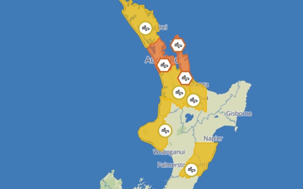
The forecaster MetService has issued an orange strong-wind warning for Auckland.
Photo: MetService/Supplied
High winds and thunderstorms in Auckland could force infrastructure and business closures in some places, including the possible closure of the Harbour Bridge.
Forecaster MetService has issued an orange strong-wind warning for Auckland, Great Barrier Island and Coromandel Peninsula from 3pm through to midnight.
Winds are expected to gust up to 120km/h in exposed places.
⚡ More than 2700 strikes have been detected since midnight ⚡
We’ve already recorded gusts of 90-100km/h in parts of Northland, and a line just coming on to the west coast of Northland and Auckland has the potential to bring even stronger damaging gusts pic.twitter.com/klW4hJ7Fpe
— MetService (@MetService) August 30, 2025
MetService said on Sunday morning it had detected more than 2700 strikes since midnight.
The forecaster said it had also already recorded gusts of 100km/h in parts of Northland.
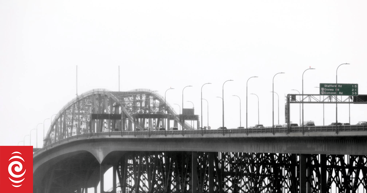
Harbour Bridge may be forced to close
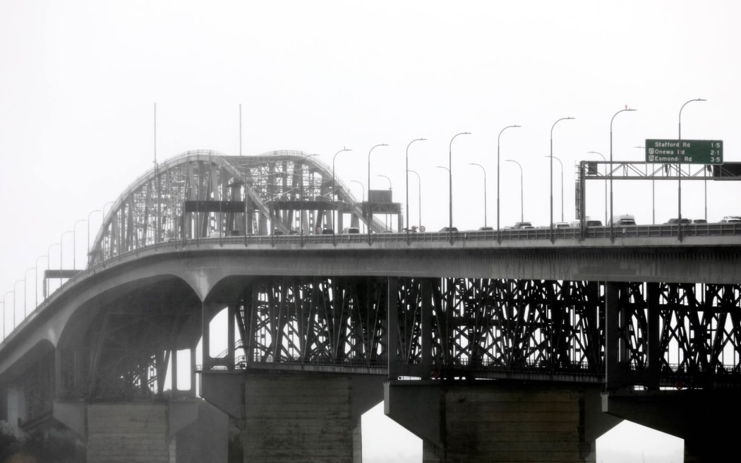
Auckland Harbour Bridge on a rainy day. Weather generic.
Photo: MARIKA KHABAZI / RNZ
Waka Kotahi said Auckland Harbour Bridge may also be required to close if severe winds gust over 90km/h.
It said reduced speeds were now in place and lane reductions were likely. Motorists should expect delays.
Auckland Transport delays
Auckland Transport is asking people to plan ahead, saying bus services across the Harbour Bridge are likely to be disrupted.
The agency said buses could be delayed, cancelled or detoured throughout the day.
Ferries across the harbour may also be impacted.
Cornwall Park already closed
The managers of Cornwall Park have already announced the park will close from 1pm, saying there could be unseen hazards if extreme winds ripped through the Auckland region.
Park officials said the safety of staff and the public was their highest priority.
All facilities within the park will be closed, including the toilets, the Huia Lodge Discovery Hub, Acacia Cottage and eateries.
Damage to trees, powerlines, tramps
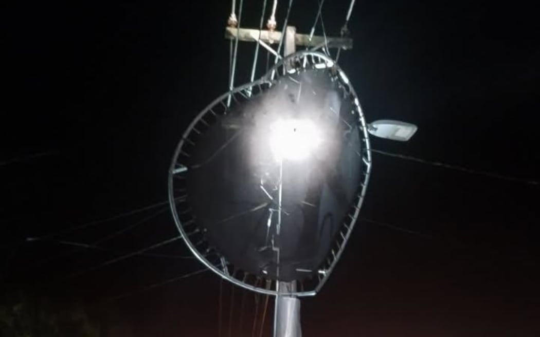
A trampoline hit the powerlines on Grandview Road, Hamilton in May.
Photo: Supplied
MetService also warned that the high winds could cause damage to trees, powerlines and unsecured structures.
The lead meteorologist Alain Baillie said winds were expected to gust up to 120km/h and conditions could be hazardous.
“We can expect trees to come down, obviously powerlines are at risk.
“If you’ve got unsecure things like trampolines they are likely to be transported somewhere that you do not want them to be transported to, so fix them down as best you can.”
He said there was also a risk to vehicles – especially those that were high-sided – and motorcycles.
Significant snow for the south
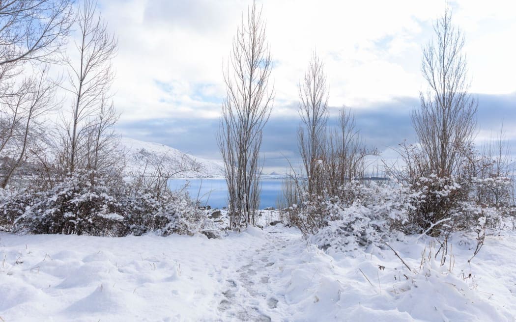
Snow in Tekapo on 9 August, 2025.
Photo: Supplied
Road snowfall warnings were in place for several South Island roads, as snowfall is forecast above 600m-800m.
MetService issued warnings for the Crown Range Road, and the Lewis, Lindis and Porters Passes through to Sunday evening.
Between one and four centimetres of snow was expected to accumulate.
A warning remained in place for Milford Road until Monday afternoon. An additional 10 to 20 centimetres of snow was expected to accumulate on higher parts of the road.
Sign up for Ngā Pitopito Kōrero, a daily newsletter curated by our editors and delivered straight to your inbox every weekday.