
Published on Sep. 20, 2025, 12:13 AM
Updated on Sep. 20, 2025, 2:12 PM
Some much-needed precipitation is on the way later this weekend, and it’s bringing some storms with it
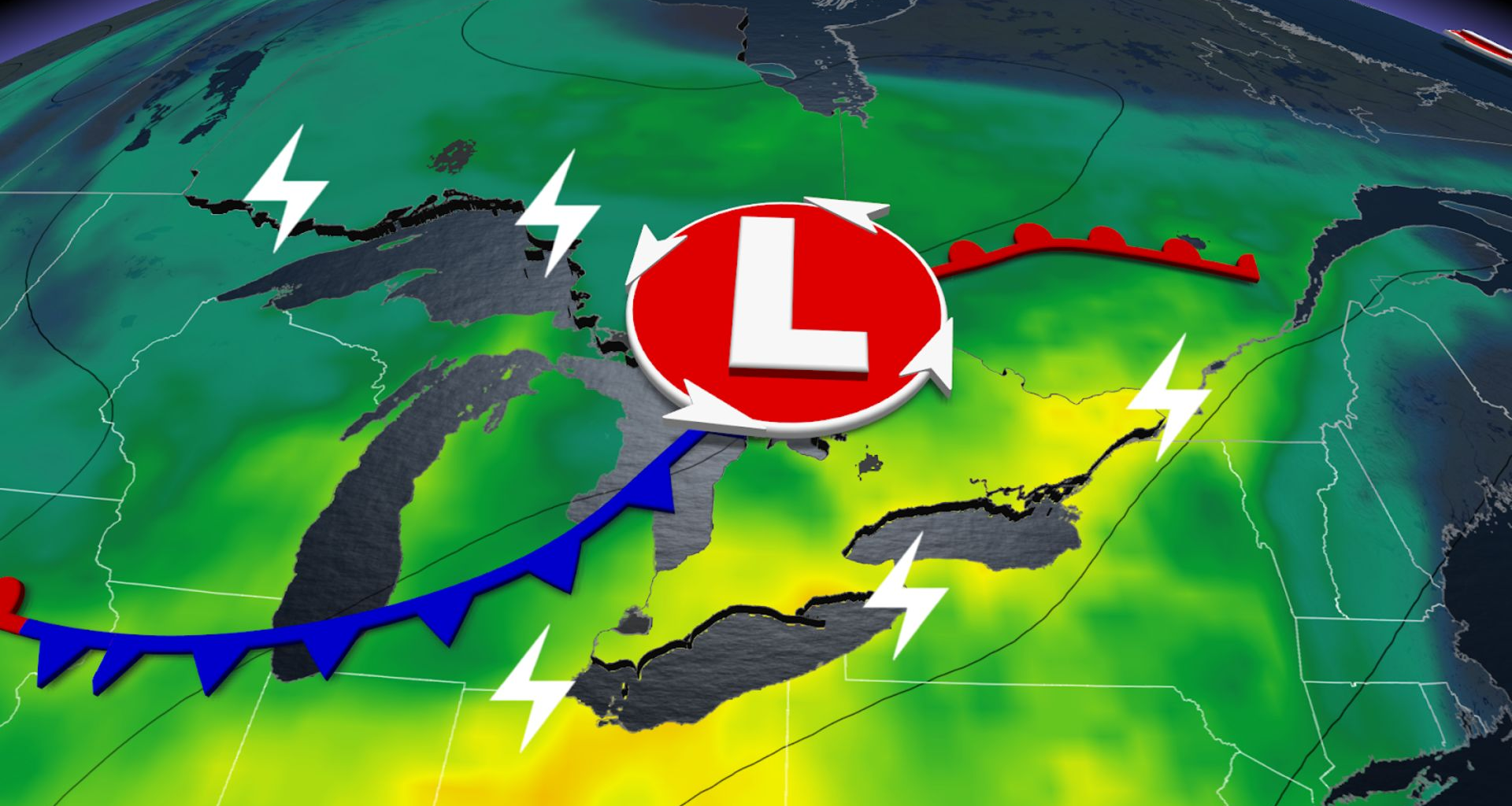
Some much-needed rain is on the way to Ontario to round out this weekend as a low-pressure system moves across the Great Lakes. And potentially the last severe storm of the summer.
On Sunday, thunderstorms could potentially pop up all across the province from Toronto to Kenora, with severe thunderstorms expected mostly in southern Ontario from Windsor to Owen Sound.
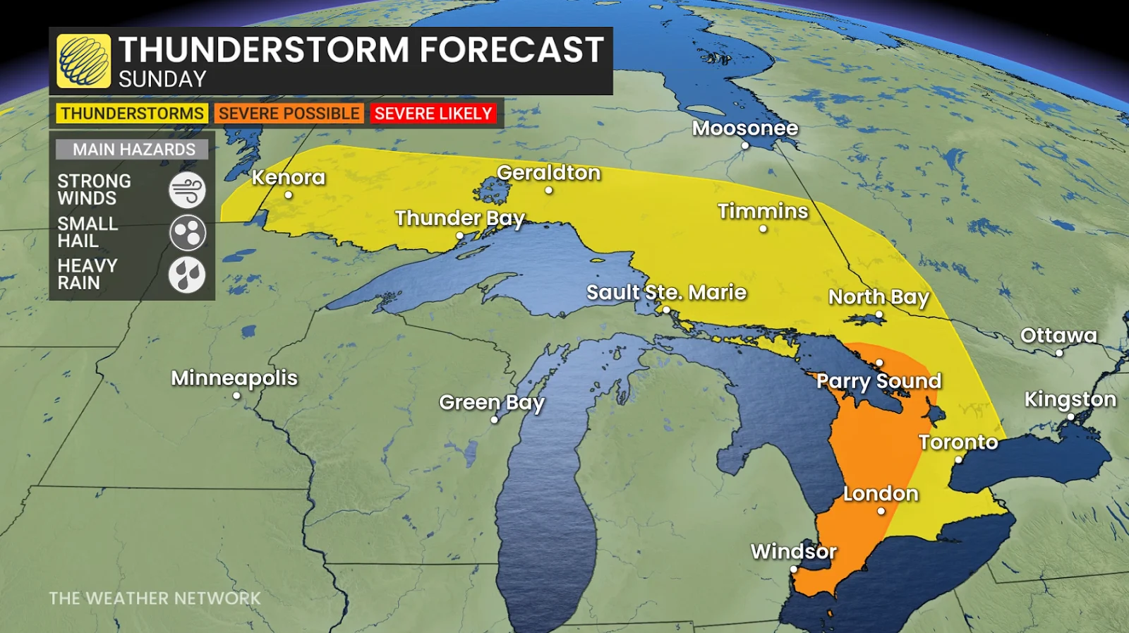
The majority of these storms will remain below the severe limit, but isolated stronger cells may form west of the GTA, where stronger winds are more likely.
DON’T MISS: More dangerous than snow: Why driving in the rain can be a bigger hazard
Conditions are just right to allow the storms to form. Saturday’s fall chill dropped temperatures, just as a warm airmass will move into southern Ontario along with a low-pressure system on Sunday.
On top of that, moisture is building, with dew points climbing into the mid to upper teens; these factors are generating the right conditions for Sunday to see some thunderstorm energy build.
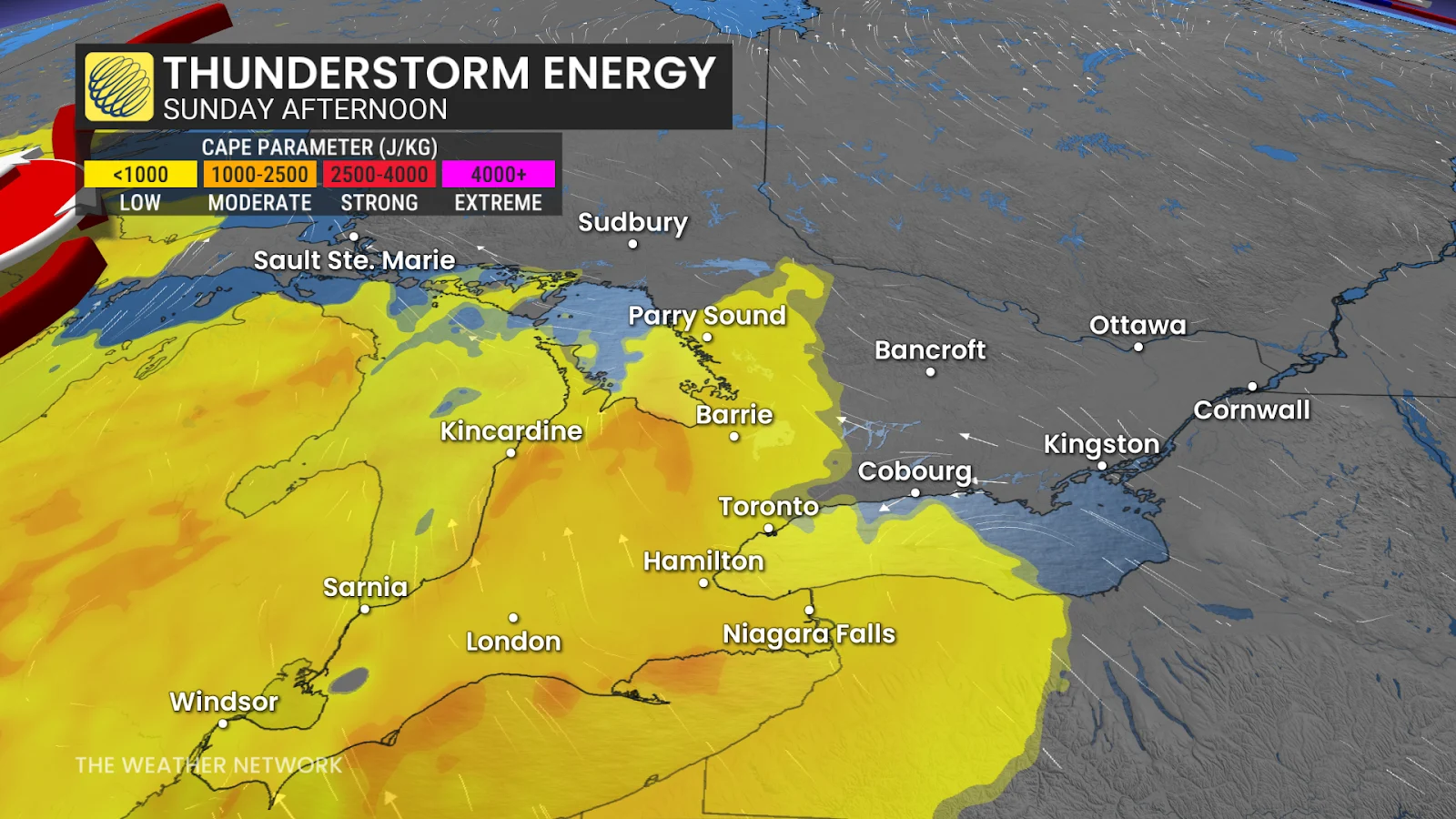
Still, the energy is modest-to-moderate, so nothing too intense, with thunderstorms expected to have gusty winds and small hail.