
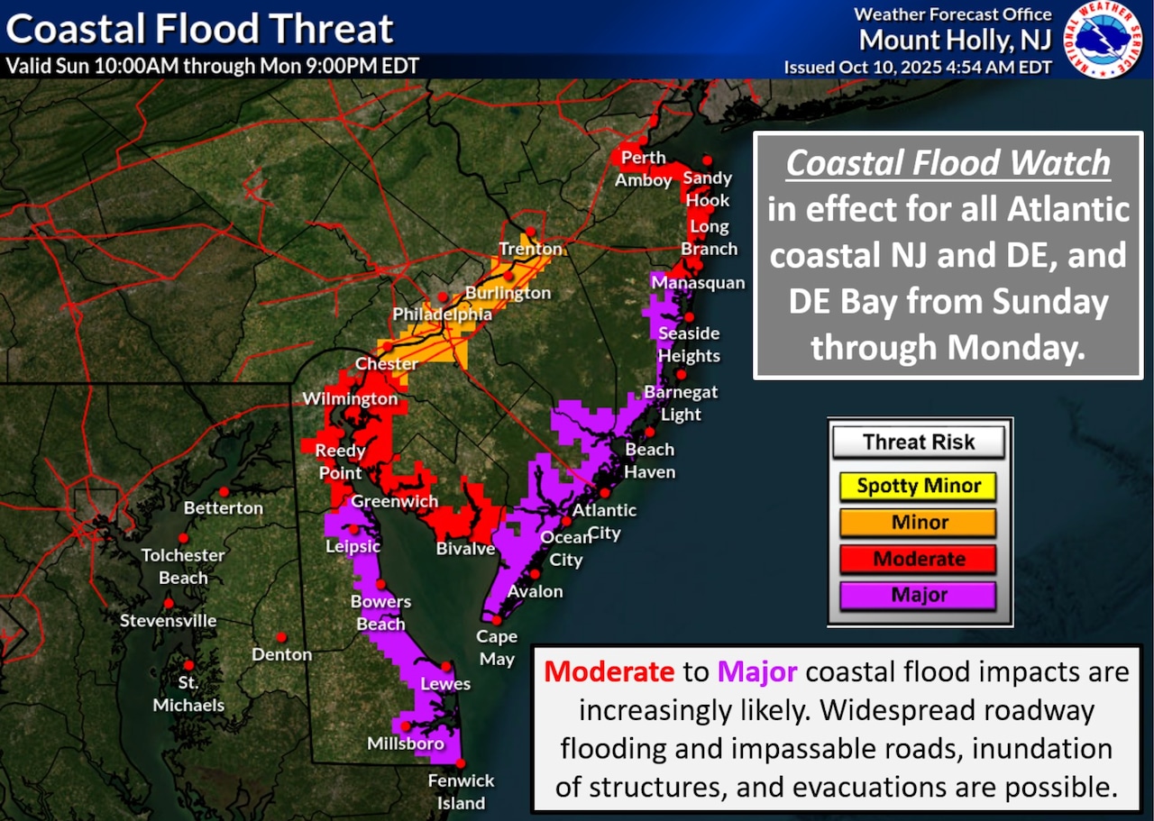
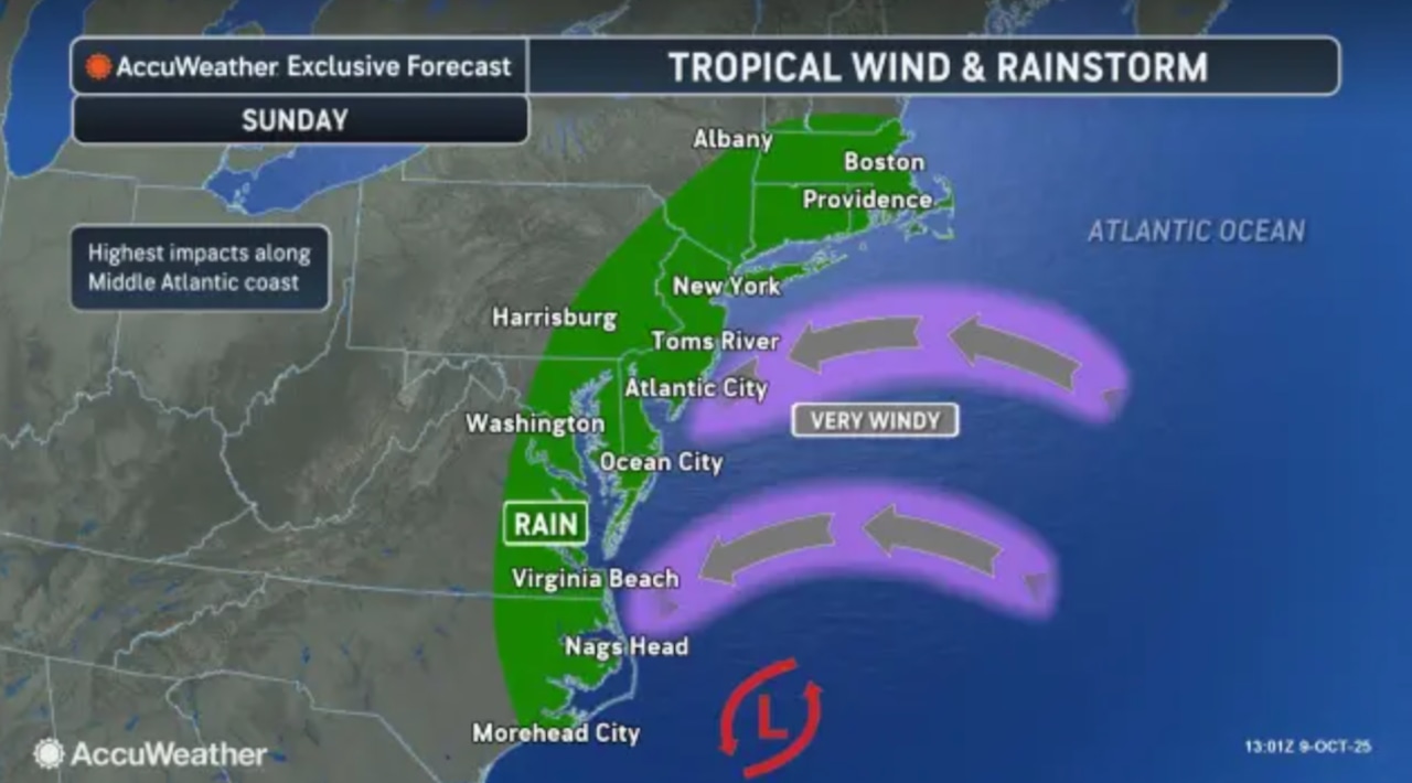
A dangerous nor’easter storm is expected to churn high winds and heavy rain to New Jersey beginning Sunday, causing significant flooding and potential evacuations in Jersey Shore towns, forecasters say.
The National Weather Service has issued high wind watches and coastal flood watches for multiple counties, with the most severe conditions anticipated at high tides along beaches and bays.
“Moderate to major coastal flood impacts are increasingly likely,” the weather service said in an update early Friday. “Widespread roadway flooding and impassable roads, inundation of structures, and evacuations are possible Sunday-Monday.”
 A dangerous nor’easter storm is expected to bring wind gusts up to 60 mph, heavy rain and coastal flood at the Jersey Shore beginning Sunday and lasting into Monday, forecasters say.National Weather Service
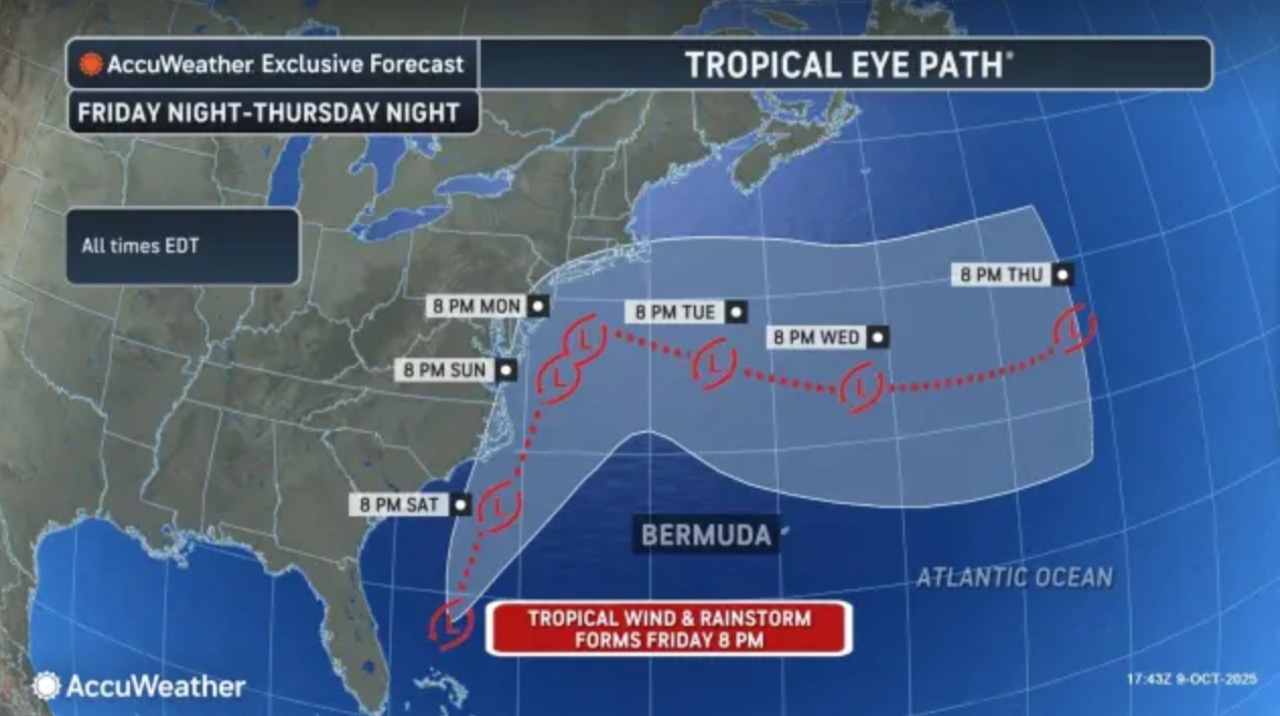
Forecasters say the storm will develop Sunday morning, with northeast winds increasing to 30-50 mph inland and potentially gusting up to 60 mph along the coast.
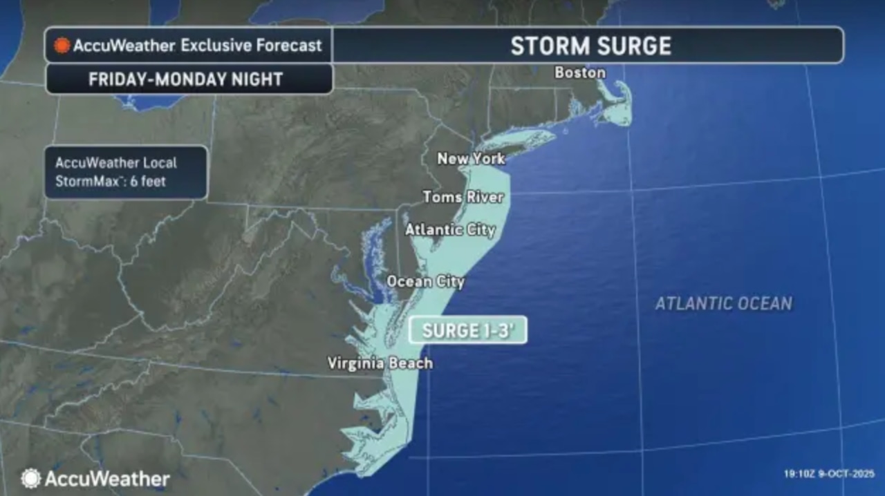
Jersey Shore counties face the highest risk of strong winds and potential coastal flooding.
 A dangerous nor’easter storm is expected to bring wind gusts up to 60 mph, heavy rain and coastal flood at the Jersey Shore beginning Sunday and lasting into Monday, forecasters say.AccuWeather
Residents in these areas should prepare for possible power outages and property damage.
“Significant beach erosion and dune breaching is possible due to very high surf,” the weather service said. “Now is the time to prepare your property for the threat of coastal flooding.”
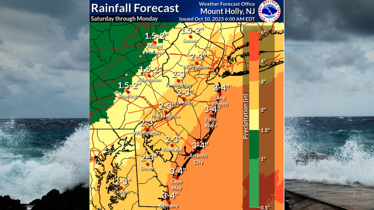
Rainfall is expected to be substantial, with most areas predicted to receive 1-3 inches of rain over 36 to 48 hours.
“Locally higher amounts of 3-5 inches of rain are possible,” the weather service said in an updated briefing Friday. “Coastal areas could see a compounded impact with heavy rain on top of moderate to major tidal flooding.”
 A dangerous nor’easter storm is expected to pound New Jersey beginning Sunday with up to 60 mph, widespread heavy rain and major coastal flooding at the Jersey Shore.National Weather Service and Canva
While significant flooding inland of the Jersey Shore is not anticipated due to recent dry conditions, minor poor drainage flooding is possible.
The heaviest precipitation is likely to occur Sunday afternoon through Monday, with rain potentially continuing into early Tuesday.
 A dangerous nor’easter storm is expected to bring wind gusts up to 60 mph, heavy rain and coastal flood at the Jersey Shore beginning Sunday and lasting into Monday, forecasters say.AccuWeather
The storm’s impacts will vary by location, with coastal regions experiencing more severe conditions.
Inland areas may see less intense winds and rainfall, though gusts up to 30-50 mph are still possible near the I-95 corridor.
A dangerous nor’easter storm is expected to bring wind gusts up to 60 mph, heavy rain and coastal flood at the Jersey Shore beginning Sunday and lasting into Monday, forecasters say.AccuWeather
The National Weather Service emphasized the complexity of the storm’s track, noting some uncertainty in its exact path and intensity.
By Tuesday, conditions should begin to improve as the storm weakens and moves offshore.
High pressure is expected to build back into the region by midweek, bringing more stable and cooler weather.
Temperatures are forecast to return to near-normal levels for early October, with potentially below-normal temperatures by Thursday.
Residents are advised to stay informed about changing weather conditions, secure loose outdoor items, and be prepared for potential power interruptions.
Local emergency management offices recommend having an emergency kit ready and staying tuned to local weather updates throughout the weekend.
Current weather radar
If you purchase a product or register for an account through a link on our site, we may receive compensation. By using this site, you consent to our User Agreement and agree that your clicks, interactions, and personal information may be collected, recorded, and/or stored by us and social media and other third-party partners in accordance with our Privacy Policy.