
We could be in for a wet and windy week Ireland storm fears
The rain is finally clearing after a washout Saturday night for many areas, though one county will remain under a Status Yellow rainfall warning for another couple of hours yet. Co Louth remains under a weather warning until midday after other warnings expired earlier this morning.
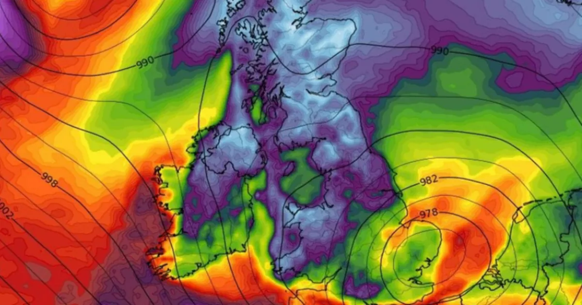
The week ahead is set to feature mixed and changeable conditions, with fears of a storm midweek, though there remains some uncertainty in the forecast.
Weather expert Alan O’Reilly, who mans the @CarlowWeather account on X, highlighted that he is keeping a close eye on storm possibilities after numerous queries from his followers. Thankfully, current indications suggest that Ireland should escape the worst of the impact.
He posted: “Few people asking about a possible storm Wednesday or Thursday. There will be low systems nearby and some wind and rain is possible but we look likely to escape the worst of it in Ireland.”
Much of the country endured a wet and windy weekend, and conditions aren’t expected to improve much on Monday as Met Eireann has suggested that thunderstorms are possible. The national forecaster has also admitted that its current indications for the middle of next week are “uncertain” though wind and rain are likely to dominate.
Delivering the forecast for the end of the weekend, a Met Eireann spokesperson said: “Outbreaks of rain, heavy at times, will continue to clear northeastwards this morning. Drier and brighter conditions in the west and southwest will gradually extend nationwide by the early afternoon with a mix of sunshine and a few showers. Some of the showers will turn heavy or possibly thundery later, mainly in Munster. Fresh to strong and gusty southeasterly winds easing light to moderate southwesterly as the rain clears. Highest temperatures of 13 to 17 degrees.
“Tonight will bring a mix of clear spells and showers for most. The showers will merge to longer spells of rain at times, especially over the southern half of the country, where some heavy and thundery downpours are possible. Lowest temperatures of 7 to 11 degrees, coldest in Ulster. Light to moderate variable winds, becoming northerly towards morning and freshening near southwestern coasts. Patchy mist and fog also.
“Rather cloudy to begin tomorrow, Monday, with scattered showers, merging to longer spells of rain at times, especially near the east coast. Some heavy bursts and isolated thunderstorms are possible but they will ease towards the evening. Highest temperatures of 13 to 16 degrees. Mostly light to moderate northerly winds at first, will back northwesterly and increase fresh at times near southern and southwestern coasts.”
Subscribe to our newsletter for the latest news from the Irish Mirror direct to your inbox: Sign up here.