

DON’T MISS: Why do we ‘fall back’?: The story of daylight saving time
WATCH: Why November can be a monster for snow near Canada’s big lakesQuebec
There will be little shortage of snow in Quebec this week, as most of the province is forecast to see at least a few flakes fall thanks to the cold air over Hudson Bay.
Wet snow is forecast to fall north of Sept-Îles on Monday, and by Tuesday, we’ll see the snow threat spread across the Laurentians north of Quebec City. This will be great news for ski resorts in the area, such as Mont-Sainte-Anne and Le Massif de Charlevoix.
By Thursday, we’ll see an even chiller burst of cold air move into the province with an upper-level trough, bringing the chance for scattered snow across central regions of the province.
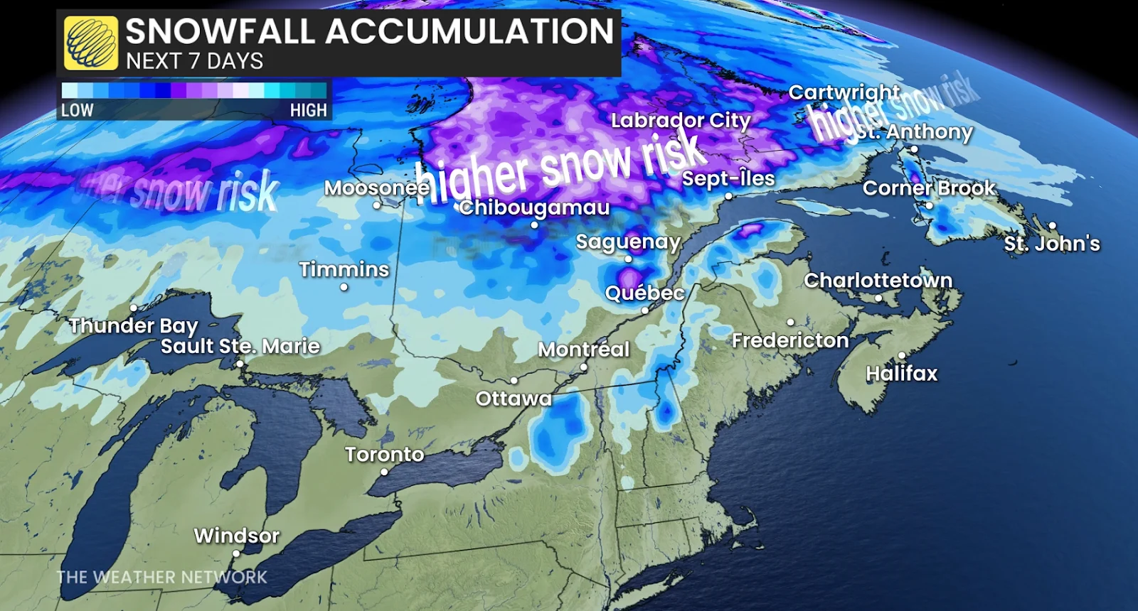 Atlantic Canada
Labrador has already been seeing its fair share of the snow over the weekend, which will continue into the week. We could see some snowfall over western Newfoundland as well.
The Maritime provinces will be focusing on two rainy systems forecast to sweep through the region over the week. Parts of northern New Brunswick do have a chance to see some wet snow as cooler air seeps in from Quebec, but the majority of the province should be in the clear.
The only two provinces not forecast to get any snow this week are Prince Edward Island and Nova Scotia. This is thanks to a mass of mild Atlantic air sitting over the region, keeping out the cold Arctic air that is trying to seep south.
Stay with The Weather Network for more information and updates on your snowy forecast across Canada.