
DON’T MISS: Canada’s November features extended fall, but winter lurks on the sidelines
Winds will be strongest along the south, east, and north coasts of Newfoundland, with gusts of 90-100+ km/h.
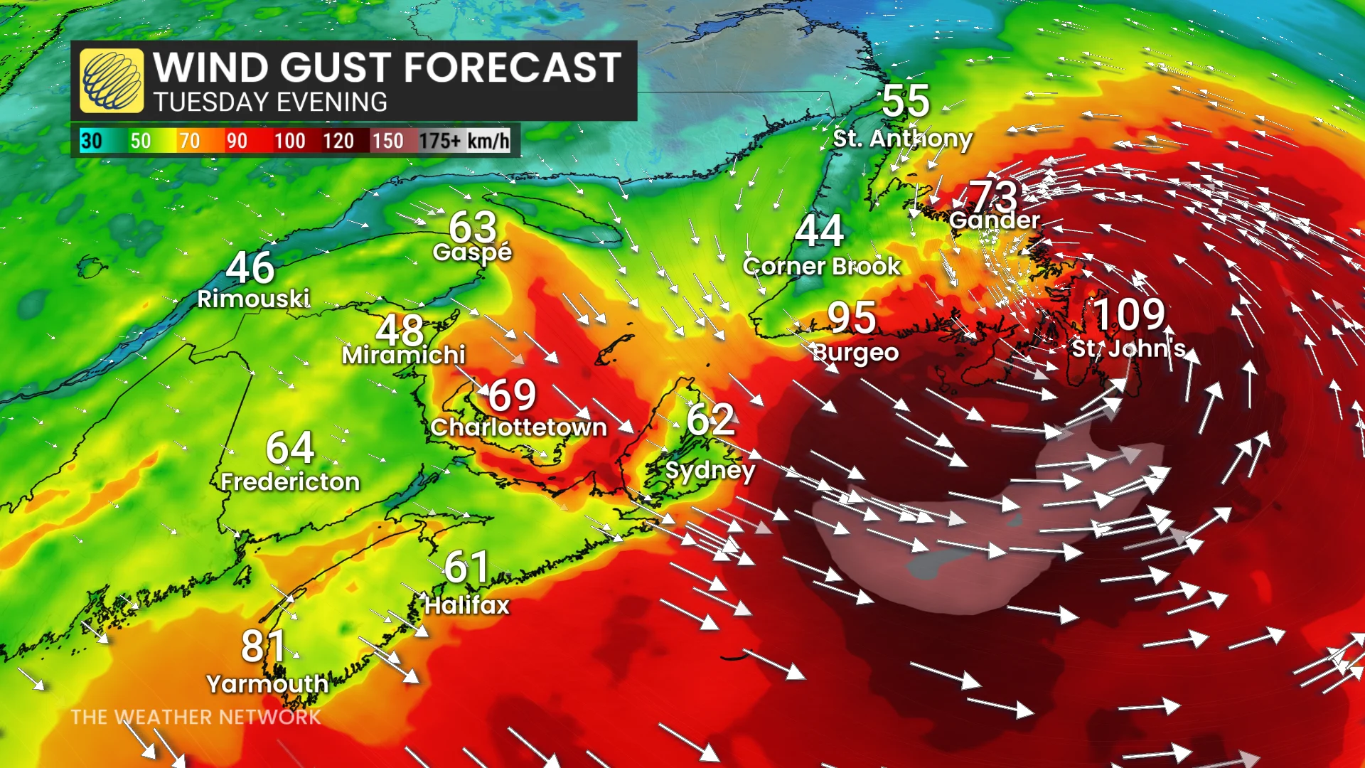
Gusts exceeding 110 km/h are possible, especially around Sable Island and southeastern coastal Newfoundland, including St. John’s and the Avalon Peninsula. Wind warnings are in effect.
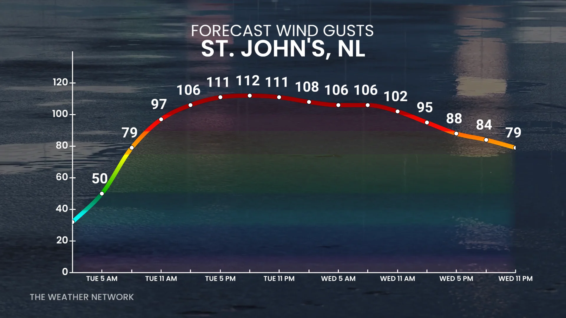
The most recent gust over 100 km/h in St. John’s occurred on February 15, while the last gust exceeding 110 km/h was recorded on January 5.
Wet snow may also develop in higher elevations in western Newfoundland and Labrador.
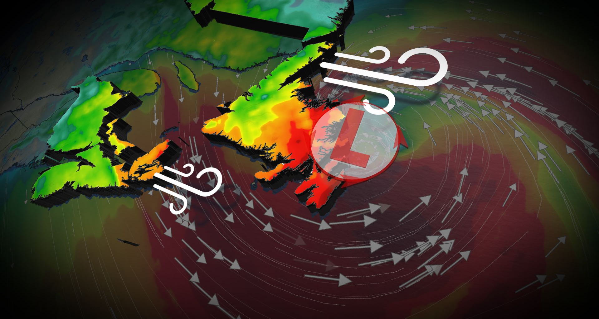
Localized flooding and coastal erosion a threat
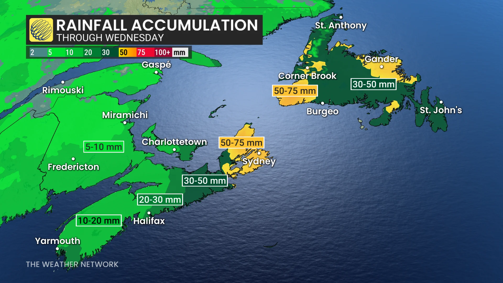
Rainfall accumulations of 50-75 mm are expected in Cape Breton and along the Burgeo coast, with widespread amounts of 30-50 mm across the Avalon Peninsula.
Impacts may include power outages, downed trees, minor structural damage, localized flooding in Cape Breton and Newfoundland, as well as coastal erosion due to large waves reaching 7-8 metres.
Stay updated as this system develops. Weather conditions may present risks for travel and infrastructure in the region.
WATCH: How a ‘Weather Bomb’ forms and what it means
Stay tuned to The Weather Network for the latest forecast updates for Atlantic Canada.