
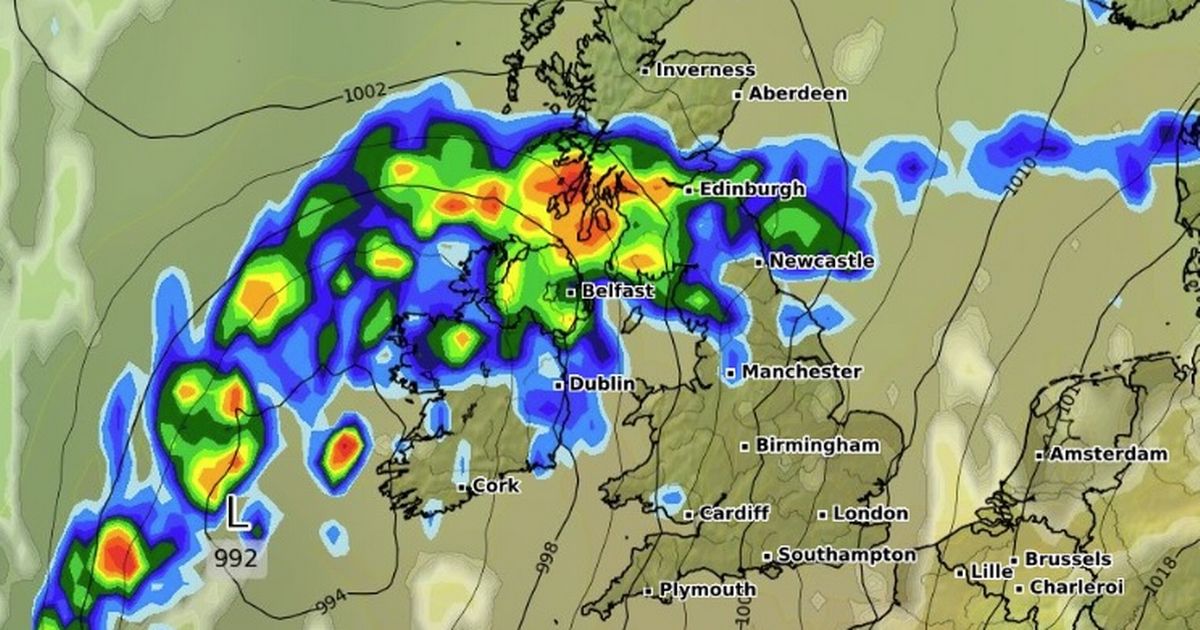
Met Eireann lists the potential impacts as localised flooding; difficult travel conditions and poor visibility The weather warning becomes active at midnight. (Image: WXCharts.com)
Met Eireann has issued a weather warning for heavy rain.
The alert was issued on Monday evening and will be active between midnight and 12pm on Tuesday. The weather warning applies to counties Carlow, Kilkenny, Wexford, Wicklow, Cork and Waterford.
Met Eireann lists the potential impacts as localised flooding; difficult travel conditions and poor visibility.
“New yellow rainfall warning added for tonight and Tuesday morning with over 30mm possible in parts of South and Southeast,” said Carlow based weather expert, Alan O’Reilly of Carlow Weather on X.
Meanwhile, Met Eireann is forecasting rain for many parts of the country for the rest of the week but there is a chance more settled conditions could emerge at the weekend.
Met Eireann National Outlook:
Tuesday night: Cloudy and misty with areas of fog. There’ll be scattered showers at first and it will become wet overnight as spells of rain move northwards across the country. Lowest temperatures of 10 to 13 degrees with light to moderate east to northeast or variable winds.
Wednesday: The morning will be dull and wet with widespread rain, heavy at times. The rain will gradually clear northwards and it’ll be drier for the afternoon and evening with just patches of light rain or drizzle. There’ll be some mist and fog too. Highest temperatures of 13 to 17 degrees with light to moderate southerly winds.
Wednesday night: Cloudy with patches of light rain or drizzle at first. More frequent spells of rain will move northwards over the country overnight, clearing to isolated showers in the south by morning. There’ll be mist and fog too. Lowest temperatures of 9 to 13 degrees with light to moderate southerly or variable winds.
Thursday: A mostly cloudy and misty start to the day, with rain in northern areas and isolated showers elsewhere. The rain and mist will clear during the morning and the cloud will gradually clear eastwards too, leaving sunny spells and just isolated showers. Highest temperatures of 11 to 14 degrees with light to moderate southwesterly winds.
Thursday night: Dry and clear at first. Cloud and outbreaks of rain will move into the west and southwest overnight and moderate to fresh southeasterly winds will develop. Lowest temperatures of 4 to 8 degrees.
Friday: Cloud and rain will move northeastwards across the country during Friday and will be followed by sunny spells in the west and southwest. Highest temperatures of 9 to 15 degrees with moderate to fresh southeasterly winds, easing and becoming westerly behind the rain.
Friday night: Rain will clear from the northeast, giving way to mainly dry conditions, although areas of mist and fog will form. Lowest temperatures of 5 to 9 degrees with light west to southwest winds.
The Weekend: There is uncertainty in the forecast, but current guidance suggests a dry and bright day on Saturday, once any mist and fog clears, followed by a more unsettled day on Sunday.
Subscribe to our newsletter for the latest news from the Irish Mirror direct to your inbox: Sign up here.