
Long range weather maps show when snowfall could hit the midlands, northwest and west of Ireland Snow is forecast to fall in Ireland later in November
Irish weather is famed for its unpredictability, and a significant shift might be on the horizon as weather maps hint at the possibility of snowfall this month.
Typically, January and February are the months most likely to see snow in Ireland, but there’s always a chance it could make an early appearance. Weather forecasters WX Charts are predicting a dusting of snow in Ireland on November 15 and 16.
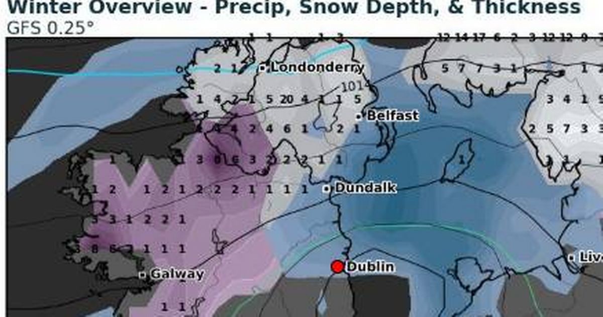
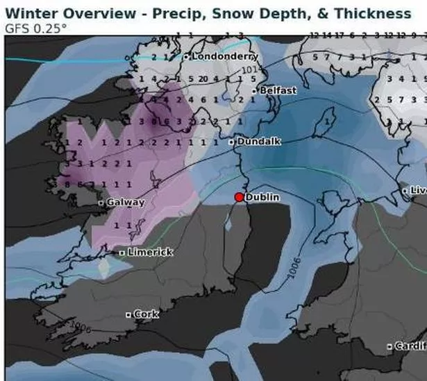
Long range forecasts are notoriously changeable, but the current maps suggest that while most of the country can expect wintry rainfall, some parts of the north, west and midlands may experience snow. A maximum depth of 9cm is predicted, although most areas are forecast to receive no more than 1-3cm.
READ MORE: Two men in court in connection with IPAS centre arson attack
READ MORE: Dublin Zoo ‘vehemently disputes’ staff harassment and animal cruelty claims
In the map, white represents snow, purple indicates snow depth, and blue signifies rainfall. You can track the weather yourself on the WX Charts website.
In contrast, Met Éireann’s most extended range forecast suggests changeable conditions with low temperatures – albeit still above average – are expected towards the year’s end. “The signal from the C3S seasonal models for Ireland during the September October November (SON) period is for above average temperatures, with average rainfall overall,” they predict.
 WX CHARTS Winter Predictions
“Mean temperatures during SON are signalled to be above average overall. Temperatures are likely to trend between 0.5 and 1.0°C above average over the three-month period. The rainfall forecast is less certain, with the potential for both wetter and drier periods through the Autumn season. There is however a higher signal for drier periods in October at times.”
Their long-range forecast for the week including November 15th and 16th says “there is a signal for low pressure to continue bringing unsettled conditions. Mean air temperatures are expected to be average for this time of year with above average rainfall across the country.”
Here is your weather forecast for Dublin over the weekend:.
Friday.
Rather overcast or cloudy today with some rain, drizzle or mist at the start. More widespread rainfall will arrive through the morning, continuing then throughout daylight hours.
Highest temperatures of 12 to 14 degrees in moderate southeast winds.
Persistent rain is possible for a time early tonight but it should turn dry by midnight. Some mist will develop though.
Cool with lowest temperatures of 4 to 9 degrees in light southerly or variable breezes.
Saturday.
Some sunny intervals early on Saturday with largely dry conditions for daylight hours. However, cloud will build with rain developing into the evening hours, along with strengthening southerly winds.
Some hill, mist and coastal fog then too. Highest temperatures of 12 to 14 degrees.
Saturday night is set to be wet and breezy with widespread rain, heavy at times. Expect the mercury to drop to between 8 and 11 degrees, accompanied by a moderate to fresh southerly wind.
Sunday.
The day will start off cloudy with some scattered showers and drizzle, but this will soon clear northeastwards. The rest of the day will see mostly dry weather with sunny spells breaking through.
Temperatures will peak at 12 to 14 degrees, with light to moderate southwesterly winds. The night will remain mostly dry and calm, but there may be some mist and fog, mainly across eastern areas.
It’ll be a bit nippy too, with temperatures dropping to between 3 and 6 degrees.
Sign up to the Irish Mirror’s daily newsletter here to get breaking news and top stories sent direct to your inbox twice a week.