
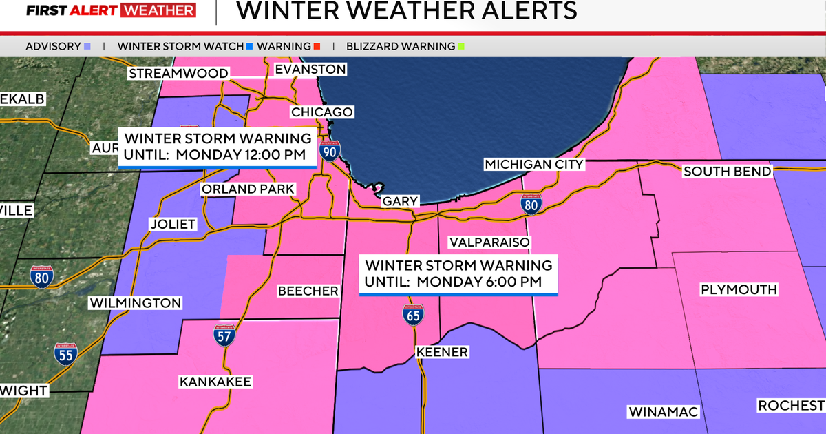
A Winter Storm Warning is in effect for most of the Chicago area and Northwest Indiana Sunday and into Monday as an unseasonable snow storm could drop more than a foot of lake-effect snow in some places and create extremely hazardous driving conditions during the morning commute.
Some snowflakes are forecast to fall off and on during the day Sunday, but the strongest parts of the storm with the heaviest snowfall will start later in the day.
The Winter Storm Warning begins at 9 p.m. Sunday and will be in effect through noon Monday for the entirety of Cook County, as well as eastern Will County. In Kankakee County, the warning begins at midnight Monday morning and also continues through noon Monday.
The warning is in effect through 6 p.m. Monday for Lake and Porter counties in Indiana.
For LaPorte County, Indiana, a Winter Storm Warning was already in effect as of midday Sunday and continues until midnight Tuesday morning.
A Winter Storm Warning is also now in effect for Lake County, Illinois, from 9 p.m. Sunday to 6 a.m. Monday.
A Winter Weather Advisory will be in place for DuPage and western Will counties in Illinois and Newton and Jasper counties in Indiana.
Intense lake-effect snow bands will move onshore and intensify after 9 p.m. Sunday. Near whiteout conditions will be seen at times through the night and into Monday morning.
Northwest winds of 35 mph could bring whiteout conditions and hazardous travel, and even thundersnow getting into Sunday night.
Travel conditions near the lake will be next to impossible where the intense bands form into the Monday morning rush. People are urged to stay home if at all possible or take public transportation to stay off the roads.
Snowfall rates of 3 inches per hour are possible. Snow totals of 8 to 12 inches are expected in areas where lake effect snow plumes form. In areas where they linger, localized totals could be much higher, topping out at 12 to 18 inches — or 1 to 1.5 feet — at the edge of Lake Michigan.
More from CBS News