
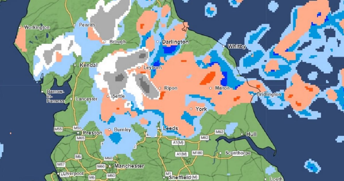
Temperatures are expected to drop in the coming days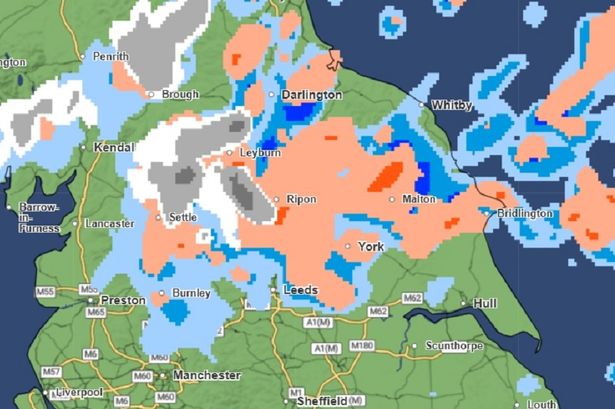 The Met Office weather maps currently show snow falling over parts of England at 9pm on Tuesday evening
The latest Met Office weather maps show snow will fall over parts of Greater Manchester within the coming days.
Temperatures are expected to plunge in the coming week with the weather in many parts of the UK dipping below freezing.
At the end of last week, Met Office forecasters warned of a “widespread wintry spell” which could see snow fall on the hills and mountains in Scotland, Northern Ireland, northern England, and possibly North Wales.
The weather agency said the colder spell is due to a flow of Arctic air will push south across the UK.
As off 5.30pm on Sunday, the Met Office’s latest weather maps for the coming days show snow falling in the Lake District, and parts of Northumbria, at around 3am on Tuesday morning – with more again later in the afternoon.
 Met Office weather maps show snow falling at 3am on Tuesday morning
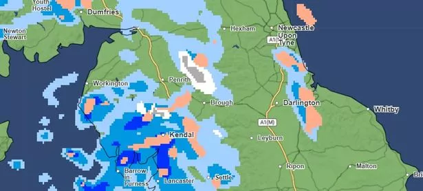
Maps show it will become heavier and widespread into Tuesday evening – with snow potentially falling across the Lake District, Northumberland, the North East and North Yorkshire. This will continue across the North East and North Yorkshire into the early hours of the morning.
By midday on Wednesday, the maps show heavy snow falling across the east coast between Hartlepool and Bridlington. This will continue into the night before more snow showers at around 9am on Thursday, this time further south around Hull.
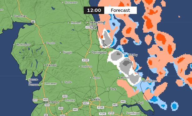 The current Met Office weather maps for Wednesday at midday
A Met Office spokesperson said: “By Wednesday night (November 12), much of Scotland will be in cooler air moving in from the north. This will bring below freezing overnight temperatures, as well as the risk of some snow over higher ground.”
While Met Office meteorologist Simon Partridge said: “There is the possibility of snow by the end of next week and into next weekend.”
Speaking to The Independent, he added: “There are lots of different computer models and they all run multiple times a day, but some of them are coming up with some cold air coming in from the north that might result in some snow across most likely Scotland.”
It comes after Storm Claudia battered Greater Manchester yesterday, November 14, and overnight into Saturday.
Join our Traffic and Travel WhatsApp group HERE
Flood alerts were issued as heavy rain and fierce gusty winds as Storm Claudia brought havoc across the UK.
The Environment Agency issued the warning for the River Mersey on Friday night, with flooding expected from 11pm last night (November 14)
The storm has been named by the Spanish meteorological service, but its impact has been felt across much of England and Wales.
A fallen tree left trams suspended on the Metrolink line between Bury and Whitefield, with repairs set to continue throughout the weekend.
In Oldham, firefighters cordoned off part of a shopping centre after the roof became damaged