A rare November cyclone is expected to hit Australian land this weekend, the first in more than a decade, the Bureau of Meteorology has announced.
The weather agency urged the thousands of locals living across the Northern Territory to monitor for updates as a tropical low lurked some 250 kilometres north of Darwin earlier this week.
That system has now officially been declared Cyclone Fina, the first in November in 12 years.
The last time the region saw a cyclone in November was back in 2013 when it was rattled by Cyclone Alessia, a category one system.
Prior to that, it was the Severe Tropical Cyclone Joan that ravaged parts of the northern and western coasts in 1975.
It caused significant damage, particularly in the Port Hedland area, and remains one of the most intense tropical cyclones to have affected Australia.
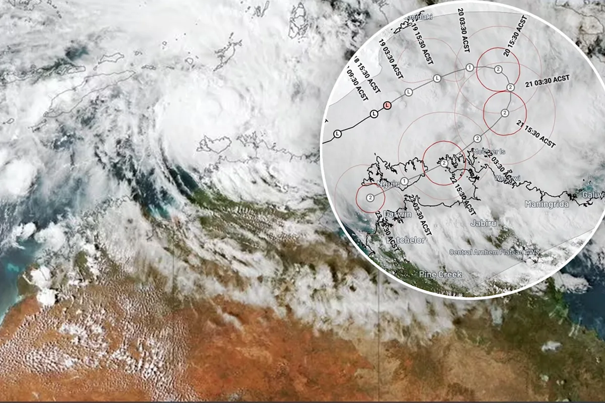
The storm is expected to reach a Category 2 classification. Source: Weatherzone Radar showing Cyclone Fina off the NT coast.
What conditions do category two cyclones bring?
Early forecasts predict a Category 2 storm to sweep across the territory late this week and into the weekend, which typically brings ferocious winds strong enough to rip off roofs, knock down trees, and cut power.
Heavy rain triggering flash flooding, huge waves and storm surges are also possible, meteorologists say.
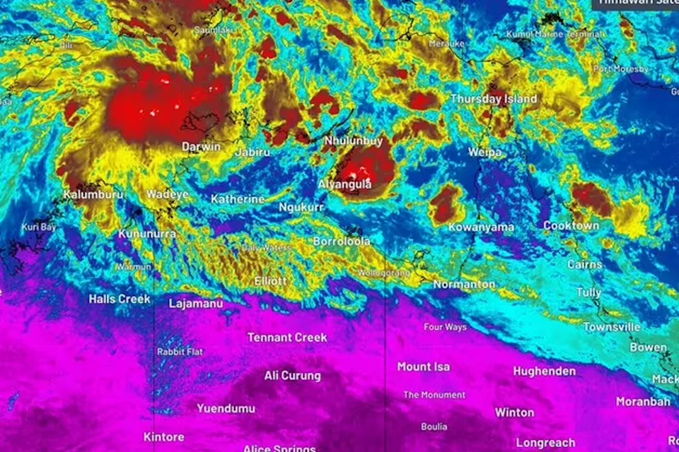
Weatherzone reports that the storm is “gaining strength” and “drawing energy from the warm Timor Sea”, where sea surface temperatures are currently around 30 to 31C.
Warm ocean temperatures and “supportive atmospheric conditions” are expected to help Fina develop, with its smaller size meaning it can intensify more quickly than a larger system.
While the cyclone is currently moving offshore, the BOM anticipates a southward turn later on Thursday, directing it toward the Top End of the Northern Territory.
Weatherzone said the system will likely approach the Tiwi Islands on Saturday before moving west of Darwin on Sunday.
People in the NT’s north and WA’s Kimberley should keep an eye on the latest cyclone updates over the coming days, as forecasts and warnings may shift as new information comes in.
Australia has seen several Category 2 cyclones in recent years. In December 2023, Cyclone Jasper crossed the far north Queensland coast near Wujal Wujal as a Category 2 system, unleashing destructive winds and torrential rain that caused major flooding, cut power to tens of thousands of homes and triggered landslips that shut key roads.
In February, Cyclone Alfred wreaked havoc on large parts of Southeast Queensland. It reached its peak as a Category 4 cyclone offshore, making landfall as a Category 1.
In March 2025, Cyclone Dianne made landfall in WA’s Kimberley as a Category 2 storm, bringing damaging gusts above 115 km/h and heavy rainfall that sparked flood warnings across inland communities.
Love Australia’s weird and wonderful environment? 🐊🦘😳 Get our new newsletter showcasing the week’s best stories.