
Some areas across the UK could see up to seven inches of snowfall, according to the latest weather mapsBradley Jolly Overnight News Editor and Ashlie Blakey Live and breaking news reporter
08:34, 26 Nov 2025
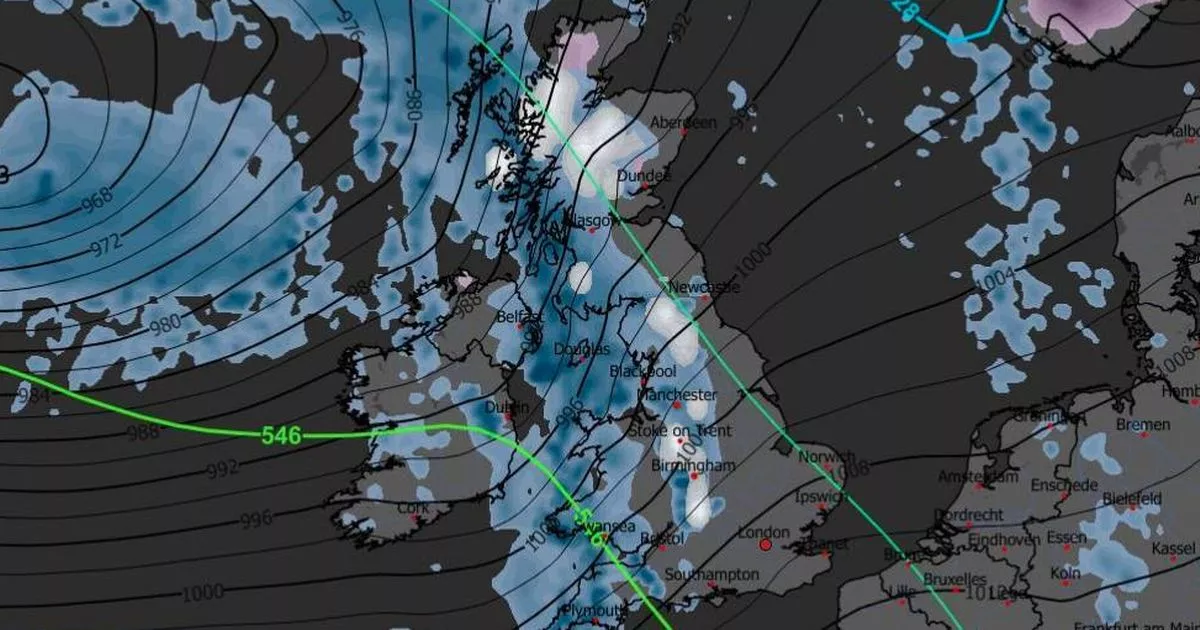
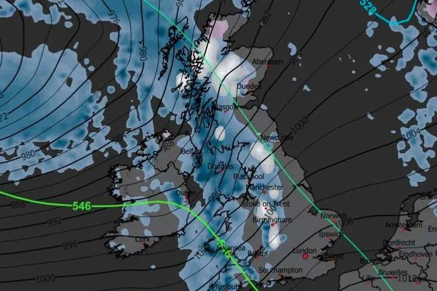 Weather maps show snow is forecast in the next couple of weeks
Weather maps have revealed the exact date more snow could hit the UK amid another Arctic blast.
Some areas across the UK could see up to seven inches of snowfall as a band of freezing low pressure sweeps across the UK from the northwest. After a rise in temperatures since last week’s freezing cold snap, the mercury is set to drop again in early December, the Mirror reports.
Metdesk forecasters and the WX Chart suggest the next period of snowfall in the UK is most likely to be on Saturday, December 6. The snow showers could continue for several days if temperatures remain low.
Weather maps show white hues as far south as the Cotswolds on the morning of December 6, with widespread snow predicted for some time, including in Greater Manchester. The thickest white patches on the WX Chart are across the Scottish Highlands, Cumbria, and Staffordshire.
Seven inches of snow is forecast in these areas, with lighter dustings expected elsewhere later that day, including most of Wales and the Northwest of England. However, it’s unlikely this pattern will persist throughout the month leading to a white Christmas, the Mirror adds.
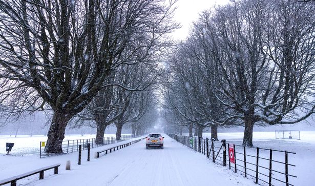 The UK is set to see more snowfall in the coming weeks(Image: Jason Roberts /Manchester Evening News)
This is despite data showing that more than half of all Christmas Days in the UK have seen snow falling somewhere. Temperatures are set to rise in the week following the next Arctic storm.
They dropped below freezing last week across the country, but Monday saw a high of 11.7C, recorded near Preston in Lancashire. In the days leading up to December 6 – the Arctic storm – it is expected that conditions will be cold and wet for most of the UK.
Netweather forecasters predict particularly heavy rainfall, until temperatures drop enough for snowfall. Nick Finnis, writing on the meteorological service’s blog, stated: “Highest rainfall totals across the west next week, where we could see well in excess of 100mm fall, also could be quite wet across the far south, as secondary lows run across here.
“So we may start to see an increase in flooding issues in the west and perhaps far south. Spring tides end of next week / following weekend could bring a risk of coastal flooding too should there be strong winds.”
The BBC Weather forecast for the period from December 1 to December 7 reads: “A weakening front or two could bring a little rain farther southwards and eastwards, so it’s unlikely to be completely dry. The risk to the forecast is that high pressure will position itself differently – more strongly over Scandinavia, for example – which would mean chances of colder flows developing.”