
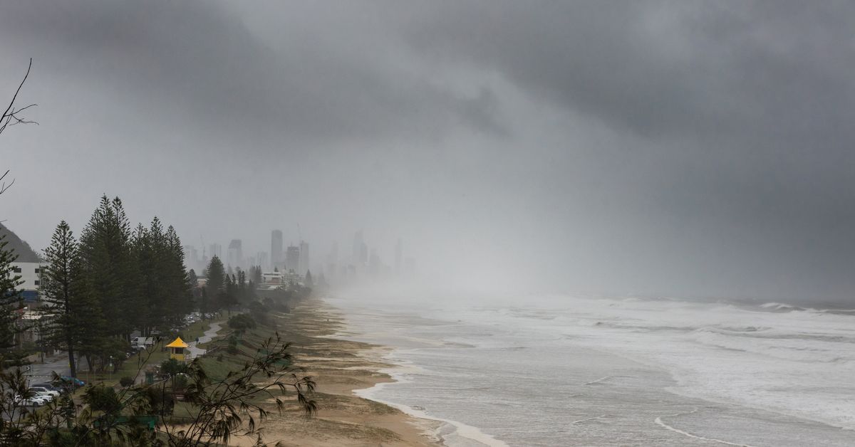
The Bureau of Meteorology has declared that La Niña is under way off Australia just days ahead of summer, but a counteracting weather event means it will not be as impactful as other La Niñas.
Conditions consistent with the weather phenomenon have been observed in the Pacific Ocean since early October, with meteorologists today saying all signs point to La Niña.
“There are clear signs the tropical Pacific ocean and atmosphere are now coupled, meaning they are acting to reinforce and sustain the La Niña pattern,” the Bureau of Meteorology said.
 The Bureau of Meteorology has declared that La Niña is currently underway off Australia just days ahead of summer. (Getty Images/iStockphoto)
”Atmospheric indicators, such as trade winds, pressure and cloud patterns over the equatorial central Pacific, also show consistent signs of La Niña.”
The last La Niña was in 2023.
The Bureau of Meteorology’s La Niña declarations are mostly retrospective, meaning conditions need to be present in the ocean and atmosphere for some time before it can be determined that the event is occurring.
The La Niña declaration comes after warmer-than-average waters were observed across much of the Australian region, with sea surface temperatures the second warmest on record for October.
Meteorologists forecast that the unusually warm conditions are likely to continue from December through to February, particularly for the east coast.
This could worsen the severity of rainfall, storms and cyclones.
But this year’s La Niña appears to be quite weak and forecast to be short-lived, with levels returning to neutral by early 2026.
 Bureau of Meteorology’s long-range summer weather forecast. (Bureau of Meteorology)
“Our rainfall forecast currently suggests there will be little overall influence from this event,” the Bureau of Meteorology said.
The Bureau of Meteorology’s latest long-range outlooks predict near or below average rainfall and abnormally warm days for much of the country this summer.
Weatherzone said one of the reasons why La Niña is not having too much of an influence on the weather is because of the ongoing negative southern annular mode in the Southern Hemisphere, which has been in place since early October.
The southern annular mode is a shift in strong westerly winds over Australia, which can counteract the influence of La Niña’s easterly winds.
“The current negative southern annular mode phase has indeed been hindering La Nina’s influence on Australian weather in recent months, and this influence may linger into early summer,” Weatherzone said.
 La Niña is one of the phases of a Pacific Ocean phenomenon called the El Niño–Southern Oscillation. (Bureau of Meteorology)
La Niña is one of the phases of a Pacific Ocean phenomenon called the El Niño–Southern Oscillation, which affects weather patterns roughly every two to seven years.
The event occurs when equatorial winds become stronger, changing the ocean currents.
In Australia, it is synonymous with increased rainfall, storms, and tropical cyclones in the northern and eastern parts of the country.
El Niño and neutral are the other phases of the El Niño–Southern Oscillation.
El Niño typically leads to drier conditions, higher temperatures and a greater risk of heatwaves and bushfires in northern and eastern parts of the country.
The phenomenon is considered one of the most important climate drivers in our region.
It has a large impact on Australia, as well as every other continent in the world, particularly South America, Asia and Africa.