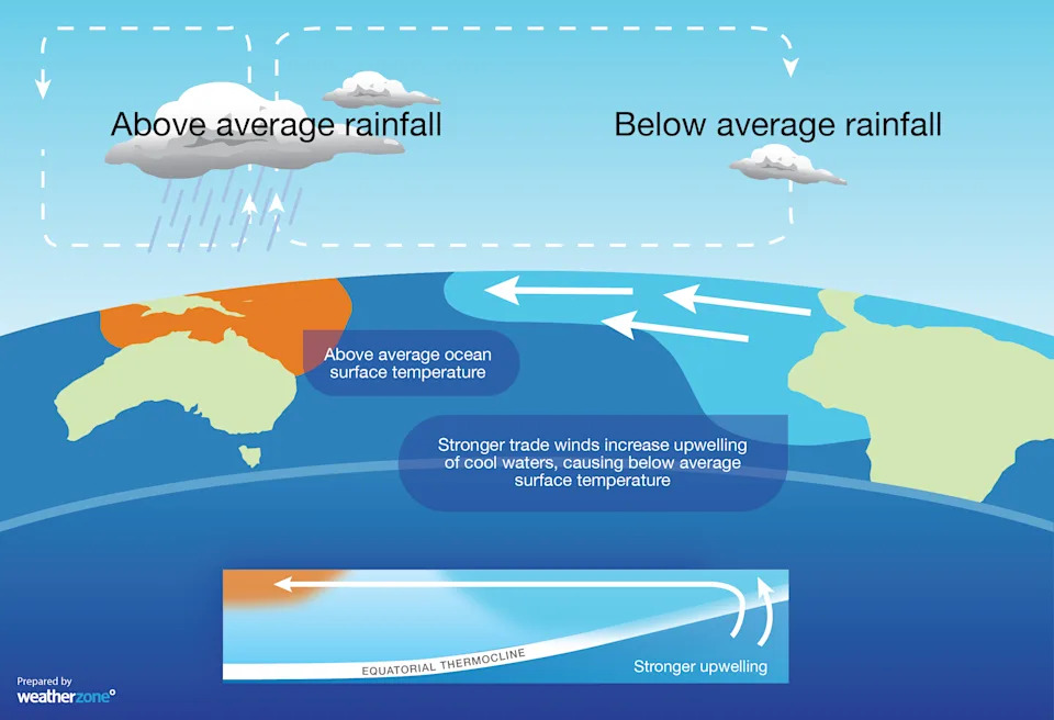
Nearly two months after La Niña was first declared in the United States, Australia’s Bureau of Meteorology has finally confirmed the wet weather system is underway in the Pacific Ocean.
Meteorologists confirmed this week that the weather event, which can bring above-average rainfall, but described the system as “relatively weak”.
In a relief for many Australians, the Bureau expects La Niñato be “short-lived”. In more good news, the Indian Ocean Dipole, which has brought wet weather to Australia, is expected to return to neutral in December.
Nonetheless, the NSW State Emergency Service issued a warning after widespread damage caused by storms across the state. Destructive 120 k/h winds caused significant damage to homes, powerlines and trees/
Since La Niña weather patterns can bring above-average rainfall, Assistant Commissioner Sean Kearns urged people not to become complacent.
“It is important to know your storm and flooding risk, have a plan in place, get your home ready, be aware of what you will do if disaster strikes, and look out for one another,” he said.
“Stay across local warnings and information in your area by downloading the Hazards Near Me app and please steer clear of floodwater. If you encounter a flooded road, turn around and find an alternative route.”

La Nina Source: Weatherzone
What is La Niña?
La Niña is a weather phenomenon that brings cooler ocean temperatures in the Pacific and typically results in increased rainfall and more frequent storms across much of Australia.
It is the counterpart to El Niño, which causes drier conditions.
From 2020 to 2022, Australia experienced consecutive La Niña events — an unusual occurrence known as a “triple-dip” — which led to record-breaking rainfall in many areas, causing widespread flooding, particularly in eastern states like Queensland and New South Wales.
Experts warn that the impacts of La Niña are becoming more pronounced due to climate change, making it crucial to prepare for more intense weather cycles in the future.
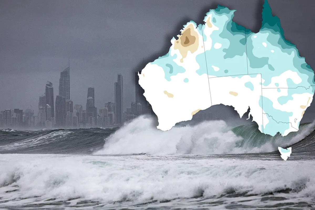
Spring and summer are typically when more storms occur, with the most destructive type — supercell thunderstorms — also more commonly seen in the warmer months.
The threat of more severe conditions has prompted a plea from wildlife rescuers for homeowners to check their homes for fallen hollow-bearing trees following wild storms.

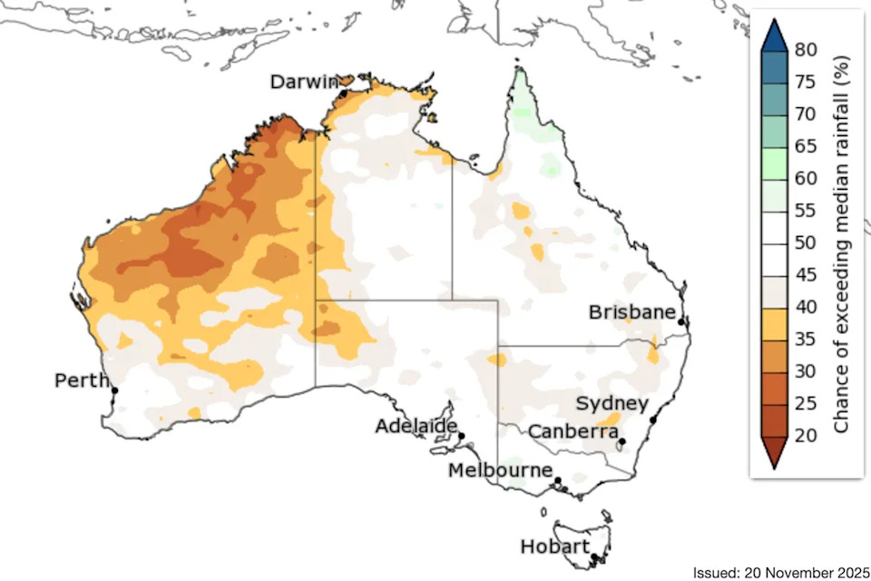
BoM’s three-month rainfall forecast. Source: BoM
2025 summer long-range forecast
The BoM have suggested in its long-range forecast that summer days and nights are likely to be warmer than average across most of Australia.
Queensland
Daytime temperatures are likely to be above average across Queensland. There is an increased chance of unusually warm daytime temperatures for large areas.
At night, there is an increased chance of unusually warm overnight temperatures, especially in the north.
Rainfall is expected to be above average in the far north and below average in the west.
New South Wales and the ACT
Rainfall in December is expected to be below average for NSW and the ACT, but in January and February, there is an equal chance of either above or below average rainfall.
Temperatures are expected to be above average both during the day and night.
Victoria
Warmer-than-usual summer days and nights are likely across Victoria, with an increased chance of unusually high daytime temperatures for much of the state.
The forecast for December currently shows rainfall is likely to be below average in Victoria, and near-equal chances of above or below average rainfall for January and February.
Western Australia
The summer forecast currently shows that rainfall is likely to be below average for large parts of Western Australia. Above, below or near-average rainfall are all possible outcomes for the south.
Summer days and nights are likely to be warmer than usual throughout most of Western Australia.
South Australia
Summer days and nights are likely to be warmer than average throughout South Australia.
The forecast for December currently shows below average rainfall is likely for much of the state.
January and February is showing near-equal chances of above or below average rainfall.
Tasmania
Tasmania is very likely to have warmer than usual summer days and nights.
There is an increased chance of unusually high temperatures for much of the state.
The summer forecast currently shows there are near-equal chances of above or below average rainfall.
Northern Territory
Despite having already experienced a cyclone this season, the forecast for summer currently shows below below-average rainfall is likely throughout the Territory.
It is set to be unusually warm in the Top End, with summer days and nights are very likely to be warmer than usual for much of the Northern Territory.
Do you have a story tip? Email: newsroomau@yahoonews.com.
You can also follow us on Facebook, Instagram, TikTok, Twitter and YouTube.


