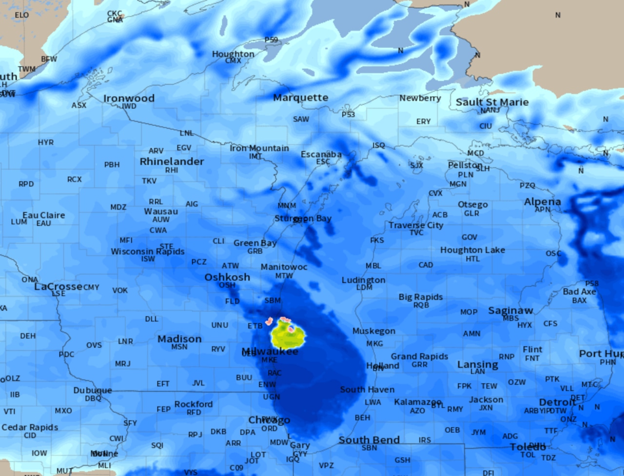
The snowstorm scheduled to develop today is right on target. There are just a couple of small modifications to the overall Michigan snowstorm forecast.
The first addition is winter storm warnings have been also issued for the Sunrise Side shoreline from Saginaw Bay north to Alpena and Rogers City. Part of Mackinac County in Michigan’s Upper Peninsula is also now in the winter storm warning. The Thumb and the eastern part of the Detroit area are under a winter weather advisory, just because snow totals there will be an inch or two less than the rest of the state.
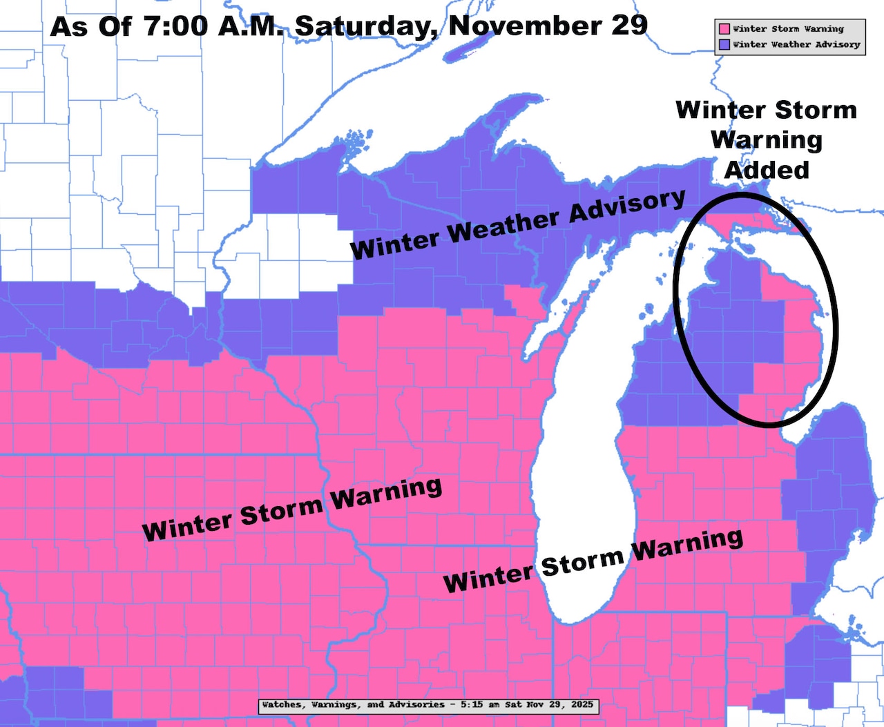 Winter Storm Warnings in pink. Winter Weather Advisories in purpleNOAA
The end times of the winter storm warnings range from 10 a.m. Sunday over central Michigan to 1 p.m. Sunday over eastern Lower. The southwest corner, with several hours of lake-effect snow Sunday afternoon, doesn’t have the warning ending until 7 p.m. Sunday.
The whole look of the storm system has not changed overnight. There is one small tweak in far southeast Michigan, including Ann Arbor and Detroit. The mixed precipitation of snow, sleet, freezing rain and rain expected yesterday is now expected to be mostly all snow. There may be a couple of hours of rain right around sunrise Sunday in the very far southeast part of Michigan, including Monroe and downtown Detroit. This forecast could change back to a larger area of mix. The reason is the track of the low pressure center will be across Ann Arbor and into the Thumb. In most storms, the area just southeast of a storm track has a mixture of precipitation. Watch for that possible flip-flop back to yesterday’s idea. It won’t change the outcome much.
Here is the radar forecast through the life of the storm.
 Radar forecast from 9 a.m. today to 3 p.m. Sunday.NOAA
Here are some key times in the snowstorm. The snow should be light for the first two hours of the snow.
Over eastern and northern Lower Michigan, we have until noon-ish before the snow gets close. Southwest Lower should have snow developing this morning.
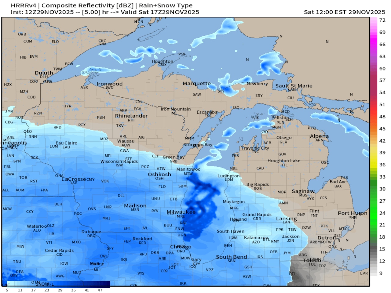 Radar forecast at noon today, November 29NOAA
By 5 p.m. the snow will be falling across most of Lower Michigan. This means the second half of the afternoon is when roads start to get slick over eastern Michigan and north to Cadillac and Traverse City. You will still have a few dry hours in the far northeast corner.
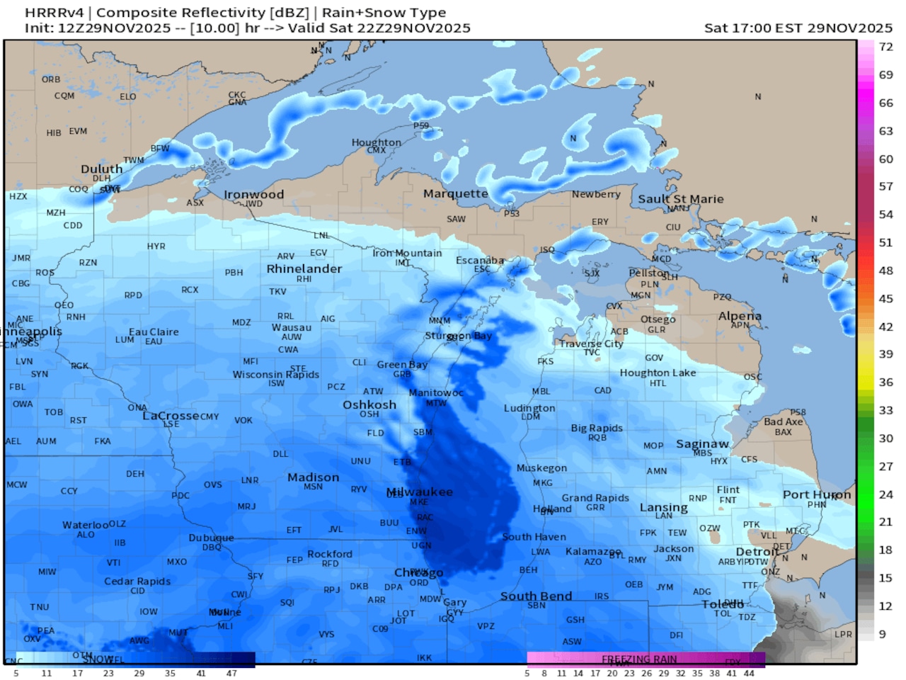 Radar forecast at 5 p.m. today, November 29NOAA
By 8 p.m. tonight, we are all in snow, including most of the U.P. The radar forecast shows the heavier snow will be developing over southern Michigan.
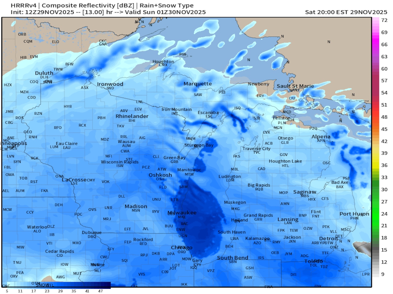 Radar forecast at 8 p.m. today, November 29NOAA
Snowfall forecast amounts have stayed very steady overnight. I still like to call this at four inch to seven inch snow for most. The southwest quarter will have a few inches of lake-effect, so it’s a six inch to 11 inch snow for you, depending on your location.
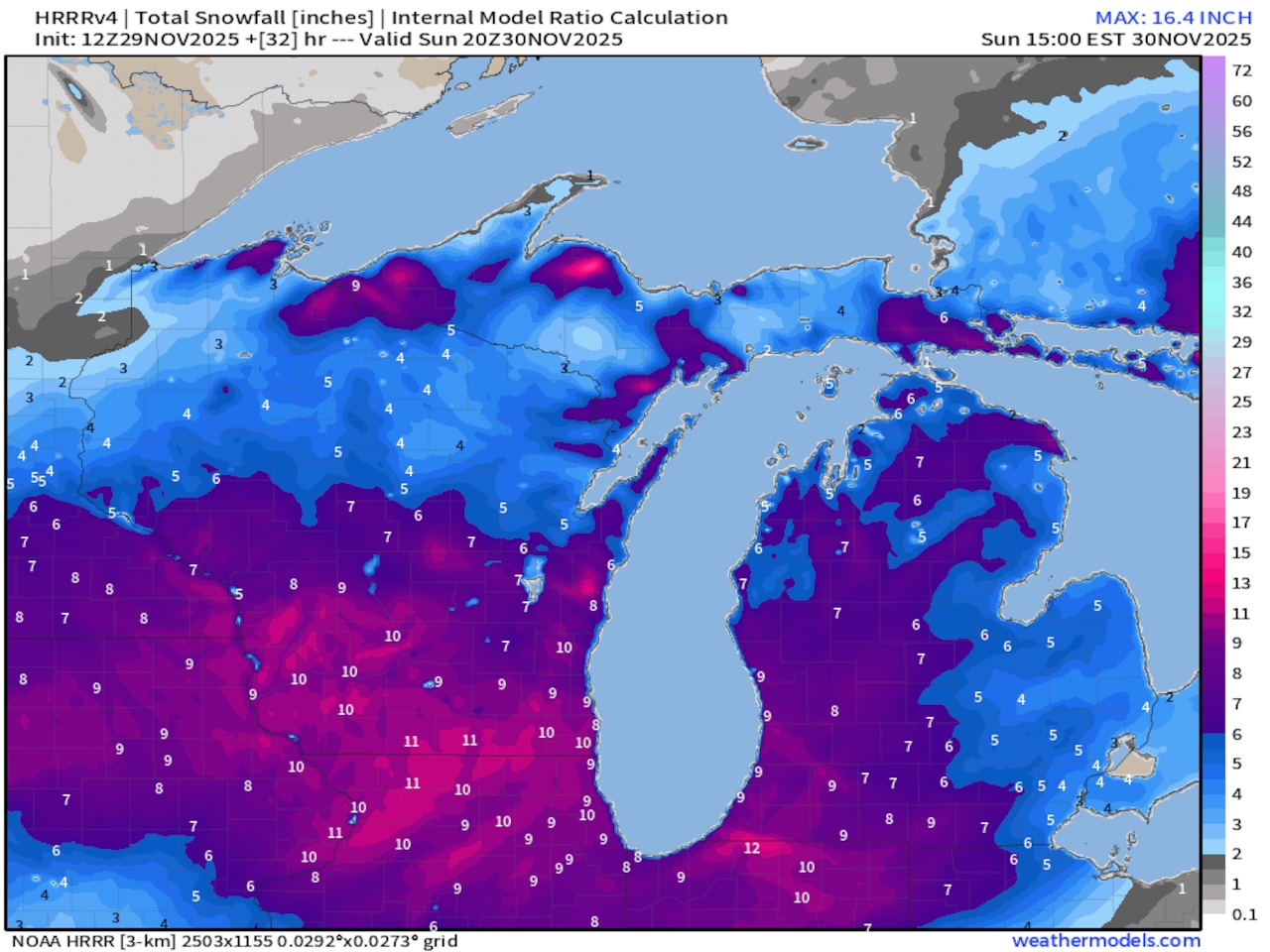 Total snowfall forecast at the end of the snowstorm.NOAA
It’s a pretty easy snowfall idea. The western half of Michigan will have at least six inches to as much as 10 inches. This includes Grand Rapids, Kalamazoo, Battle Creek, Muskegon, and Ludington. The Traverse City area and Cadillac will have five to eight inches of snow.
It’s going to snow just a touch less over eastern Lower Michigan. Let’s call it a four to seven inches, with most of us around five or six inches. This includes Lansing, Jackson, Ann Arbor, Flint, Saginaw, Bay City and Midland.
The Detroit area should expect three to five inches of total snow.
There is a touch of good news Sunday afternoon as the snow ends. Temperatures over the southern half of Michigan may warm to around 33 degrees. Road conditions could improve some in the second half of the afternoon.
The safest ideas are leave this morning or delay returning to Michigan or your home state after 3 p.m. Sunday. The lake-effect snow belt at the south end of Lake Michigan will still have bursts of heavy snow, however.
Stay updated with this snowstorm at MLive.com/weather.

