

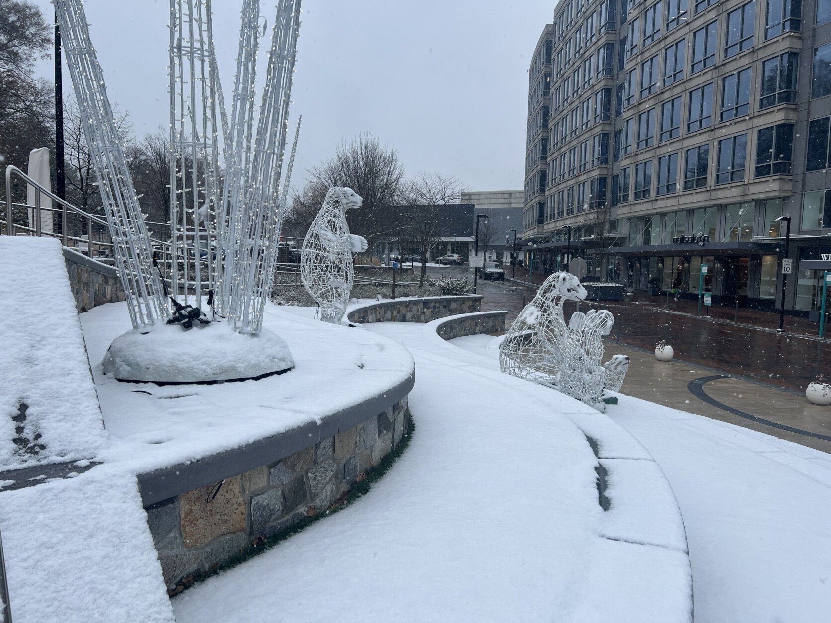
Much of D.C. region was coated in at least an inch of snow Friday morning, marking the first time the D.C. region has seen measurable snowfall in December since 2017.
This page contains a video which is being blocked by your ad blocker.
In order to view the video you must disable your ad blocker.
Snow it goes: DC region sees first snow of the season Friday
Much of the D.C. region was coated in about an inch of snow Friday morning, marking the first time the area has seen measurable snowfall in December since 2017.
That snowfall was enough to impact driving conditions across the D.C. region Friday and prompt many school systems to delay or cancel classes.
There’s another chance for wintry weather Friday night, this time in the form of freezing rain and drizzle. That precipitation could make for icy conditions on sidewalks, bridges and overpasses.
But for the most part, snowfall has come to a close Friday, in the D.C. region’s first winter storm of the season.
Flurries and freezing rain have largely tapered off; some areas may see sunshine peaking through gray cloud cover, according to WTOP Meteorologist Mike Stinneford.
Freezing rain, icy patches could be on the way
The National Weather Service has issued a winter weather advisory for the D.C. area beginning at 7 p.m. and continuing overnight until 1 a.m. Saturday.
Outside the potential for freezing rain, drizzle and fog after dark, wet spots on the roadway from earlier snowfall could refreeze, according to the National Weather Service.
Warnique West, a snow coordinator with the D.C. Department of Public Works, spoke with WTOP while snow was falling Friday morning.
“The hope is that once this storm actually ends, that we’re able to get enough salt on the roadway, along with the wind and a little bit of daylight time, that we’re able to get these streets dry,” West said.
How much snow actually fell?
A surge of cold air overnight brought temperatures into the low 20s and ushered in the first snow of the season early Friday morning — though winter doesn’t technically start for two more weeks.
Some unofficial snow totals from around the D.C. region, according to the National Weather Service:
Fair Oaks, Virginia, 2 inches, as of 12:49 p.m.
Rosslyn, Virginia, 1.7 inches, as of 11 a.m.
Aspen Hill, Maryland, 1.5 inches, as of 12:45 p.m.
American University in D.C., 1.1 inches, as of 11 a.m.
Stafford, Virginia, 3 inches, as of 11:55 a.m.
Reagan National Airport in Virginia, 1.1 inches, as of 10 a.m.
Dulles International Airport in Virginia, 1.1 inches, as of 10:12 a.m.
Laurel, Maryland, 1 inch, as of noon
Waldorf, Maryland, 2 inches, as of 9:35 a.m.
Culpeper County, Virginia, 1.4 inches, as of 10:15 a.m.
The last measurable snowfall in D.C. in the month of December was back in 2017, with 2 inches at Reagan National Airport, according to 7News.
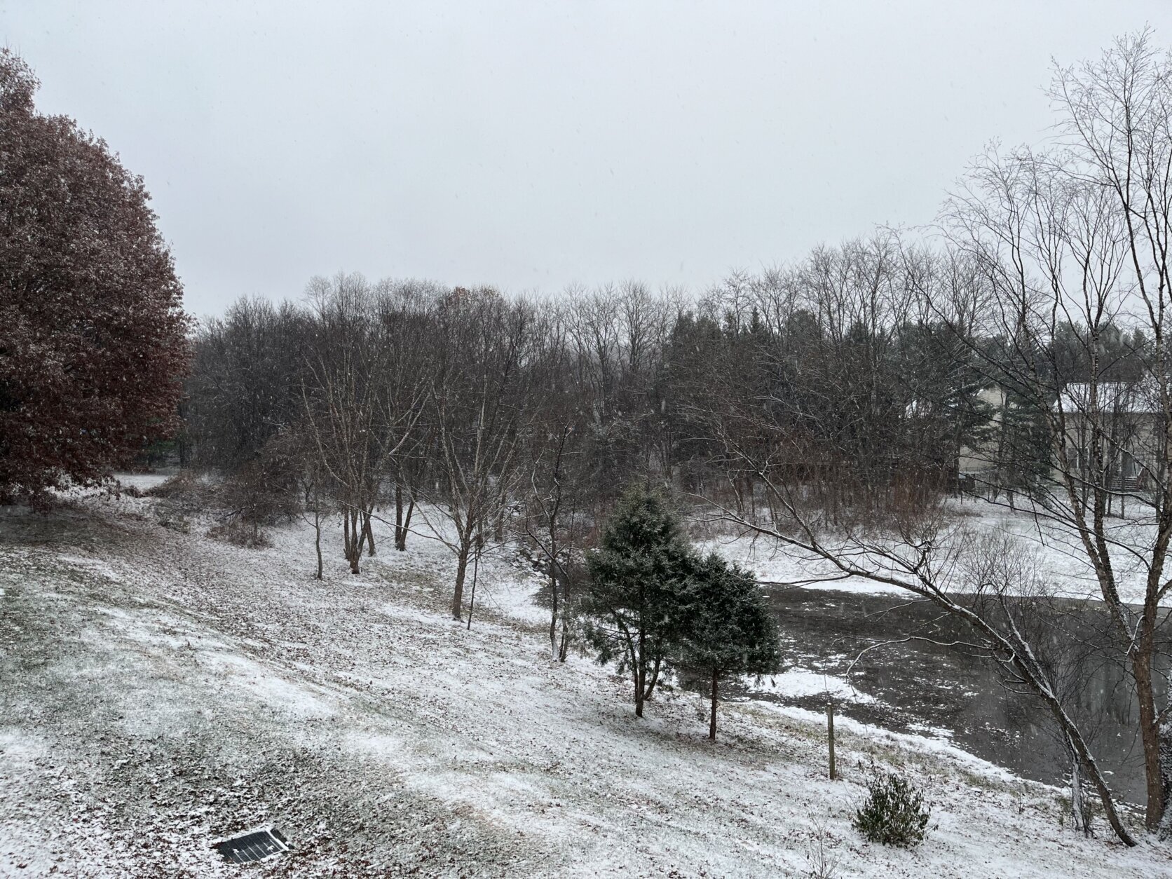
Snowfall accumulations in Montgomery County, Maryland.
(WTOP/Gaby Arancibia)
WTOP/Gaby Arancibia
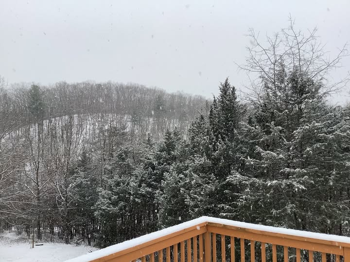
Snowfall continues to pack in Front Royal, Maryland, as the D.C. region sees its first snow appearance in December since 2017.
(WTOP/Mike Stinneford)
WTOP/Mike Stinneford
Snow falls in Bethesda, Maryland, on Dec. 5, 2025.
(WTOP/ Tadi Abedje)
WTOP/ Tadi Abedje
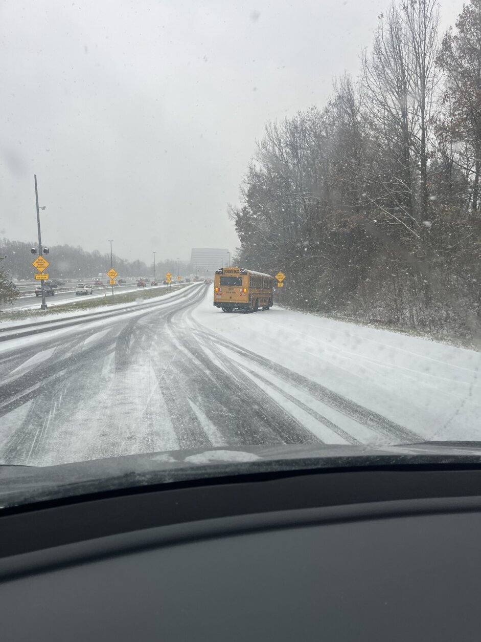
School bus pulled over on Interstate 270 as snow creates traffic jams on both sides of the highway.
(Courtesy Matt Mills)
Courtesy Matt Mills
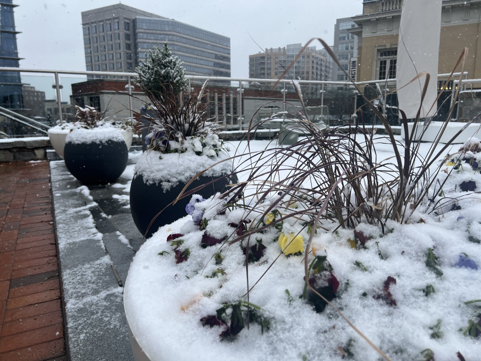
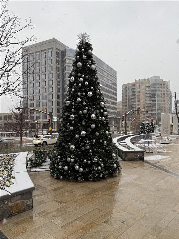
Snow-covered planters in Bethesda, Maryland, on Dec. 5, 2025.
(WTOP/Jessica Kronzer)
WTOP/Jessica Kronzer
A tiered terrace in Bethesda, Maryland, covered in snow during the first snowfall in December in eight years.
(WTOP/Jessica Kronzer)
WTOP/Jessica Kronzer
‘Limit your time on the roads’
Even with preparations throughout the D.C. region, some roadways became slick during the Friday morning commute.
Ahead of the storm, D.C. Mayor Muriel Bowser activated the District Snow Team, which began salting streets on major roadways Thursday night.
“When you see us, give us space, right? Stay back at least six feet,” said West with the D.C. Department of Public Works. “Give the trucks room and time to spread the salt.”
Otherwise, that salt just bounces off your car instead of fully coating the roadway, she said.
“Be safe, drive slow and careful,” West said.
In Maryland, delays were reported Friday morning in both directions of Interstate 270, between Urbana and Rockville, in addition to several crashes, two of which were reported on local roads of the interstate.
“With the snow in the area, you got to keep those speeds down,” WTOP Traffic Reporter Reada Kessler said, adding the conditions of the morning commute were “all over the place.”
In Virginia, where crashes were reported in Fairfax and Prince William counties, officials urged drivers to be cautious as they hit the roads.
Alex Liggitt, communications manager with Virginia’s Department of Transportation, told WTOP that despite pretreatment efforts to major roadways ahead of the snowfall, “there are a fair number of roads out there that have become snow covered.”
“We’re still asking folks, if you don’t need to be out there, just limit your time on the roads, if you can at all. Also drive for the conditions,” he said Friday morning. “We notice a lot of people going just way too fast, even over the speed limit. We do not need that.”
In Virginia, drivers who spot icy roads are asked to report the condition through VDOT’s website.
D.C. residents can call 311 to report icy spots that could use salt, West said.
Looking ahead
Conditions will stay cloudy and overcast throughout the day. Freezing fog and freezing drizzle are expected to develop Friday night.
The sun makes a slight return come Saturday, although the day will be cold as temperatures start in the 20s and hit a high in the low 40s. Anticipate light winds across the region.
Liggitt said officials believe roads should resume normal conditions by Saturday.
According to the National Weather Service, the high pressure moving in will keep the weekend dry and seasonably cool.
FORECAST
FRIDAY: COLD ALERT AND WINTER ALERT
Mostly cloudy after morning snow
Highs: 30-35
Winds: Southeast 5-10 mph
FRIDAY NIGHT: Cloudy and cold with patchy fog
Lows: 22-30
Winds: Light
SATURDAY: Partly to mostly cloudy
Highs: 40-45
Winds: Southwest 5 mph
SUNDAY: Partly to mostly cloudy
Highs: 42-46
Winds: Light and variable
CURRENT CONDITIONS
Get breaking news and daily headlines delivered to your email inbox by signing up here.
© 2025 WTOP. All Rights Reserved. This website is not intended for users located within the European Economic Area.