
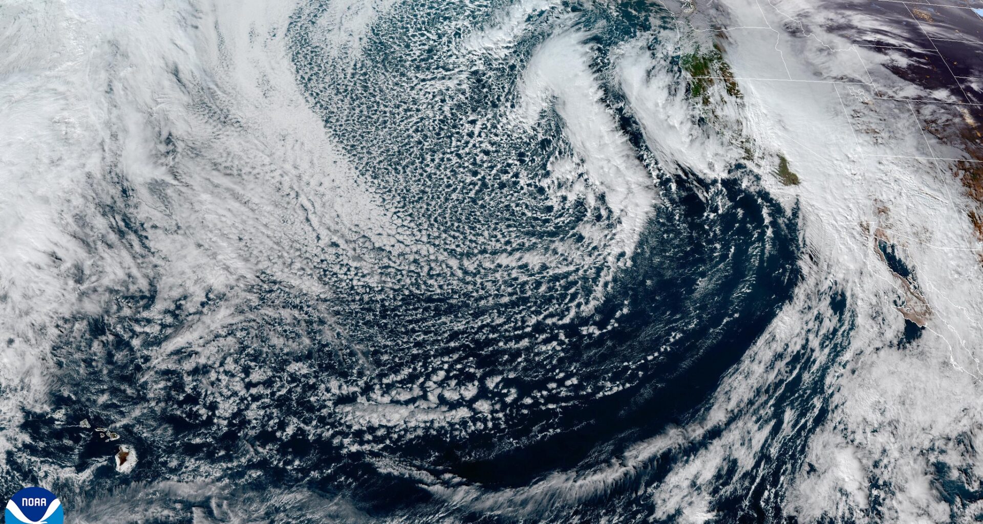
Satellite imagery shows a new storm swirling hundreds of miles off the California coast, with thunderstorms moving toward the Bay Area ahead of it.
CSU/CIRA & NOAA
Forecast confidence is increasing that the Bay Area could see dangerous storms in the early morning hours of Christmas, especially Marin and Sonoma counties.
High-resolution weather models are now in strong agreement that a line of intense storms will approach the Bay Area around 1 and 3 a.m. What is concerning in these forecasts is the structure of these storms. Instead of a solid, messy band of rain, models show storms forming as separate, organized cells. When storms stay spaced apart like this, it doesn’t disrupt the other’s airflow, a setup that allows some storms to rotate.
Rotating storms, known as supercells, are the type most likely to produce brief tornadoes or damaging wind gusts.
Another red flag is coming from Nadocast, an experimental AI-based forecasting tool designed to flag tornado-favorable environments. The model is highlighting parts of the North Bay as an area of elevated risk in the early morning Christmas hours.
Article continues below this ad
Moderate to heavy showers were also predicted to arrive in San Francisco between 7 p.m. and 9 p.m. The heaviest showers could cause roadway flooding. Wind gusts of 35 to 45 mph will accompany the rain, with crossbreezes on the Bay Bridge and Richmond-San Rafael Bridge making driving difficult. Wind and rain should move toward Berkeley and Oakland by 10 p.m. A few lightning strikes are also possible.
More extreme rain and wind is predicted around midnight. Storm cells could whip up 65-mph gusts, rainfall rates up to an inch per hour and a low-end tornado threat.
Weather models predict increasing showers Wednesday evening in the Bay Area. Some of those showers could contain thunder and lightning. There is a low chance of waterspouts or tornadoes from 11 p.m. Wednesday to 5 a.m. Thursday.
Baron Lynx
Overall, rain and wind intensity is forecast to be on par with Tuesday night’s storm, but waves of showers and thunderstorms lasting through Christmas Day could compound impacts.
San Francisco Chronicle Logo
Make us a Preferred Source to get more of our news when you search.
Add Preferred Source
“It’s a totally separate system, but it’s going to feel almost identical,” said Dylan Flynn, a meteorologist at the National Weather Service. “The stormy conditions are definitely gonna peak overnight, but they’re gonna linger through (Christmas Day) as well.”
Article continues below this ad
Wind is the biggest threat, according to Flynn.
A high wind warning is in effect for coastal areas, including San Francisco, for southerly gusts up to 65 mph from 8 p.m. Wednesday to 10 a.m. Thursday. Gusts up to 55 mph are predicted inland, where a wind advisory is in effect for the same time, including Oakland and San Jose.
High wind warnings and wind advisories are in effect across the Bay Area until 10 a.m. Christmas Day. Wind gusts could exceed 60 mph in coastal areas.
Baron/Lynx
Tornadoes are Flynn’s second biggest concern.
“Try to get your phone charged so if we have any of those severe thunderstorms or possible tornadoes, we’ll be able to give you a heads up and make sure it’s in the bedroom with you as well,” Flynn said.
Article continues below this ad
The tornado risk is greatest along the immediate coast from about 11 p.m. Wednesday to 5 a.m. Thursday, including in San Francisco and other cities from Point Arena to Monterey.
“The parameters severe weather meteorologists use to assess risk for severe weather are in values that are high for this area,” said John Monteverdi, a meteorologist and professor emeritus at San Francisco State University.
While the Bay Area may experience at least one tornado from Wednesday night through Thursday, the overall risk is low for any given point. Flooding from heavy rain and fallen trees from non-tornadic winds present a greater risk for most people.
Heavy rain could also cause urban flooding and trigger landslides, but wind is a bigger threat from the storm, according to Flynn.
“Fortunately, with the wind speeds as high as they are, the (rain) should be clearing out pretty fast over a certain area,” Flynn said. “But if you get a couple of (thunderstorms) in a row, that could lead to some local flooding issues.”
Article continues below this ad
Many Bay Area residents awoke to blue skies Wednesday after a stormy night, as wind speeds eclipsed 60 mph along the coast. Storms are likely to peak overnight again into early Thursday, but Flynn said rounds of heavy rain and strong winds will linger Christmas Day.
“If you slept through it, congratulations, you sleep better than most people,” Flynn said. “It was a legit storm that came through last night, especially along the coast. We’re gonna be dealing with that again tonight. So, be prepared.”