
A prolonged winter weather system is expected to impact Israel for several days, arriving in waves. Beginning Saturday, rainfall will return with a renewed focus on the coastal plain, from Tel Aviv southward.
On Sunday and Monday, rain is also forecast in the north, alongside significant snowfall on Mount Hermon. Accumulations in higher elevations could reach up to half a meter. Speaking with the ynet studio, Dr. Amir Givati of the Israel Meteorological Service explained why rainfall this year has concentrated in southern regions, outlined the main hazards ahead, and issued public recommendations.
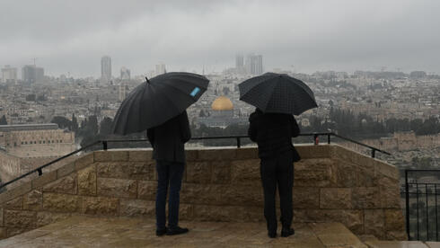
3 View gallery
")
Jerusalem
(Photo: Mahmoud Illean/ AP)
The upcoming system, Dr. Givati said, will consist of several waves. The first is expected to reach central Israel by Saturday afternoon. A subsequent wave is likely to cause flooding along the southern coast and in the Negev. On Monday, another major wave is forecast, bringing heavy rain to central areas from Ashdod to Jerusalem.
According to Dr. Givati, Sunday poses the greatest danger, particularly in southern Israel.
He urged the public to avoid hiking in streambeds starting Saturday, noting that as with previous systems, emergency rescues may be required in flooded areas. “Roads could be closed on Sunday due to flooding or blocked access to communities. There is no recommendation to stay home or avoid work, but it is essential to follow instructions from authorities at both the local and national levels,” he said.
Despite the system’s southern focus, Mount Hermon is expected to receive what Dr. Givati described as “a very generous amount of snow,” both in newly opened areas and traditional zones near the lower and upper cable cars. He said conditions may allow the ski site to open, calling it welcome news.
Temperatures in the coming days will be colder than during recent systems, though still short of the true cold typical of January and February. Winds will intensify, becoming strong on Sunday and especially Monday. “These will be consecutive winter days. That is why we define this as an event with extreme characteristics, due to its duration and large rainfall totals,” he explained.
3 View gallery

Netanya earlier this week
Rainfall patterns this year diverge sharply from past expectations. In northern Israel, typically the rainiest region, only about 50 percent of the seasonal average had fallen by the end of December. In contrast, southern Israel has already reached its average rainfall.
Dr. Givati said this trend, while more pronounced this year, has persisted for roughly three decades. As part of global climate change, warming temperatures heat the Mediterranean Sea, causing warmer regions to receive heavier rain in shorter, more intense bursts.
The system’s core impact will continue to center on southern Israel. Beersheba, the western Negev, and communities near the Gaza border face a high risk of flooding, Dr. Givati said. The peak of the system, though not classified as a storm, is expected Sunday, with extreme rainfall episodes from Saturday through Monday. Precipitation totals could reach up to 100 millimeters.
Overnight conditions will range from clear to partly cloudy, with possible light drizzle along the coastal plain toward morning. Temperatures are expected to dip slightly. Light rain or drizzle may affect northern Israel and the coast during the day, spreading into central regions and intensifying by evening.
3 View gallery
")
Floods after heavy rain
(Photo: Ayalon El-Hai)
Saturday is forecast to bring intermittent rain across the north and central regions, accompanied by isolated thunderstorms. Local rain is possible in the northern Negev. Westerly winds will strengthen, with a further drop in temperatures, particularly in mountainous and inland areas. By evening and overnight, rainfall is expected to intensify, raising concerns of flash floods in Judean Desert and Dead Sea streams, along with flooding along the southern coast.
On Sunday, intermittent rain with isolated thunderstorms is expected from northern Israel to the northern Negev, accompanied by strong westerly winds. Flood risks will persist in eastern streams and along the coastal plain. Rain is forecast to weaken gradually by midday. Snow will fall on Mount Hermon.
Rainfall is expected to intensify again on Monday, with flooding possible in northern streams, followed by renewed flash flood risks in the Judean Desert and Dead Sea region.
The most intense rainfall is forecast in the Ashkelon area, the Gaza border region, and the western and northern Negev. These areas face urban flooding and flash floods, with cumulative rainfall totals of 80 to 100 millimeters expected by Monday.
Following this system, many parts of central and southern Israel are projected to exceed the multi-year rainfall average for this period through December. In contrast, northern regions such as the Golan Heights and Upper Galilee remain at only 50 to 60 percent of the seasonal average, reflecting a severe rainfall deficit.