

While monthly rainfall averages across the south in December stay around 40-50 mm, we could see 50+ mm of rain locally north of Lake Erie, including the Grand River watershed, in a 12-hour period.
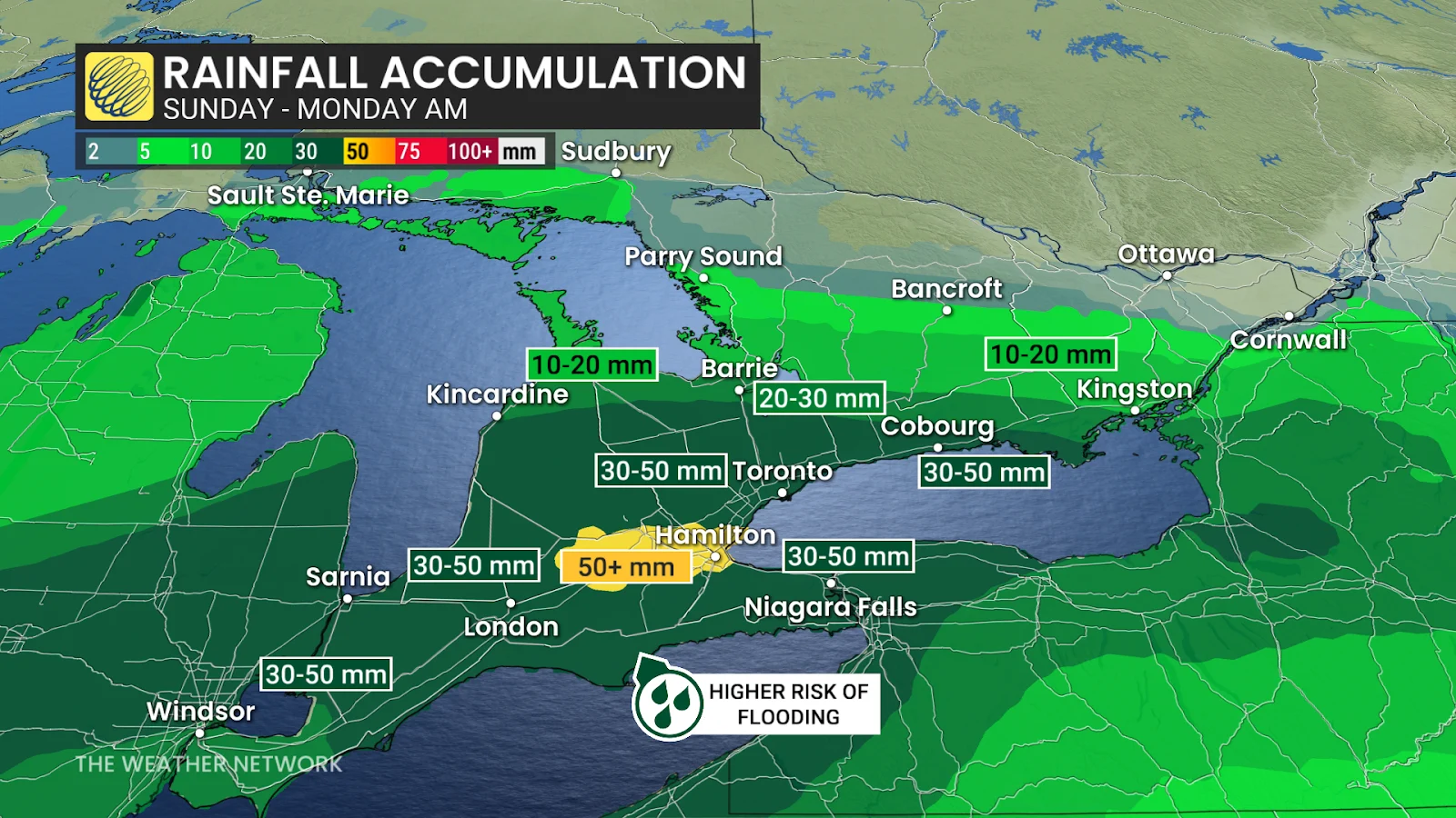
However, due to recent cold temperatures, the ground across much of the region is frozen, which will significantly limit the amount of rainfall absorbed into the ground and increase the risk of flooding.
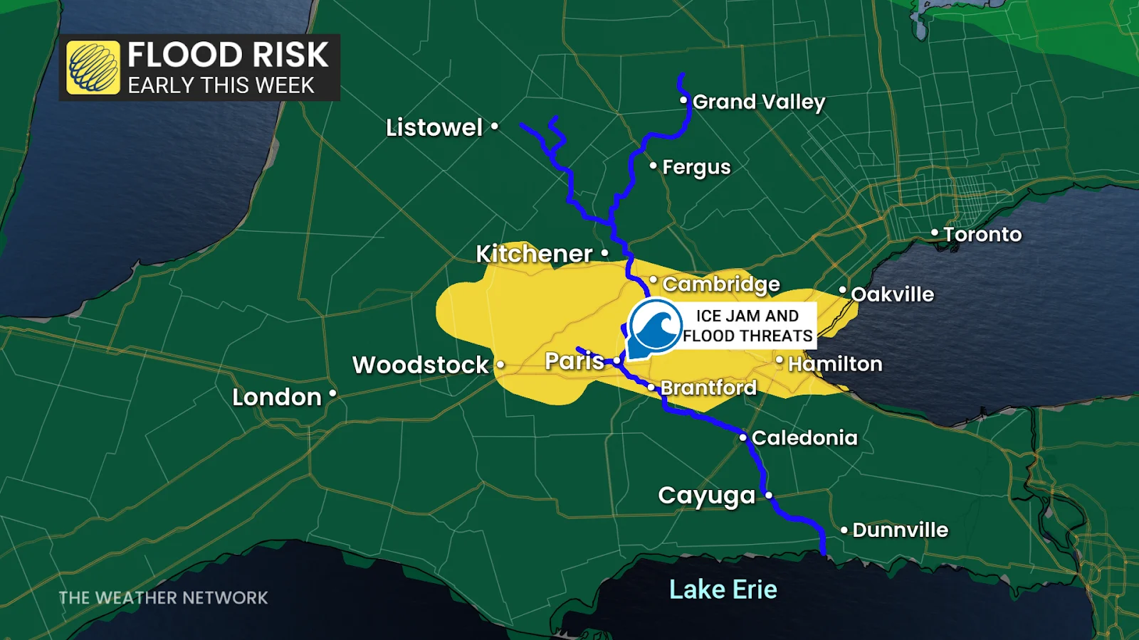
Along the Humber River watershed, we’re looking at the threat of ice jams due to repeated freeze-thaw cycles, increasing the risk of damaging floods.
Thunderstorms are also possible in southwestern Ontario as some instability inches into the region late Sunday through the pre-dawn hours Monday.
 Damaging winds, flash freeze risk builds Monday and Tuesday
After Sunday night’s rainfall across southern Ontario, we will see a rush of cold air move into the region on Monday. Communities in and around Hamilton and Niagara could see temperatures drop by as much as 10°C in just one to two hours.
This is a red flag signalling the risk of a flash freeze late Monday morning as the ponding water on the ground suddenly freezes up and forms a layer of slick ice.