
Published on Dec. 29, 2025, 11:54 AM
Updated on Dec. 29, 2025, 7:24 PM
Icy hazards will transition over to powerful winds and snow squalls through Monday, increasing the risk of power outages across southern Ontario
Major impacts are occurring across Ontario as another, powerful low-pressure system traverses the province with an entire assortment of hazardous conditions.
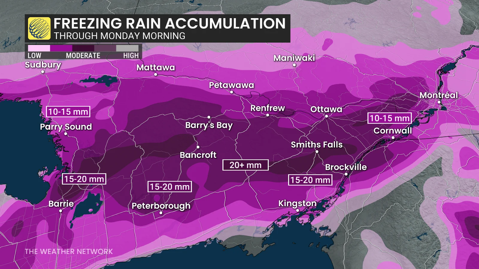
Warm air aloft provided plenty of freezing rain to southern and eastern Ontario through the day Sunday and early Monday, coating surfaces, trees, and power lines with a weighty crust of ice.
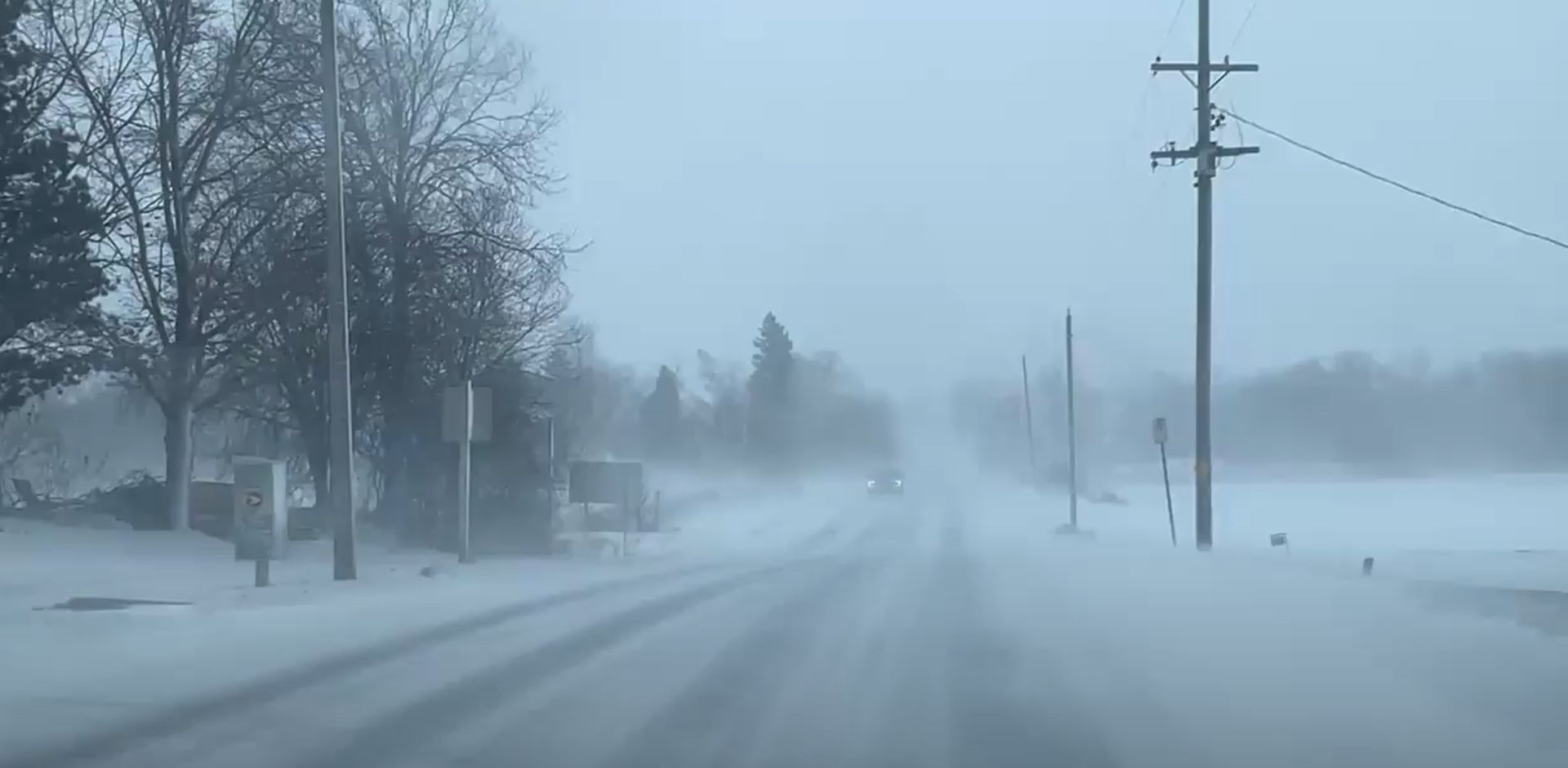
Meanwhile, northeastern Ontario has been battling against blizzard conditions, which have resulted in highways closures in and near locales such as Wawa, Sault Ste. Marie, Chapleau, and the Timmins area.
The threats don’t end there. Powerful winds and dangerous snow squalls are building in parts of southern Ontario, threatening more power outages and road closures.
RELATED: Treacherous road conditions in Ontario, travel not advised
Over 45,000 customers are without power in Ontario as of early Monday morning due to the icy weather and gusty winds.
Blizzard conditions continue in the northeast
Strong winds and heavy snow over northeastern Ontario are forecast to continue bringing whiteout conditions across the region through Monday afternoon. Portions of Highways 11, 17, 129, 144, and 101 have been closed due to the weather. These closures include cutting off highway access in and out of Wawa and Chapleau as of early Monday morning.