

Published on Jan. 16, 2026, 1:54 AM
The active pattern responsible for this week’s snowstorm will continue straight through the weekend
Folks who love the cold and snow are in for a real treat with Ontario’s forecast into next week.
Fresh off the snowstorm that blanketed the region into the day Thursday, we’re looking at several more opportunities for snow moving into southern Ontario as cold Arctic air surges into the region.
DON’T MISS: What is wind chill and why does it ‘feel’ so miserable?
More snow arrives Friday
Thursday saw widespread snowfall totals ranging from 20-25+ cm throughout the Greater Toronto and Hamilton Area, prompting school and road closures throughout the area.
Don’t put away the snow brushes just yet.
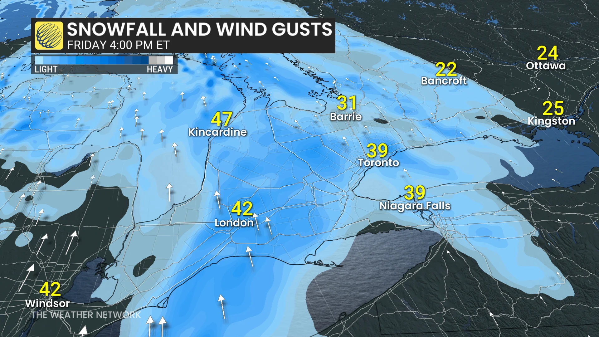
A weak system from the Prairies moving in on Friday will produce additional widespread snow through the late afternoon and evening hours.
While accumulations will be rather light, on the order of 3-5 cm, wind gusts of 40-50 km/h will lead to blowing snow. Drivers should use caution and prepare for reduced visibility at times.