
Several cities face snow before the end of January as advanced weather maps reveal blizzards bringing four inches per hour could strike in an Arctic blast lasting five days
12:15, 16 Jan 2026Updated 12:23, 16 Jan 2026
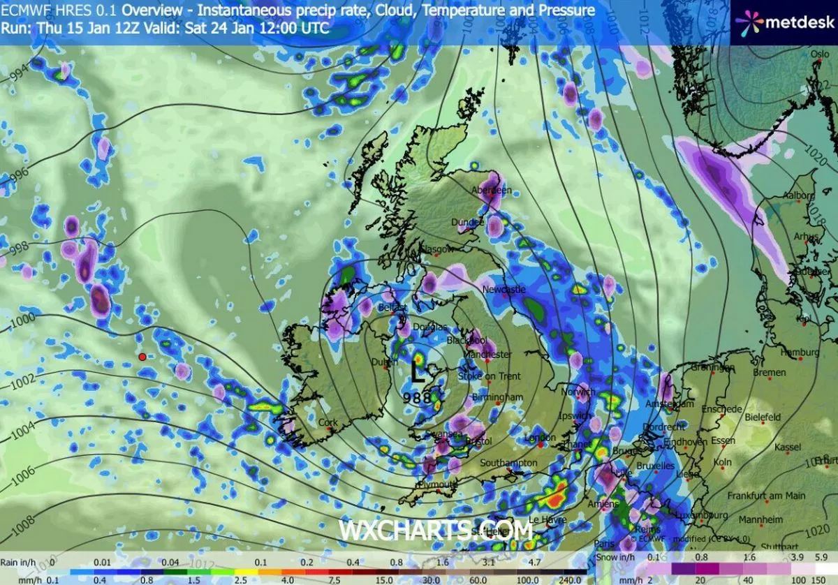
Snow (in purple) falling at midday on January 23(Image: WXCHARTS)
Snow looks to be just days away from returning to the UK as advanced weather maps show four inch per hour flurries are on the cards.
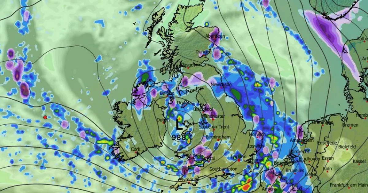
The ECMWF weather model suggests scattered snow could hit the UK on January 23, landing in parts of Northern Ireland, Wales, the north of England and Scotland at around midday. The most intense flurries should hit Scotland initially, with Glasgow in the firing line.
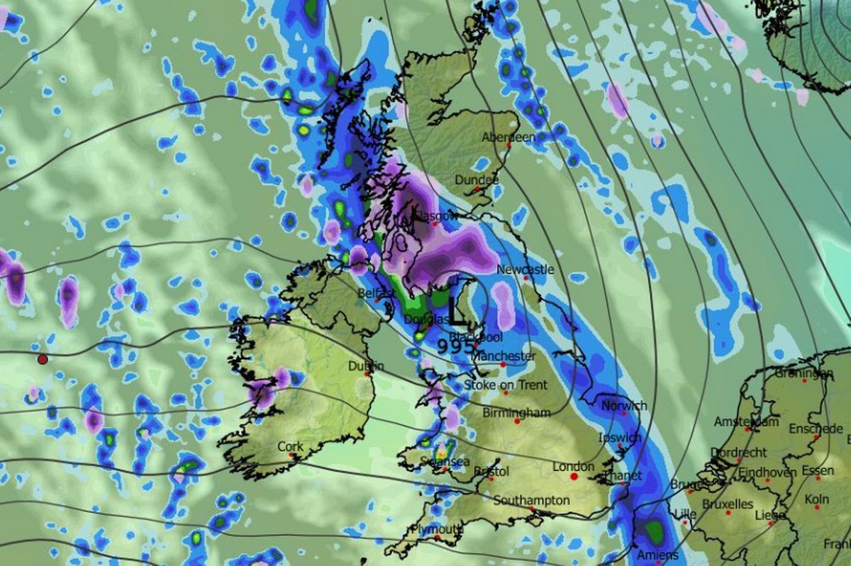
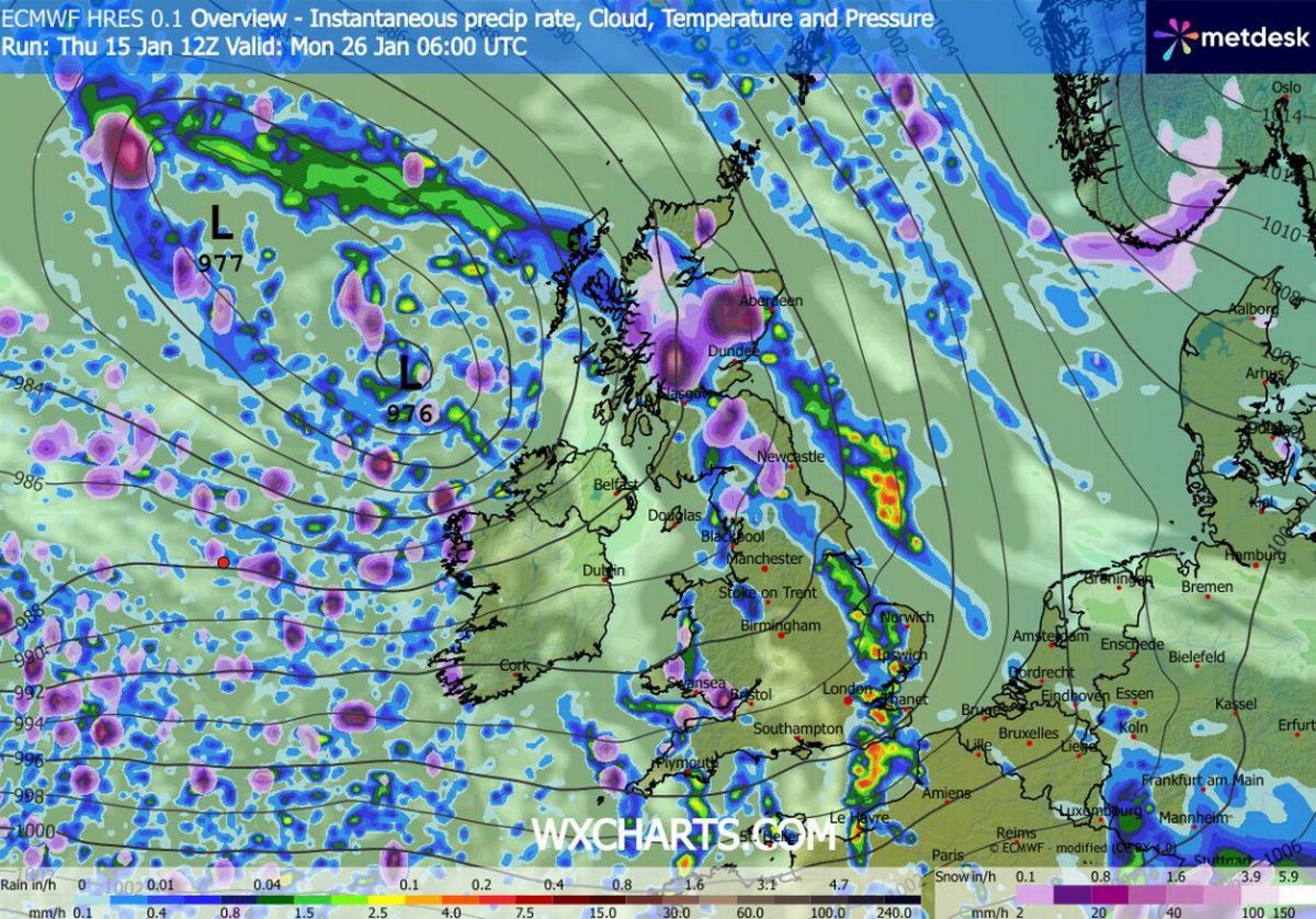
Maps then show snow showers impacting the UK for five consecutive days. Data for midday on January 24 shows Bristol could see snow as the wintry weather impacts the south-west and Wales. Manchester and Aberdeen could also see some around this time as flurries continue in the north and in Scotland.
More snow is expected on January 24(Image: WXCHARTS)
READ MORE: Snow forecast as ‘Scandinavian system’ could bury one huge region in deep freezeREAD MORE: Snow maps reveal blizzard will bury UK cities and bring 31 inches over 24 hours
This scattered pattern is also expected on January 25, but on January 26 the maps suggest heavy snow will become more concentrated in Scotland and South Wales, where it could fall at a staggering rate of around four inches per hour at 6am.
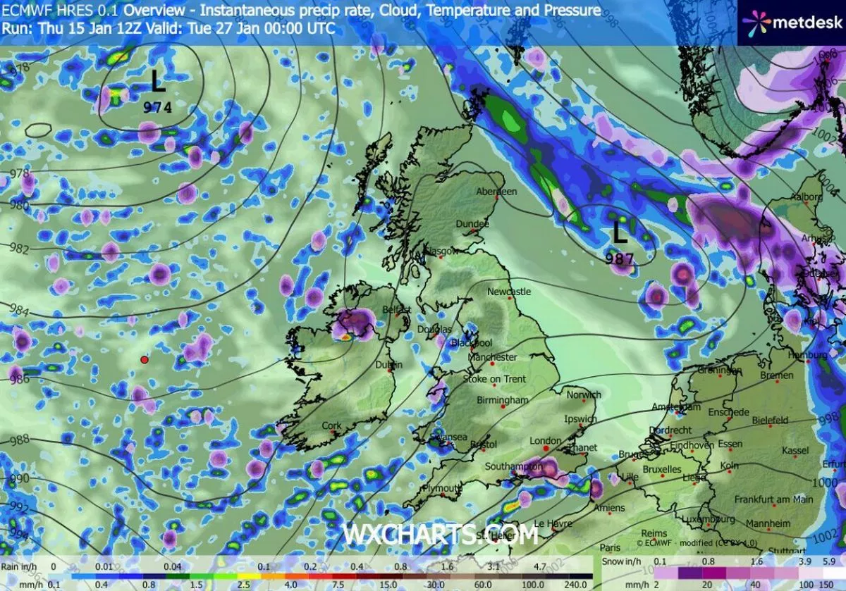
On January 27, the maps show another small yet powerful snow front bringing four inches per hour to southern England – with Brighton seemingly set to see some of the white stuff.
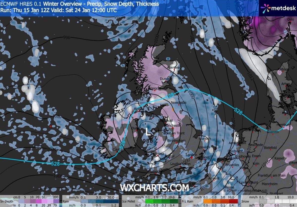
Snow coverage (in purple) on January 24(Image: WXCHARTS)
READ MORE: Met Office urges Brits in 11 areas to do one thing before getting in their cars
And snow coverage maps for this five-day period reveal the full extent of the wintry weather blast. On January 24, they show snow settled on the ground in Wales, central and northern England, Northern Ireland and most of Scotland.
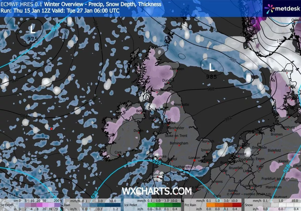
Snow is also seen on the ground in maps for January 27, hitting Brighton and Southampton on the south coast as well as northern regions and Wales. Thankfully, outside of the Scottish Highlands where 32cm could settle, the data suggests snow accumulations won’t be massive. The Lake District could see 9cm, but low-lying regions elsewhere will likely only see 1cm or 2cm actually settle on the ground.
Heavy snow is on the cards in Scotland on January 26(Image: WXCHARTS)
READ MORE: UK snow maps show huge blizzard in cities including London and Birmingham next week
The Met Office also suggests more snow could fall before the end of this month. Its forecast for January 20 to 29 states: “Throughout this period, the UK will see a battle between Atlantic weather systems attempting to arrive from the west while high pressure and colder conditions attempt to exert some influence from the east. Initially, milder Atlantic air is expected to dominate.
Snow could hit the south coast on January 27(Image: WXCHARTS)
“This should maintain often cloudy, changeable conditions with showers or longer spells of rain for most. The wettest weather in western parts of the country, drier in the east.
“Temperatures overall likely to be around average with some night frosts in clearer areas. Later in the period, there is an increased chance that conditions will turn colder. This aspect of the forecast is still somewhat uncertain but the potential transition to colder weather also increases the chance of snow across parts of the country.”
Snow coverage on January 27(Image: WXCHARTS)
This follows Storm Goretti, a ‘multi-hazard’ event which brought 99mph winds and as much as 27cm of snow to parts of the UK – even prompting a red weather warning – earlier this month.