

The Bruce Peninsula and the shores of Georgian Bay will also see a sustained snowsquall drape across the region, potentially producing up to 30 cm of accumulation in spots.
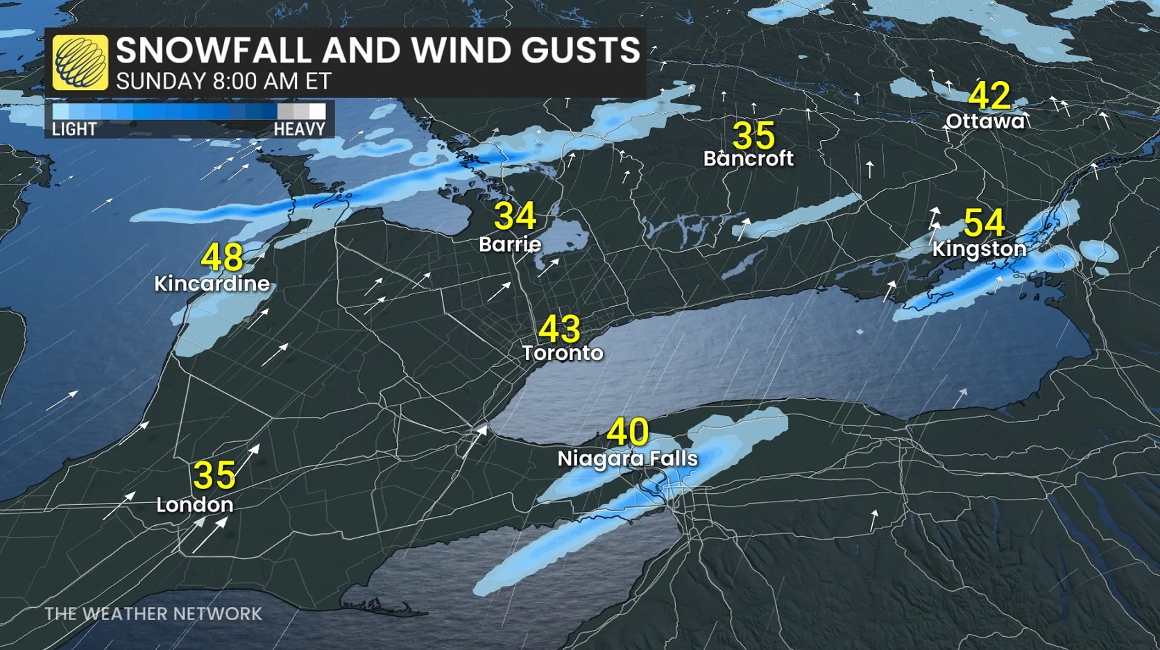
Another band of lake-effect snow will spread over the north shore of Lake Erie toward Niagara Falls and Welland, where localized totals of 10-20 cm are possible.
By Monday evening, more traditional bands of lake-effect snow will develop as west-northwesterly winds sweep across the snowbelt communities.
Dangerously cold temperatures likely next weekend
A slug of truly frigid air is likely to arrive in the Great Lakes region by next weekend.
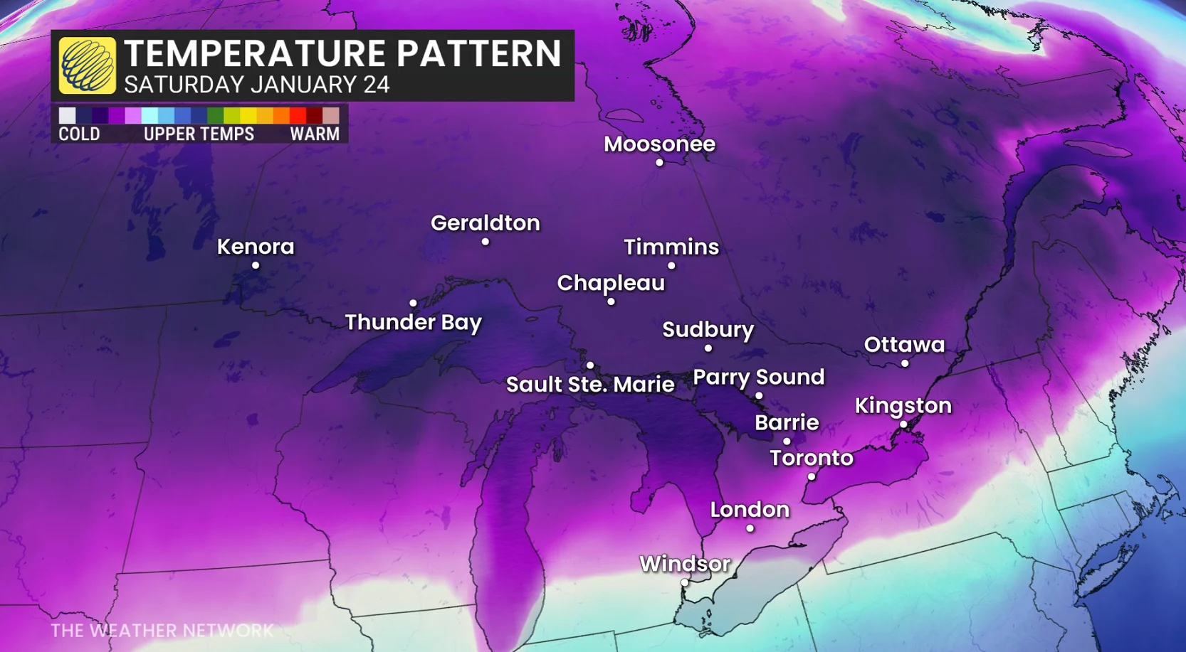
Daytime highs could struggle to warm past the minus teens on Saturday for much of Ontario. Temperatures are likely to remain below seasonal for the remainder of January.
How cold could it get? Temperatures may reach -40°C for pockets of northern Ontario during the worst of the cold snap, with widespread temperatures as low as -30°C in northeastern Ontario.
WATCH: This is what you should have in your emergency kit this winter