

The Met Office has dismissed media reports of a “Beast from the East” bringing a “656-mile snow wall” to the UK by the end of January.
Citing data from WXCharts, some reports claim a huge band of snow expected to pass over Bulgaria and Hungary on 30 January will reach the UK by 6am the following morning.
This would mean most of the UK would wake up to heavy snow on 31 January, with temperatures dropping to -5C in some parts of the country, according to these projections.
However, the Met Office has suggested such a dramatic cold spell is not likely and that it is far too early to make such a prediction.
“While it does look increasingly likely that conditions will turn more widely colder into next week, the timing and extent of this colder air remains uncertain,” said Met Office deputy chief forecaster Steven Keates.
“There are variations between the different weather models, and although a few show very low temperature values, this is currently the minority.”
Will there be another Beast from the East cold snap in the UK?
Based on the Met Office’s current outlook, a Beast from the East weather pattern such as the one that swept the UK in February 2018 does not appear to be on the cards.
That event was associated with “a rare combination of a Sudden Stratospheric Warming (SSW) high in the atmosphere and a strong blocking high‑pressure pattern over Scandinavia that drew extremely cold air from Siberia”, which are “conditions that do not occur every winter,” the Met Office told Yahoo News.
A spokesperson for the forecaster said: “Although cold spells and easterly outbreaks like those seen in 2018 can still occur due to natural weather variability, the overall trend in the UK climate is toward warmer winters with fewer and less intense extreme cold events.
“Severe events with widespread impacts like the 2018 ‘Beast from the East’ remain possible, but are likely to occur less often.”

Much of the UK saw harsher wintry conditions in the first two weeks of January, but the outlook ahead appears uncertain. (Getty Images)
(DARREN STAPLES via Getty Images)
While the majority of weather models “indicate below-average temperatures from the east”, according to the Met Office, they are showing “nothing too extreme at the moment”.
As we enter this weekend, the forecaster says there will be a “battle” between an Atlantic weather system attempting to push in wet and windy weather from the west, and high pressure bringing colder and drier conditions from the east.
Milder Atlantic air is “expected to dominate for most parts” at the start of next week, the Met Office says, with “showers or longer spells of rain and temperatures around or a little above average”.
The exception to this is in the far northeast of the UK, where it is likely to be colder from this weekend onwards with some sleet or snow.
However, the Met Office has made no mention of snow on a mass scale, as one would expect if a so-called Beast from the East was on its way.
As we get closer to 1 February, the forecaster says there is an “increased chance that conditions will turn more widely colder and drier” with a higher chance of snow in some parts, although this is “still somewhat uncertain”.
The Met Office’s long-range forecast for 2-16 February says low pressure to the west or southwest and high pressure to the northeast “brings an increased chance of cold conditions affecting the UK, and the associated risk of wintry hazards at times”.
“Deeper into February, whilst confidence is naturally low, there may be a transition to more widely unsettled conditions and a corresponding recovery in temperature back closer to average,” it says.
What is a Beast from the East weather pattern?
The term Beast from the East is used to describe “cold and wintry conditions in the UK as a result of a polar continental air mass”, the Met Office said.
“When pressure is high over Scandinavia, the UK tends to experience a polar continental air mass,” it added.
“When this happens in winter, cold air is drawn in from the Eurasian landmass, bringing the cold and wintry conditions that give rise to the ‘Beast from the East’ moniker.”
The flashy media term made headlines in February 2018 as the UK and much of Europe was gripped by a lengthy cold snap, with heavy snow pushing in from the east as Anticyclone Hartmut hit the British Isles.
By 27 February, temperatures dropped to -11.7C overnight, with many areas remaining below freezing all day, the BBC reported.
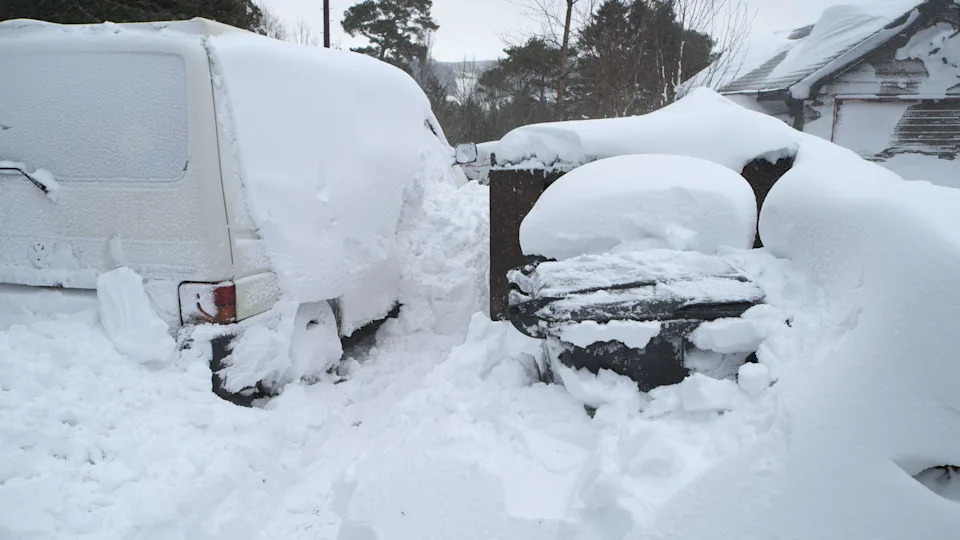
A van in Kielder Water, Northumberland, left caked in snow during the Beast from the East of February 2018. (Alamy)
(Leslie Garland / LGPL, Leslie Garland Pictures)
The quality of this cold air flowing in from the east depends on the length of sea it passes over during its passage from Europe, the Met Office said.
“The air is inherently very cold and dry and if it reaches southern Britain, with a short sea track over the English Channel, the weather is characterised by clear skies and severe frost.
“With a longer sea track over the North Sea, the air becomes unstable and moisture is added, giving rise to showers of rain or snow, especially near the east coast of Britain.”
The Met Office says that polar continental air “only reaches Britain between November and April”, adding that at other times of the year winds from northeastern Europe “bring a form of tropical continental air”.