
The Met Office has urged Brits living in nine areas to consider preparing an ’emergency’ kit as a 48-hour ‘danger to life’ weather warning has been issued
17:34, 19 Jan 2026Updated 17:42, 19 Jan 2026
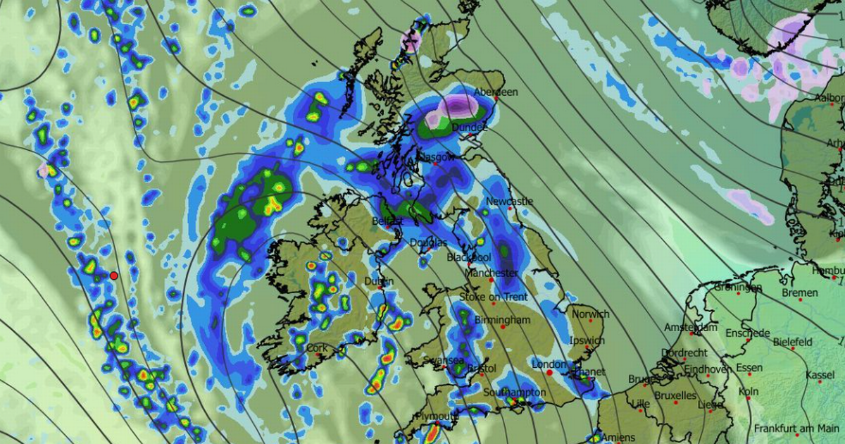
Heavy rain is expected in places this week (map here for Thursday)(Image: WXCHARTS)
Brits have been urged to prepare emergency kits as a yellow weather warning has been issued for rain.
Weather experts at the Met Office warn of a “small chance of fast flowing or deep floodwater causing danger to life”. Some homes and businesses could be flooded in north-east Scotland, with possible damage to buildings, the weather service warned.
“Persistent and heavy rain over hills later Wednesday and through Thursday and Friday may lead to some flooding,” the Met Office said. The warning is in place from 12pm on Wednesday, until the same time on Friday. Residents in affected areas should consider preparing a flood plan and emergency flood kit.
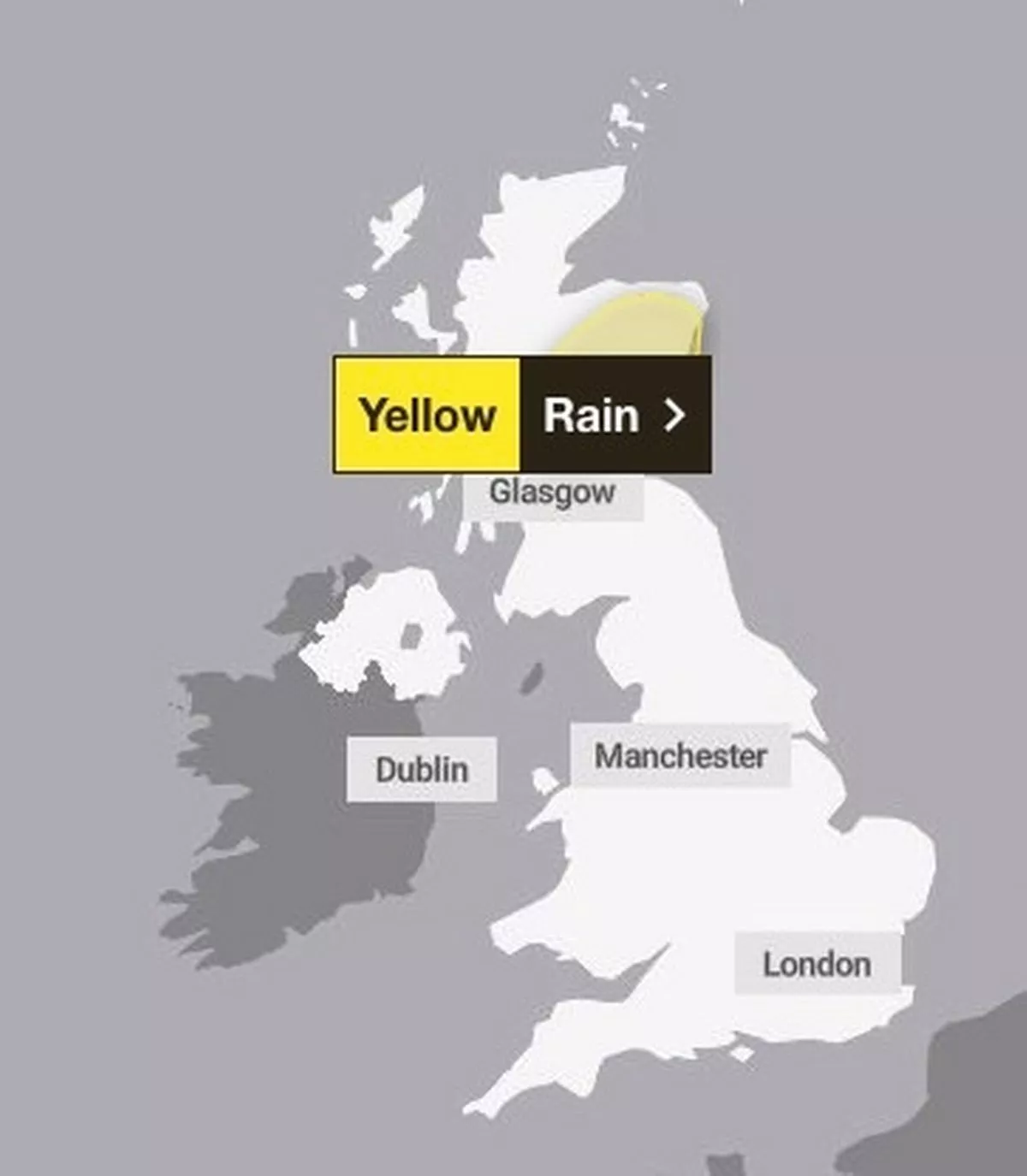
The Met Office has issued a warning for rain(Image: Met Office)
READ MORE: Snow map shows blizzard hitting UK as Met Office warns of wintry hazardsREAD MORE: UK weather maps show Britain buried in snow as Met Office gives verdictAreas impacted by Met Office rain warning:
Central, Tayside & Fife
AngusDundeeFifePerth and KinrossStirling
Grampian
AberdeenAberdeenshireMoray
Highlands & Eilean Siar
Residents in these areas may wish to consider preparing a flood kit, which includes a torch with spare batteries, insurance documents, a list of contacts, first aid kit, any required prescription medicines, warm and waterproof clothes, blankets, a battery or wind-up radio, vital supplies for looking after a baby or pet, bottled water and snacks.
Additionally, a flood plan could also come into use. This may include knowing how to shut off the gas and electricity, preparing useful numbers such as your insurance company, local council and utility providers. You may also want to consider who you can ask for help, or those that are vulnerable and may require help of their own.

‘Persistent and heavy rain over hills later Wednesday and through Thursday and Friday may lead to some flooding,’ the Met Office said (stock)(Image: Getty Images)
The warning suggests rain on Wednesday will be “intermittent at first” before becoming “persistent and heavy over high ground later in the day, continuing into Thursday and potentially Friday”.
The Met Office said: “Rainfall accumulations of 30-60 mm are likely fairly widely inland, with as much as 80-120 mm possible over the highest ground exposed to the brisk southeasterly winds.
“Given the nature of the ground following recent rain and snow thaw, this may lead to some flooding in places. Rainfall totals will be smaller in coastal areas, but strong onshore winds and large waves at times will be additional hazards.”
A yellow wether warning for wind is also in place from 4am tomorrow until 4pm in south-west England and Wales. “South-easterly winds will become strong and gusty during Tuesday morning,” experts said.
Areas impacted by Met Office wind warning:
South West England
CornwallDevonIsles of ScillyPlymouthSomersetTorbay
Wales
BridgendCarmarthenshireCeredigionConwyGwyneddIsle of AngleseyNeath Port TalbotPembrokeshirePowysRhondda Cynon TafSwanseaVale of Glamorgan